How to get to AM Clauserweg by bus?
Click on the bus route to see step by step directions with maps, line arrival times and updated time schedules.
From Norauto, Wittenheim
96 minFrom Royaume du Bonheur, Mulhouse
83 minFrom 51 Rue de Mulhouse, Morschwiller-Le-Bas
84 minFrom Brutes, Mulhouse
52 minFrom Toto Tissus, Wittenheim
96 minFrom 147 C Rue des Mines, Wittenheim
100 minFrom Societe Protectrice des Animaux Spa, Mulhouse
58 minFrom Sémaphore Mulhouse Sud Alsace, Wittenheim
87 minFrom Le Quignon Gourmand, Lutterbach
105 minFrom Easy Cash, Wittenheim
100 min
Bus stop near AM Clauserweg in Mulhouse
- Courtine, 10 min walk,VIEW
What are the closest stations to AM Clauserweg?
The closest stations to AM Clauserweg are:
- Courtine is 708 meters away, 10 min walk.
Which bus lines stop near AM Clauserweg?
These bus lines stop near AM Clauserweg: 10, 55, 9.
What’s the nearest bus station to AM Clauserweg in Mulhouse?
The nearest bus station to AM Clauserweg in Mulhouse is Courtine. It’s a 10 min walk away.
What time is the first bus to AM Clauserweg in Mulhouse?
The 56 is the first bus that goes to AM Clauserweg in Mulhouse. It stops nearby at 7:07 AM.
What time is the last bus to AM Clauserweg in Mulhouse?
The 55 is the last bus that goes to AM Clauserweg in Mulhouse. It stops nearby at 6:38 PM.
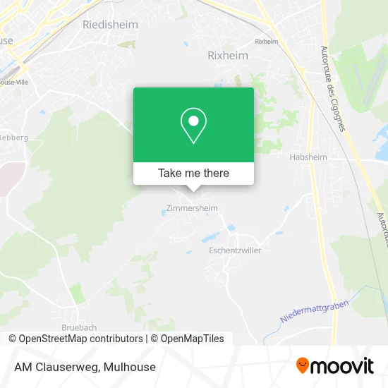
See AM Clauserweg, Mulhouse, on the map
Public Transit to AM Clauserweg in Mulhouse
Wondering how to get to AM Clauserweg in Mulhouse? Moovit helps you find the best way to get to AM Clauserweg with step-by-step directions from the nearest public transit station.
Moovit provides free maps and live directions to help you navigate through your city. View schedules, routes, timetables, and find out how long does it take to get to AM Clauserweg in real time.
Looking for the nearest stop or station to AM Clauserweg? Check out this list of stops closest to your destination: Courtine.
Bus: 10, 55, 9, 56.
Want to see if there’s another route that gets you there at an earlier time? Moovit helps you find alternative routes or times. Get directions from and directions to AM Clauserweg easily from the Moovit App or Website.
We make riding to AM Clauserweg easy, which is why over 1.5 million users, including users in Mulhouse, trust Moovit as the best app for public transit. You don’t need to download an individual bus app or train app, Moovit is your all-in-one transit app that helps you find the best bus time or train time available.
For information on prices of bus and light rail, costs and ride fares to AM Clauserweg, please check the Moovit app.
Use the app to navigate to popular places including to the airport, hospital, stadium, grocery store, mall, coffee shop, school, college, and university.
AM Clauserweg Address: Rue des Noyers street in Mulhouse
- Hinterm Dorf,
- Sarl Preference,
- An Der Muehlhausergasse,
- Rebgarten,
- Zimmersheim,
- Église Notre-Dame-De-L'Assomption,
- Association Culture Et Loisirs,
- Mairie De Zimmersheim,
- Nicolas,
- École Primaire,
- Loyen,
- Baselpfad,
- La Ferme Fischer,
- Feldplaetz,
- Clausser,
- Feldergasse,
- Vordere Grund,
- Zimmersheim,
- Ferme Fischer,
- Rothstueck
Places Near AM Clauserweg (Mulhouse)
- Lycée louis armand, Mulhouse,
- Action, Mulhouse,
- Parc Expo, Mulhouse,
- Centre Commercial de Wittenheim, Wittenheim,
- 5 Rue des Frères Lumière, Mulhouse,
- Moenschberg, Mulhouse,
- Hôpital Émile Muller, Mulhouse,
- Cité Du Train, Mulhouse,
- Centre Pénitentiaire De Lutterbach, Lutterbach,
- Clinique du Diaconat, Mulhouse,
- Decathlon Mulhouse, Mulhouse,
- Decathlon, Wittenheim,
- Carrefour, Illzach,
- PSA Peugeot Citroën Mulhouse, Rixheim,
- E.R.D.F-G.R.D.F Campus d'Ottmarsheim,
- Clinique Du Diaconat - Fonderie, Mulhouse,
- Kinepolis, Mulhouse,
- La Fonderie, Mulhouse,
- Ikea Mulhouse, Morschwiller-Le-Bas,
- Automobiles Peugeot S.a., Mulhouse
How to get to popular places in Mulhouse with public transit
Get around Mulhouse by public transit!
Traveling around Mulhouse has never been so easy. See step by step directions as you travel to any attraction, street or major public transit station. View bus and train schedules, arrival times, service alerts and detailed routes on a map, so you know exactly how to get to anywhere in Mulhouse.
When traveling to any destination around Mulhouse use Moovit's Live Directions with Get Off Notifications to know exactly where and how far to walk, how long to wait for your line, and how many stops are left. Moovit will alert you when it's time to get off — no need to constantly re-check whether yours is the next stop.
Wondering how to use public transit in Mulhouse or how to pay for public transit in Mulhouse? Moovit public transit app can help you navigate your way with public transit easily, and at minimum cost. It includes public transit fees, ticket prices, and costs. Looking for a map of Mulhouse public transit lines? Moovit public transit app shows all public transit maps in Mulhouse with all Bus and Light Rail routes and stops on an interactive map.
Mulhouse has 2 transit type(s), including: Bus and Light Rail, operated by several transit agencies, including SOLEA