How to get to APlus by bus?
Click on the bus route to see step by step directions with maps, line arrival times and updated time schedules.
From George Washington University, Washington
85 minFrom Georgetown University Law Center, Washington
138 minFrom Balian Springs, Fairfax County
87 minFrom Chinatown, Washington
85 minFrom Hyatt Place Washington DC/White House, Washington
92 minFrom Hyatt Place-Arlington Courthouse Plaza (Hyatt Place Arlington/Courthouse Plaza), Arlington County
46 minFrom World War II Memorial, Washington
82 minFrom Quarterdeck, Arlington County
65 minFrom CityCenter DC, Washington
82 minFrom VFS Services USA, Washington
91 min
How to get to APlus by train?
Click on the train route to see step by step directions with maps, line arrival times and updated time schedules.
How to get to APlus by metro?
Click on the metro route to see step by step directions with maps, line arrival times and updated time schedules.
From George Washington University, Washington
25 minFrom Georgetown University Law Center, Washington
37 minFrom Chinatown, Washington
26 minFrom Hyatt Place Washington DC/White House, Washington
33 minFrom Hyatt Place-Arlington Courthouse Plaza (Hyatt Place Arlington/Courthouse Plaza), Arlington County
34 minFrom World War II Memorial, Washington
47 minFrom Quarterdeck, Arlington County
38 minFrom CityCenter DC, Washington
31 minFrom VFS Services USA, Washington
31 min
Bus stops near APlus in Alexandria
Metro station near APlus in Alexandria
- Braddock Road Metro, 17 min walk,VIEW
Train station near APlus in Alexandria
- Alexandria, 18 min walk,VIEW
Bus lines to APlus in Alexandria
What are the closest stations to APlus?
The closest stations to APlus are:
- E Braddock Rd + Ramsey St is 84 yards away, 2 min walk.
- E Braddock Rd+Mt Vernon Av is 128 yards away, 2 min walk.
- Braddock Rd Metro Station - Bay D is 381 yards away, 5 min walk.
- Braddock Rd+Bay B is 430 yards away, 6 min walk.
- Braddock Road Metro is 1407 yards away, 17 min walk.
- Alexandria is 1480 yards away, 18 min walk.
Which bus lines stop near APlus?
These bus lines stop near APlus: 103, 104, 30, A11, A12, A1X.
Which train lines stop near APlus?
These train lines stop near APlus: MANASSAS LINE, PALMETTO.
Which metro lines stop near APlus?
These metro lines stop near APlus: BLUE, YELLOW.
What’s the nearest metro station to APlus in Alexandria?
The nearest metro station to APlus in Alexandria is Braddock Road Metro. It’s a 17 min walk away.
What’s the nearest train station to APlus in Alexandria?
The nearest train station to APlus in Alexandria is Alexandria. It’s a 18 min walk away.
What’s the nearest bus station to APlus in Alexandria?
The nearest bus stations to APlus in Alexandria are E Braddock Rd + Ramsey St and E Braddock Rd+Mt Vernon Av. The closest one is a 2 min walk away.
What time is the first metro to APlus in Alexandria?
The YELLOW is the first metro that goes to APlus in Alexandria. It stops nearby at 5:02 AM.
What time is the last metro to APlus in Alexandria?
The YELLOW is the last metro that goes to APlus in Alexandria. It stops nearby at 12:37 AM.
What time is the first train to APlus in Alexandria?
The SILVER METEOR is the first train that goes to APlus in Alexandria. It stops nearby at 5:54 AM.
What time is the last train to APlus in Alexandria?
The SILVER METEOR is the last train that goes to APlus in Alexandria. It stops nearby at 5:54 AM.
What time is the first bus to APlus in Alexandria?
The 30 is the first bus that goes to APlus in Alexandria. It stops nearby at 4:45 AM.
What time is the last bus to APlus in Alexandria?
The 30 is the last bus that goes to APlus in Alexandria. It stops nearby at 2:02 AM.
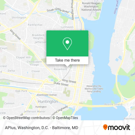
See APlus, Alexandria, on the map
Public Transit to APlus in Alexandria
Wondering how to get to APlus in Alexandria? Moovit helps you find the best way to get to APlus with step-by-step directions from the nearest public transit station.
Moovit provides free maps and live directions to help you navigate through your city. View schedules, routes, timetables, and find out how long does it take to get to APlus in real time.
Looking for the nearest stop or station to APlus? Check out this list of stops closest to your destination: E Braddock Rd + Ramsey St; E Braddock Rd+Mt Vernon Av; Braddock Rd Metro Station - Bay D; Braddock Rd+Bay B; Braddock Road Metro; Alexandria.
Bus: 103, 104, 30, A11, A12, A1X, 31.Train: MANASSAS LINE, PALMETTO, CARDINAL, CAROLINIAN, CRESCENT, FLORIDIAN, NORTHEAST REGIONAL.Metro: BLUE, YELLOW.
Want to see if there’s another route that gets you there at an earlier time? Moovit helps you find alternative routes or times. Get directions from and directions to APlus easily from the Moovit App or Website.
We make riding to APlus easy, which is why over 1.5 million users, including users in Alexandria, trust Moovit as the best app for public transit. You don’t need to download an individual bus app or train app, Moovit is your all-in-one transit app that helps you find the best bus time or train time available.
For information on prices of bus, metro and train, costs and ride fares to APlus, please check the Moovit app.
Use the app to navigate to popular places including to the airport, hospital, stadium, grocery store, mall, coffee shop, school, college, and university.
APlus Address: 317 E Braddock Rd Alexandria, VA 22301 street in Alexandria
- Mobile Solution,
- Washington Cooking and Entertainment Show,
- 407 E Braddock Rd Parking,
- Credit Union 1,
- Potomac Yard Park,
- Coldwell Banker Realty,
- Braddock Road Metro Station,
- Zipcar,
- 545 E Braddock Rd Garage,
- Cut and Shave,
- GWMS Baseball Field,
- Ink by Hero,
- Metro-Braddock Road (Braddock Rd Metro Station - Bay C),
- 780 N West St Parking,
- Canal Center Plaza Shuttle,
- Berkshire Hathaway Homeservices Penfed Realty,
- Center for Human Capital,
- USPS Collection Box - Blue Box,
- Mandi Mediterranean Bistro,
- Carroll County Job & Family Services
Places Near APlus (Alexandria)
- Amazon Hq2, Arlington County,
- Sibley Memorial Hospital, Washington,
- Rock Creek Tennis Center, Washington,
- Pennsylvania Ave NW (3rd st and pennsylvania), Washington,
- Camden Yards, Baltimore,
- Marriott Marquis Washington, DC, Washington,
- Warner Theatre, Washington,
- National Museum of African American History and Culture, Washington,
- Westfield Montgomery Mall, Montgomery County,
- M&T Bank Stadium, Baltimore,
- Basilica of the National Shrine, Washington,
- Capital One Arena, Washington,
- The Anthem, Washington,
- Washington National Cathedral, Washington,
- PG Mall, Prince George's County,
- Museum Of The Bible, Washington,
- Washington DC VA Medical Center, Washington,
- National Mall, Washington,
- National Zoo, Washington,
- Georgetown, Washington
How to get to popular places in Washington, D.C. - Baltimore, MD with public transit
Get around Alexandria by public transit!
Traveling around Alexandria has never been so easy. See step by step directions as you travel to any attraction, street or major public transit station. View bus and train schedules, arrival times, service alerts and detailed routes on a map, so you know exactly how to get to anywhere in Alexandria.
When traveling to any destination around Alexandria use Moovit's Live Directions with Get Off Notifications to know exactly where and how far to walk, how long to wait for your line, and how many stops are left. Moovit will alert you when it's time to get off — no need to constantly re-check whether yours is the next stop.
Wondering how to use public transit in Alexandria or how to pay for public transit in Alexandria? Moovit public transit app can help you navigate your way with public transit easily, and at minimum cost. It includes public transit fees, ticket prices, and costs. Looking for a map of Alexandria public transit lines? Moovit public transit app shows all public transit maps in Alexandria with all Bus, Train, Metro, Light Rail and Ferry routes and stops on an interactive map.
Washington, D.C. - Baltimore, MD has 5 transit type(s), including: Bus, Train, Metro, Light Rail and Ferry, operated by several transit agencies, including WMATA, Montgomery County Ride On, Fairfax Connector, TheBus, PRTC, DASH - Alexandria, Arlington Transit (ART), RTA of Central Maryland, MDOT MTA, MDOT MTA Light RailLink, MDOT MTA Commuter Bus, MDOT MTA Local Bus, FXBGO!, Virginia Railway Express (VRE) and MARC