How to get to ATHLETA by bus?
Click on the bus route to see step by step directions with maps, line arrival times and updated time schedules.
From Leesburg VA-684, Fairfax County
36 minFrom Chantilly, VA, Fairfax County
72 minFrom Oakton, Virginia, Fairfax County
78 minFrom Walmart, Fairfax County
39 minFrom Inova Fair Oaks Hospital, Fairfax County
27 minFrom Sterling VA USA, Loudoun County
76 minFrom Dulles Discovery, Fairfax County
61 minFrom Vienna, Virginia, Fairfax County
74 minFrom Dulles Expo Center, Fairfax County
79 minFrom Fair Oaks Mall, Fairfax County
41 min
How to get to ATHLETA by metro?
Click on the metro route to see step by step directions with maps, line arrival times and updated time schedules.
Bus stops near ATHLETA in Fairfax County
- Bluemont Way @ Library St (Rtc L), 2 min walk,VIEW
- Reston Town Ctr Bay H, 3 min walk,VIEW
- Reston Town Ctr Bay A, 3 min walk,VIEW
- Reston Town Ctr Bay G, 3 min walk,VIEW
- Reston Town Ctr Bay B, 3 min walk,VIEW
- Reston Town Ctr Bay F, 3 min walk,VIEW
- Reston Town Ctr Bay C, 4 min walk,VIEW
- Reston Town Ctr Bay E, 4 min walk,VIEW
- Reston Town Ctr Bay D, 4 min walk,VIEW
- Sunset Hills Rd @ Reston Pkwy, 7 min walk,VIEW
Metro station near ATHLETA in Fairfax County
- Herndon, 24 min walk,VIEW
Bus lines to ATHLETA in Fairfax County
- 552, 552 Wiehle Metro,VIEW
- 559, 559 Wiehle Metro,VIEW
- 950, 950 Herndon Metro,VIEW
- RIBS5, Ribs 5 Reston Town Ctr - Herndon,VIEW
- 574, 574 Reston - Town Ctr,VIEW
- 605, 605 Reston - Town Ctr,VIEW
- RIBS2, Ribs 2 Herndon Metro,VIEW
- RIBS1, Ribs 1 Lake Anne - Reston Town Ctr,VIEW
- RIBS4, Ribs 4 North Point - Reston Town Ctr,VIEW
- RIBS3, Ribs 3 Hunters Woods - Reston Town Ctr,VIEW
- 952, 952 Dulles Airport,VIEW
What are the closest stations to ATHLETA?
The closest stations to ATHLETA are:
- Bluemont Way @ Library St (Rtc L) is 152 yards away, 2 min walk.
- Reston Town Ctr Bay H is 196 yards away, 3 min walk.
- Reston Town Ctr Bay A is 196 yards away, 3 min walk.
- Reston Town Ctr Bay G is 208 yards away, 3 min walk.
- Reston Town Ctr Bay B is 217 yards away, 3 min walk.
- Reston Town Ctr Bay F is 229 yards away, 3 min walk.
- Reston Town Ctr Bay C is 236 yards away, 4 min walk.
- Reston Town Ctr Bay E is 249 yards away, 4 min walk.
- Reston Town Ctr Bay D is 295 yards away, 4 min walk.
- Sunset Hills Rd @ Reston Pkwy is 557 yards away, 7 min walk.
- Herndon is 2009 yards away, 24 min walk.
Which bus lines stop near ATHLETA?
These bus lines stop near ATHLETA: 552, 574, 605, 950, 952.
Which metro line stops near ATHLETA?
SILVER (Ashburn)
What’s the nearest metro station to ATHLETA in Fairfax County?
The nearest metro station to ATHLETA in Fairfax County is Herndon. It’s a 24 min walk away.
What’s the nearest bus station to ATHLETA in Fairfax County?
The nearest bus station to ATHLETA in Fairfax County is Bluemont Way @ Library St (Rtc L). It’s a 2 min walk away.
What time is the first metro to ATHLETA in Fairfax County?
The SILVER is the first metro that goes to ATHLETA in Fairfax County. It stops nearby at 5:00 AM.
What time is the last metro to ATHLETA in Fairfax County?
The SILVER is the last metro that goes to ATHLETA in Fairfax County. It stops nearby at 12:55 AM.
What time is the first bus to ATHLETA in Fairfax County?
The 950 is the first bus that goes to ATHLETA in Fairfax County. It stops nearby at 4:10 AM.
What time is the last bus to ATHLETA in Fairfax County?
The 950 is the last bus that goes to ATHLETA in Fairfax County. It stops nearby at 1:26 AM.
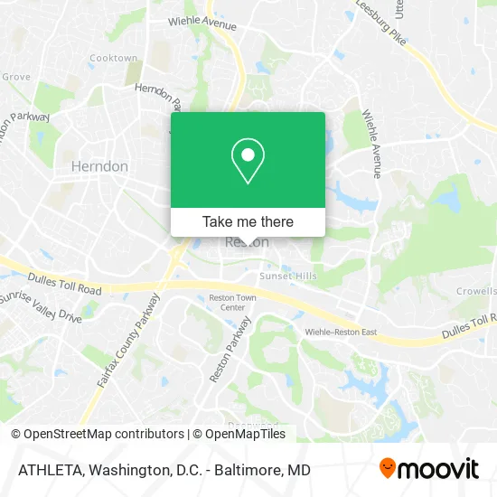
See ATHLETA, Fairfax County, on the map
Public Transit to ATHLETA in Fairfax County
Wondering how to get to ATHLETA in Fairfax County? Moovit helps you find the best way to get to ATHLETA with step-by-step directions from the nearest public transit station.
Moovit provides free maps and live directions to help you navigate through your city. View schedules, routes, timetables, and find out how long does it take to get to ATHLETA in real time.
Looking for the nearest stop or station to ATHLETA? Check out this list of stops closest to your destination: Bluemont Way @ Library St (Rtc L); Reston Town Ctr Bay H; Reston Town Ctr Bay A; Reston Town Ctr Bay G; Reston Town Ctr Bay B; Reston Town Ctr Bay F; Reston Town Ctr Bay C; Reston Town Ctr Bay E; Reston Town Ctr Bay D; Sunset Hills Rd @ Reston Pkwy; Herndon.
Bus: 552, 574, 605, 950, 952, 559, RIBS5.Metro: SILVER.
Want to see if there’s another route that gets you there at an earlier time? Moovit helps you find alternative routes or times. Get directions from and directions to ATHLETA easily from the Moovit App or Website.
We make riding to ATHLETA easy, which is why over 1.5 million users, including users in Fairfax County, trust Moovit as the best app for public transit. You don’t need to download an individual bus app or train app, Moovit is your all-in-one transit app that helps you find the best bus time or train time available.
For information on prices of bus and metro, costs and ride fares to ATHLETA, please check the Moovit app.
Use the app to navigate to popular places including to the airport, hospital, stadium, grocery store, mall, coffee shop, school, college, and university.
ATHLETA Address: 11923 Market St Reston, VA 20190 street in Fairfax County
- Town Center VSS,
- Bow Tie Cinemas,
- Sixty Vines,
- Reston, Virginia,
- Apple,
- Reston Tow Truck,
- L'Ocitane,
- Look Dine-in Cinemas Reston,
- The Greater Reston Chamber of Commerce,
- Reston Town Center - Orange Garage ,
- Homeschool National Honor Society Astronomy Club,
- Apple Reston,
- Reston VA and Annapolis MD,
- One Medical: Reston Town Center,
- RTC,
- Anatoliy Lutsik - Thrivent,
- Filiphant,
- Stratustalk,
- Keima,
- Betterworld Technology
Places Near ATHLETA (Fairfax County)
- National Mall, Washington,
- Basilica of the National Shrine, Washington,
- Westfield Montgomery Mall, Montgomery County,
- National Zoo, Washington,
- PG Mall, Prince George's County,
- Washington National Cathedral, Washington,
- Pennsylvania Ave NW (3rd st and pennsylvania), Washington,
- Washington DC VA Medical Center, Washington,
- Amazon Hq2, Arlington County,
- Museum Of The Bible, Washington,
- M&T Bank Stadium, Baltimore,
- The Anthem, Washington,
- Georgetown, Washington,
- Sibley Memorial Hospital, Washington,
- Rock Creek Tennis Center, Washington,
- National Museum of African American History and Culture, Washington,
- Warner Theatre, Washington,
- Marriott Marquis Washington, DC, Washington,
- Camden Yards, Baltimore,
- Capital One Arena, Washington
How to get to popular places in Washington, D.C. - Baltimore, MD with public transit
Get around Fairfax County by public transit!
Traveling around Fairfax County has never been so easy. See step by step directions as you travel to any attraction, street or major public transit station. View bus and train schedules, arrival times, service alerts and detailed routes on a map, so you know exactly how to get to anywhere in Fairfax County.
When traveling to any destination around Fairfax County use Moovit's Live Directions with Get Off Notifications to know exactly where and how far to walk, how long to wait for your line, and how many stops are left. Moovit will alert you when it's time to get off — no need to constantly re-check whether yours is the next stop.
Wondering how to use public transit in Fairfax County or how to pay for public transit in Fairfax County? Moovit public transit app can help you navigate your way with public transit easily, and at minimum cost. It includes public transit fees, ticket prices, and costs. Looking for a map of Fairfax County public transit lines? Moovit public transit app shows all public transit maps in Fairfax County with all Bus, Train, Metro, Light Rail and Ferry routes and stops on an interactive map.
Washington, D.C. - Baltimore, MD has 5 transit type(s), including: Bus, Train, Metro, Light Rail and Ferry, operated by several transit agencies, including WMATA, Montgomery County Ride On, Fairfax Connector, TheBus, PRTC, DASH - Alexandria, Arlington Transit (ART), RTA of Central Maryland, MDOT MTA, MDOT MTA Light RailLink, MDOT MTA Commuter Bus, MDOT MTA Local Bus, FXBGO!, Virginia Railway Express (VRE) and MARC