Bus stop near ATM in Worcester County
- S3- Coastal Hwy at 3rd Street, 3 min walk,VIEW
Bus lines to ATM in Worcester County
- CHBB, ,VIEW
- Ocean City Town Skate Park,
- Parrot Bay Condominium,
- Ocean City Appliance Repair,
- Caliber Auto Glass,
- Joseph F Schanno,
- Bayside Park,
- Ocean City Vacation Center,
- Jesus Sand Art Exhibit,
- Ocean City Park-N-Ride,
- MGD Plumbing Services,
- Ocean Gallery-World Famous,
- 3rd Street Playground,
- The Roland E. Powell Convention Center,
- Law Office of Kathleen E. Smith,
- Post Office,
- Thee Cori Noel 101, Ocean City, Maryland,
- Ocdollarstore Beer&Wine Deli,
- Town of Ocean City - Government,
- Town of Ocean City Emergency Services Department,
- Ocean City Fire Marshal
Places Near ATM (Worcester County)
- Pennsylvania Ave NW (3rd st and pennsylvania), Washington,
- Westfield Montgomery Mall, Montgomery County,
- Sibley Memorial Hospital, Washington,
- Basilica of the National Shrine, Washington,
- The Anthem, Washington,
- Marriott Marquis Washington, DC, Washington,
- Museum Of The Bible, Washington,
- National Theatre, Washington,
- Washington DC VA Medical Center, Washington,
- Rock Creek Tennis Center, Washington,
- PG Mall, Prince George's County,
- Capital One Arena, Washington,
- National Museum of African American History and Culture, Washington,
- M&T Bank Stadium, Baltimore,
- National Zoo, Washington,
- Georgetown, Washington,
- Camden Yards, Baltimore,
- Warner Theatre, Washington,
- Washington National Cathedral, Washington,
- Amazon Hq2, Arlington County
How to get to popular places in Washington, D.C. - Baltimore, MD with public transit
What are the closest stations to ATM?
The closest stations to ATM are:
- S3- Coastal Hwy at 3rd Street is 218 yards away, 3 min walk.
What’s the nearest bus station to ATM in Worcester County?
The nearest bus station to ATM in Worcester County is S3- Coastal Hwy at 3rd Street. It’s a 3 min walk away.
What time is the first bus to ATM in Worcester County?
The CHBB is the first bus that goes to ATM in Worcester County. It stops nearby at 6:00 AM.
What time is the last bus to ATM in Worcester County?
The CHBB is the last bus that goes to ATM in Worcester County. It stops nearby at 2:39 AM.
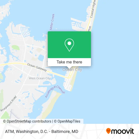
See ATM, Worcester County, on the map
Public Transit to ATM in Worcester County
Wondering how to get to ATM in Worcester County? Moovit helps you find the best way to get to ATM with step-by-step directions from the nearest public transit station.
Moovit provides free maps and live directions to help you navigate through your city. View schedules, routes, timetables, and find out how long does it take to get to ATM in real time.
Looking for the nearest stop or station to ATM? Check out this list of stops closest to your destination: S3- Coastal Hwy at 3rd Street.
Want to see if there’s another route that gets you there at an earlier time? Moovit helps you find alternative routes or times. Get directions from and directions to ATM easily from the Moovit App or Website.
We make riding to ATM easy, which is why over 1.5 million users, including users in Worcester County, trust Moovit as the best app for public transit. You don’t need to download an individual bus app or train app, Moovit is your all-in-one transit app that helps you find the best bus time or train time available.
Use the app to navigate to popular places including to the airport, hospital, stadium, grocery store, mall, coffee shop, school, college, and university.
ATM Address: 309 4th St Ocean City, MD 21842 street in Worcester County
Get around Worcester County by public transit!
Traveling around Worcester County has never been so easy. See step by step directions as you travel to any attraction, street or major public transit station. View bus and train schedules, arrival times, service alerts and detailed routes on a map, so you know exactly how to get to anywhere in Worcester County.
When traveling to any destination around Worcester County use Moovit's Live Directions with Get Off Notifications to know exactly where and how far to walk, how long to wait for your line, and how many stops are left. Moovit will alert you when it's time to get off — no need to constantly re-check whether yours is the next stop.
Wondering how to use public transit in Worcester County or how to pay for public transit in Worcester County? Moovit public transit app can help you navigate your way with public transit easily, and at minimum cost. It includes public transit fees, ticket prices, and costs. Looking for a map of Worcester County public transit lines? Moovit public transit app shows all public transit maps in Worcester County with all Bus, Train, Metro, Light Rail and Ferry routes and stops on an interactive map.
Washington, D.C. - Baltimore, MD has 5 transit type(s), including: Bus, Train, Metro, Light Rail and Ferry, operated by several transit agencies, including WMATA, Montgomery County Ride On, Fairfax Connector, TheBus, PRTC, DASH - Alexandria, Arlington Transit (ART), RTA of Central Maryland, MDOT MTA, MDOT MTA Light RailLink, MDOT MTA Commuter Bus, MDOT MTA Local Bus, FXBGO!, Virginia Railway Express (VRE) and MARC