Directions to A Forca Guinchos (Portão) with public transportation
The following transit lines have routes that pass near A Forca Guinchos
How to get to A Forca Guinchos by bus?
Click on the bus route to see step by step directions with maps, line arrival times and updated time schedules.
From Terminal Santa Felicidade, Santa Felicidade
63 minFrom Rua Flávio Dallegrave, Boa Vista
49 minFrom Hospital São Vicente - Cic, Cic
41 minFrom Rua São Bento, Hauer
39 minFrom terminal do hauer, Boqueirão
73 minFrom Quanta - Diagnostico e Terapia, Alto Da Rua XV
42 minFrom Estação Tubo Vila Olímpica, Jardim Social
43 minFrom Parque Tanguá, O Parque Mais Lindo de Curitiba, Taboão
63 minFrom Jockey Club do Paraná, Tarumã
57 minFrom Rua O Brasil para Cristo, Boqueirão
58 min
Bus stops near A Forca Guinchos in Portão
Bus lines to A Forca Guinchos in Portão
- 762 VILA ROSINHA, Praça Rui Barbosa → Vila Rosinha,VIEW
- 703 CAIUÁ, CAIUÁ,VIEW
- 706 CAIUÁ - FAZENDINHA / CENTRO, CAIUÁ - FAZENDINHA / CENTRO,VIEW
- 779 VILA VELHA / BURITI, VILA VELHA / BURITI,VIEW
- 789 MAD. CAIUÁ, MAD. CAIUÁ,VIEW
- 611 FAZENDINHA / PORTÃO, Terminal Fazendinha → Terminal Portão,VIEW
- 701 FAZENDINHA, Terminal Fazendinha → Praça Rui Barbosa,VIEW
What are the closest stations to A Forca Guinchos?
The closest stations to A Forca Guinchos are:
- Rua Pinheiro Guimarães, 854 is 195 meters away, 3 min walk.
- R. Rezala Simão, 64 is 204 meters away, 3 min walk.
- R. Amadeu Do Amaral, 870 is 300 meters away, 5 min walk.
Which bus lines stop near A Forca Guinchos?
These bus lines stop near A Forca Guinchos: 611 FAZENDINHA / PORTÃO, 701 FAZENDINHA.
What’s the nearest bus station to A Forca Guinchos in Portão?
The nearest bus stations to A Forca Guinchos in Portão are Rua Pinheiro Guimarães, 854 and R. Rezala Simão, 64. The closest one is a 3 min walk away.
What time is the first bus to A Forca Guinchos in Portão?
The 789 MAD. CAIUÁ is the first bus that goes to A Forca Guinchos in Portão. It stops nearby at 3:08 AM.
What time is the last bus to A Forca Guinchos in Portão?
The 789 MAD. CAIUÁ is the last bus that goes to A Forca Guinchos in Portão. It stops nearby at 3:08 AM.
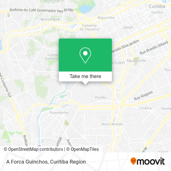
See A Forca Guinchos, Portão, on the map
Public Transit to A Forca Guinchos in Portão
Wondering how to get to A Forca Guinchos in Portão? Moovit helps you find the best way to get to A Forca Guinchos with step-by-step directions from the nearest public transit station.
Moovit provides free maps and live directions to help you navigate through your city. View schedules, routes, timetables, and find out how long does it take to get to A Forca Guinchos in real time.
Looking for the nearest stop or station to A Forca Guinchos? Check out this list of stops closest to your destination: Rua Pinheiro Guimarães; R. Rezala Simão; R. Amadeu Do Amaral.
Bus: 611 FAZENDINHA / PORTÃO, 701 FAZENDINHA, 762 VILA ROSINHA, 703 CAIUÁ, 706 CAIUÁ - FAZENDINHA / CENTRO, 779 VILA VELHA / BURITI, 789 MAD. CAIUÁ.
Want to see if there’s another route that gets you there at an earlier time? Moovit helps you find alternative routes or times. Get directions from and directions to A Forca Guinchos easily from the Moovit App or Website.
We make riding to A Forca Guinchos easy, which is why over 1.5 million users, including users in Portão, trust Moovit as the best app for public transit. You don’t need to download an individual bus app or train app, Moovit is your all-in-one transit app that helps you find the best bus time or train time available.
For information on prices of bus, costs and ride fares to A Forca Guinchos, please check the Moovit app.
Use the app to navigate to popular places including to the airport, hospital, stadium, grocery store, mall, coffee shop, school, college, and university.
A Forca Guinchos Address: Rua Amadeu do Amaral, 1026 Portão Curitiba-PR 80330-240 street in Portão
- Felix Car Serviços Automotivos,
- Reverson Antonio Basso,
- Box Carambola,
- Weber Eletricidade,
- Rua Amadeu do Amaral, 631 - Portão,
- Tools Dev,
- Laborsul,
- Codispa Distribuidora e Representacoes,
- Plateau,
- Suculentatici,
- Andrade Fagundes Sociedade Individual de Advocacia,
- Copa 14,
- J C Luxo,
- Star Safety,
- Condomínio Solar das Araucárias,
- Vila Rosinha Linha 762,
- S M Elevadores Manutencao,
- Armstrong Top Em Comunicação Visual,
- O Vegetal,
- Pastel da Ana
Places Near A Forca Guinchos (Portão)
- Rua Martim Afonso 558, Mercês,
- Hospital de Clínicas (HC - UFPR), Centro,
- Hospital Erasto Gaertner, Jardim Das Américas,
- Parque Barigui, Mercês,
- Hospital Angelina Caron, Campina Grande Do Sul,
- Park Shopping Barigüi, Mossunguê,
- Arena Da Baixada - Curitiba,
- Shopping Palladium, Portão,
- Jockey Plaza Shopping Center, Tarumã,
- Campo Largo, Campo,
- Shopping Estação, Rebouças,
- Rua General Mário Tourinho, Campina Do Siqueira,
- Hhhhh, Fazendinha,
- Hospital do Rocio, Campo,
- Jardim Botânico de Curitiba PR, Centro,
- Hospital Madalena Sofia, Bairro Alto,
- Hospital Da Cruz Vermelha, Batel,
- Hospital Universitário Evangélico de Curitiba, Bigorrilho,
- Hospital Nossa Senhora Das Graças, Mercês,
- Pontifícia Universidade Católica do Paraná (PUCPR), Prado Velho
How to get to popular places in Curitiba Region with public transit
Get around Portão by public transit!
Traveling around Portão has never been so easy. See step by step directions as you travel to any attraction, street or major public transit station. View bus and train schedules, arrival times, service alerts and detailed routes on a map, so you know exactly how to get to anywhere in Portão.
When traveling to any destination around Portão use Moovit's Live Directions with Get Off Notifications to know exactly where and how far to walk, how long to wait for your line, and how many stops are left. Moovit will alert you when it's time to get off — no need to constantly re-check whether yours is the next stop.
Wondering how to use public transit in Portão or how to pay for public transit in Portão? Moovit public transit app can help you navigate your way with public transit easily, and at minimum cost. It includes public transit fees, ticket prices, and costs. Looking for a map of Portão public transit lines? Moovit public transit app shows all public transit maps in Portão with all Bus and Cable Car routes and stops on an interactive map.
Curitiba Region has 2 transit type(s), including: Bus and Cable Car, operated by several transit agencies, including Sistema Integrado de Mobilidade (URBS), Sistema Integrado de Mobilidade (AMEP), URBS (Cartões bancários e Dinheiro), URBS (Cartões bancários / Cartão URBS), AMEP (Cartões bancários / Cartão MetroCard), AMEP (Cartões bancários / Cartão MetroCard / Dinheiro), Viação Colombo (Dinheiro), TRIAR (Cartão TRIAR / Dinheiro), Empresa Curitiba Cerro Azul (Dinheiro), Expresso Nossa Senhora da Penha (Dinheiro), Empresa Campo Alto Tijucas (Dinheiro), Auto Viação São José (Cartão VEM / Dinheiro), BRT S/A (Cartão VEM / Dinheiro), TransPiedade (Cartão Cidadão / Dinheiro) and Oceânica Sul (Cartão Transporte / Dinheiro)