Directions to A Plus Fire Protection (Baltimore) with public transportation
The following transit lines have routes that pass near A Plus Fire Protection
 Bus: 94, CITYLINK SILVER, 67, CHERRY ROUTE.
- Train: MARC.
- Metro: METRO.
- Light Rail: LIGHT RAILLINK.
- Ferry: HC3.
How to get to A Plus Fire Protection by bus?
Click on the bus route to see step by step directions with maps, line arrival times and updated time schedules.
From Pimlico Race Course, Baltimore
87 minFrom Bwi2 Employee Shuttles, Baltimore
50 minFrom NSA Friendship Annex (FANX), Anne Arundel County
69 minFrom Hampden, Baltimore
35 minFrom I-695 @ Exit 17 (Security Blvd/MD 122), Baltimore County
66 minFrom Mva, Baltimore
76 minFrom Walmart, Baltimore County
71 minFrom Druid Hill Park, Baltimore
47 minFrom Giant Food Stores, Baltimore
42 minFrom Walmart, Baltimore County
50 min
How to get to A Plus Fire Protection by metro?
Click on the metro route to see step by step directions with maps, line arrival times and updated time schedules.
Bus stops near A Plus Fire Protection in Baltimore
Light Rail stations near A Plus Fire Protection in Baltimore
- Hamburg Street, 12 min walk,VIEW
Ferry station near A Plus Fire Protection in Baltimore
- Federal Hill, 16 min walk,VIEW
Train station near A Plus Fire Protection in Baltimore
- Camden Station Marc, 32 min walk,VIEW
Bus lines to A Plus Fire Protection in Baltimore
What are the closest stations to A Plus Fire Protection?
The closest stations to A Plus Fire Protection are:
- Charles St & Cross St is 26 yards away, 1 min walk.
- West St. (Nb) is 147 yards away, 2 min walk.
- Hamburg Street is 966 yards away, 12 min walk.
- Federal Hill is 1281 yards away, 16 min walk.
- Camden Station Marc is 2703 yards away, 32 min walk.
Which bus lines stop near A Plus Fire Protection?
These bus lines stop near A Plus Fire Protection: 94, CITYLINK SILVER.
Which metro line stops near A Plus Fire Protection?
METRO (Towards John Hopkins)
Which light rail line stops near A Plus Fire Protection?
LIGHT RAILLINK (Soutbound)
What’s the nearest light rail station to A Plus Fire Protection in Baltimore?
The nearest light rail station to A Plus Fire Protection in Baltimore is Hamburg Street. It’s a 12 min walk away.
What’s the nearest bus station to A Plus Fire Protection in Baltimore?
The nearest bus station to A Plus Fire Protection in Baltimore is Charles St & Cross St. It’s a 1 min walk away.
What’s the nearest ferry station to A Plus Fire Protection in Baltimore?
The nearest ferry station to A Plus Fire Protection in Baltimore is Federal Hill. It’s a 16 min walk away.
What time is the first light rail to A Plus Fire Protection in Baltimore?
The LIGHT RAILLINK is the first light rail that goes to A Plus Fire Protection in Baltimore. It stops nearby at 4:01 AM.
What time is the last light rail to A Plus Fire Protection in Baltimore?
The LIGHT RAILLINK is the last light rail that goes to A Plus Fire Protection in Baltimore. It stops nearby at 1:15 AM.
What time is the first train to A Plus Fire Protection in Baltimore?
The MARC is the first train that goes to A Plus Fire Protection in Baltimore. It stops nearby at 5:00 AM.
What time is the last train to A Plus Fire Protection in Baltimore?
The MARC is the last train that goes to A Plus Fire Protection in Baltimore. It stops nearby at 8:55 PM.
What time is the first bus to A Plus Fire Protection in Baltimore?
The 94 is the first bus that goes to A Plus Fire Protection in Baltimore. It stops nearby at 4:01 AM.
What time is the last bus to A Plus Fire Protection in Baltimore?
The CITYLINK SILVER is the last bus that goes to A Plus Fire Protection in Baltimore. It stops nearby at 3:27 AM.
What time is the first ferry to A Plus Fire Protection in Baltimore?
The HC3 is the first ferry that goes to A Plus Fire Protection in Baltimore. It stops nearby at 6:00 AM.
What time is the last ferry to A Plus Fire Protection in Baltimore?
The HC3 is the last ferry that goes to A Plus Fire Protection in Baltimore. It stops nearby at 8:00 PM.
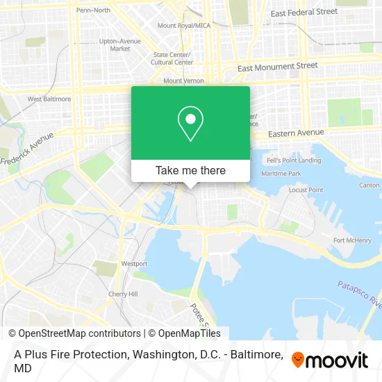
See A Plus Fire Protection, Baltimore, on the map
Public Transit to A Plus Fire Protection in Baltimore
Wondering how to get to A Plus Fire Protection in Baltimore? Moovit helps you find the best way to get to A Plus Fire Protection with step-by-step directions from the nearest public transit station.
Moovit provides free maps and live directions to help you navigate through your city. View schedules, routes, timetables, and find out how long does it take to get to A Plus Fire Protection in real time.
Looking for the nearest stop or station to A Plus Fire Protection? Check out this list of stops closest to your destination: Charles St & Cross St; West St. (Nb); Hamburg Street; Federal Hill; Camden Station Marc.
Bus: 94, CITYLINK SILVER, 67, CHERRY ROUTE.Train: MARC.Metro: METRO.Light Rail: LIGHT RAILLINK.Ferry: HC3.
Want to see if there’s another route that gets you there at an earlier time? Moovit helps you find alternative routes or times. Get directions from and directions to A Plus Fire Protection easily from the Moovit App or Website.
We make riding to A Plus Fire Protection easy, which is why over 1.5 million users, including users in Baltimore, trust Moovit as the best app for public transit. You don’t need to download an individual bus app or train app, Moovit is your all-in-one transit app that helps you find the best bus time or train time available.
For information on prices of bus, light rail and metro, costs and ride fares to A Plus Fire Protection, please check the Moovit app.
Use the app to navigate to popular places including to the airport, hospital, stadium, grocery store, mall, coffee shop, school, college, and university.
A Plus Fire Protection Address: 145 W Ostend St Baltimore, MD 21230 street in Baltimore
- Levy Konigsberg,
- B.Well Connected Health,
- Lux Car Rental,
- Eastern Shore Transportation LLC.,
- John Rizvi PA - the Idea Attorneys,
- Scarlet Shield Services,
- Ewigsol,
- Real Property Management Reliable Solutions,
- Pfister Energy,
- Kindlund Legal LLC,
- Owings Mills Office,
- Spa & Beauty All Spa & Beauty Spa Apparel,
- Home Helpers Home Care of Clarksburg,
- Cyd Business Financing,
- Roofing Experts of Baltimore,
- Kinderhealth, LLC,
- Univest Bank and Trust,
- Bbroz Events,
- Flashing York AC Units,
- M8 Beer
Places Near A Plus Fire Protection (Baltimore)
- Georgetown, Washington,
- Westfield Montgomery Mall, Montgomery County,
- Sibley Memorial Hospital, Washington,
- Marriott Marquis Washington, DC, Washington,
- The Anthem, Washington,
- M&T Bank Stadium, Baltimore,
- Museum Of The Bible, Washington,
- National Zoo, Washington,
- Pennsylvania Ave NW (3rd st and pennsylvania), Washington,
- Amazon Hq2, Arlington County,
- PG Mall, Prince George's County,
- Warner Theatre, Washington,
- Camden Yards, Baltimore,
- Washington National Cathedral, Washington,
- Washington DC VA Medical Center, Washington,
- Capital One Arena, Washington,
- Basilica of the National Shrine, Washington,
- Rock Creek Tennis Center, Washington,
- National Museum of African American History and Culture, Washington,
- National Mall, Washington
How to get to popular places in Washington, D.C. - Baltimore, MD with public transit
Get around Baltimore by public transit!
Traveling around Baltimore has never been so easy. See step by step directions as you travel to any attraction, street or major public transit station. View bus and train schedules, arrival times, service alerts and detailed routes on a map, so you know exactly how to get to anywhere in Baltimore.
When traveling to any destination around Baltimore use Moovit's Live Directions with Get Off Notifications to know exactly where and how far to walk, how long to wait for your line, and how many stops are left. Moovit will alert you when it's time to get off — no need to constantly re-check whether yours is the next stop.
Wondering how to use public transit in Baltimore or how to pay for public transit in Baltimore? Moovit public transit app can help you navigate your way with public transit easily, and at minimum cost. It includes public transit fees, ticket prices, and costs. Looking for a map of Baltimore public transit lines? Moovit public transit app shows all public transit maps in Baltimore with all Bus, Train, Metro, Light Rail and Ferry routes and stops on an interactive map.
Washington, D.C. - Baltimore, MD has 5 transit type(s), including: Bus, Train, Metro, Light Rail and Ferry, operated by several transit agencies, including WMATA, Montgomery County Ride On, Fairfax Connector, TheBus, PRTC, DASH - Alexandria, Arlington Transit (ART), RTA of Central Maryland, MDOT MTA, MDOT MTA Light RailLink, MDOT MTA Commuter Bus, MDOT MTA Local Bus, FXBGO!, Virginia Railway Express (VRE) and MARC