Directions to A Ruby's Touch (Baltimore) with public transportation
The following transit lines have routes that pass near A Ruby's Touch
 Bus: 78, CITYLINK PURPLE, 34.
- Train: MARC.
How to get to A Ruby's Touch by bus?
Click on the bus route to see step by step directions with maps, line arrival times and updated time schedules.
From Port of Baltimore - Cruise Maryland Terminal, Baltimore
65 minFrom Harford Road, Baltimore
56 minFrom CFG Bank Arena, Baltimore
35 minFrom MVA Glen Burnie, Anne Arundel County
71 minFrom Randallstown, MD, Baltimore County
82 minFrom Good Samaritan Hospital, Baltimore
73 minFrom B&O Railroad Museum, Baltimore
31 minFrom Druid Hill Park, Baltimore
56 minFrom Morgan State University, Baltimore
70 minFrom Federal Hill, Baltimore
53 min
Bus stops near A Ruby's Touch in Baltimore
Train station near A Ruby's Touch in Baltimore
- West Baltimore Marc Nb, 19 min walk,VIEW
Bus lines to A Ruby's Touch in Baltimore
What are the closest stations to A Ruby's Touch?
The closest stations to A Ruby's Touch are:
- Athol Ave & Old Frederick Rd FS Nb is 511 yards away, 8 min walk.
- Frederick Ave & Augusta Ave Eb is 792 yards away, 11 min walk.
- West Baltimore Marc Nb is 1597 yards away, 19 min walk.
Which bus lines stop near A Ruby's Touch?
These bus lines stop near A Ruby's Touch: 78, CITYLINK PURPLE.
What’s the nearest train station to A Ruby's Touch in Baltimore?
The nearest train station to A Ruby's Touch in Baltimore is West Baltimore Marc Nb. It’s a 19 min walk away.
What’s the nearest bus station to A Ruby's Touch in Baltimore?
The nearest bus station to A Ruby's Touch in Baltimore is Athol Ave & Old Frederick Rd FS Nb. It’s a 8 min walk away.
What time is the first train to A Ruby's Touch in Baltimore?
The MARC is the first train that goes to A Ruby's Touch in Baltimore. It stops nearby at 4:39 AM.
What time is the last train to A Ruby's Touch in Baltimore?
The MARC is the last train that goes to A Ruby's Touch in Baltimore. It stops nearby at 10:53 PM.
What time is the first bus to A Ruby's Touch in Baltimore?
The CITYLINK PURPLE is the first bus that goes to A Ruby's Touch in Baltimore. It stops nearby at 4:12 AM.
What time is the last bus to A Ruby's Touch in Baltimore?
The CITYLINK PURPLE is the last bus that goes to A Ruby's Touch in Baltimore. It stops nearby at 2:40 AM.
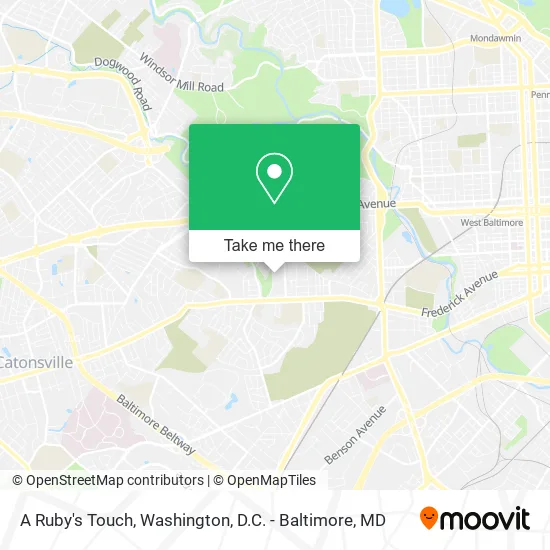
See A Ruby's Touch, Baltimore, on the map
Public Transit to A Ruby's Touch in Baltimore
Wondering how to get to A Ruby's Touch in Baltimore? Moovit helps you find the best way to get to A Ruby's Touch with step-by-step directions from the nearest public transit station.
Moovit provides free maps and live directions to help you navigate through your city. View schedules, routes, timetables, and find out how long does it take to get to A Ruby's Touch in real time.
Looking for the nearest stop or station to A Ruby's Touch? Check out this list of stops closest to your destination: Athol Ave & Old Frederick Rd FS Nb; Frederick Ave & Augusta Ave Eb; West Baltimore Marc Nb.
Bus: 78, CITYLINK PURPLE, 34.Train: MARC.
Want to see if there’s another route that gets you there at an earlier time? Moovit helps you find alternative routes or times. Get directions from and directions to A Ruby's Touch easily from the Moovit App or Website.
We make riding to A Ruby's Touch easy, which is why over 1.5 million users, including users in Baltimore, trust Moovit as the best app for public transit. You don’t need to download an individual bus app or train app, Moovit is your all-in-one transit app that helps you find the best bus time or train time available.
For information on prices of bus, costs and ride fares to A Ruby's Touch, please check the Moovit app.
Use the app to navigate to popular places including to the airport, hospital, stadium, grocery store, mall, coffee shop, school, college, and university.
A Ruby's Touch Address: Baltimore, MD 21229 street in Baltimore
- Nneka Davis,DDS,
- Mydawg Two,
- Quick Qlean Queen,
- Decks by Dave,
- Ashley Jones,
- Hard Work No Play,
- BNB Services,
- 410 Junk Removal,
- Exquisite Decor by Drea,
- Kak3 Transport,
- Breannas Skincare,
- Friendly Neighbor Mobile Auto Detailing Service,
- Archnemesis for Brows,
- Romeo's Restoration,
- Cyd Electrical,
- Charlie's Auto Repair,
- Macemia Place,
- Ajs Transportation Roadside Assistance,
- Kstyle Creationz,
- Stuckey & Son
Places Near A Ruby's Touch (Baltimore)
- Museum Of The Bible, Washington,
- National Zoo, Washington,
- Camden Yards, Baltimore,
- Warner Theatre, Washington,
- Washington DC VA Medical Center, Washington,
- PG Mall, Prince George's County,
- Amazon Hq2, Arlington County,
- The Anthem, Washington,
- Pennsylvania Ave NW (3rd st and pennsylvania), Washington,
- Basilica of the National Shrine, Washington,
- Rock Creek Tennis Center, Washington,
- National Mall, Washington,
- Sibley Memorial Hospital, Washington,
- Georgetown, Washington,
- M&T Bank Stadium, Baltimore,
- Marriott Marquis Washington, DC, Washington,
- Capital One Arena, Washington,
- Washington National Cathedral, Washington,
- National Museum of African American History and Culture, Washington,
- Westfield Montgomery Mall, Montgomery County
How to get to popular places in Washington, D.C. - Baltimore, MD with public transit
Get around Baltimore by public transit!
Traveling around Baltimore has never been so easy. See step by step directions as you travel to any attraction, street or major public transit station. View bus and train schedules, arrival times, service alerts and detailed routes on a map, so you know exactly how to get to anywhere in Baltimore.
When traveling to any destination around Baltimore use Moovit's Live Directions with Get Off Notifications to know exactly where and how far to walk, how long to wait for your line, and how many stops are left. Moovit will alert you when it's time to get off — no need to constantly re-check whether yours is the next stop.
Wondering how to use public transit in Baltimore or how to pay for public transit in Baltimore? Moovit public transit app can help you navigate your way with public transit easily, and at minimum cost. It includes public transit fees, ticket prices, and costs. Looking for a map of Baltimore public transit lines? Moovit public transit app shows all public transit maps in Baltimore with all Bus, Train, Metro, Light Rail and Ferry routes and stops on an interactive map.
Washington, D.C. - Baltimore, MD has 5 transit type(s), including: Bus, Train, Metro, Light Rail and Ferry, operated by several transit agencies, including WMATA, Montgomery County Ride On, Fairfax Connector, TheBus, PRTC, DASH - Alexandria, Arlington Transit (ART), RTA of Central Maryland, MDOT MTA, MDOT MTA Light RailLink, MDOT MTA Commuter Bus, MDOT MTA Local Bus, FXBGO!, Virginia Railway Express (VRE) and MARC