How to get to A.S.F. by bus?
Click on the bus route to see step by step directions with maps, line arrival times and updated time schedules.
From Carrefour Montesson, Montesson
153 minFrom Fête des Loges, Saint-Germain-En-Laye
59 minFrom Herblay, Herblay
101 minFrom Les 3 Fontaines, Cergy
55 minFrom Clinique de L'Europe, Le Port-Marly
78 minFrom Hôpital de Poissy, Poissy
49 minFrom Osny, Osny
80 minFrom Chambourcy, Chambourcy
52 minFrom Les Pyramides Le Port Marly, Le Port-Marly
86 min
How to get to A.S.F. by train?
Click on the train route to see step by step directions with maps, line arrival times and updated time schedules.
Bus stops near A.S.F. in Chanteloup-Les-Vignes
Train station near A.S.F. in Chanteloup-Les-Vignes
- Chanteloup-Les-Vignes, 11 min walk,VIEW
Bus lines to A.S.F. in Chanteloup-Les-Vignes
- 5437, Stellantis,VIEW
- 6529, Hautes Garennes,VIEW
- 6553, Lycée Le Corbusier,VIEW
- 6502, Collège André Derain,VIEW
- 6532, Les Ouches,VIEW
- 6541, Gare de Vernouillet - Verneuil (1b),VIEW
- 5441, Gare Place Romagné,VIEW
- 6574, Gare de Conflans - Fin-D'Oise,VIEW
- 6540, Gare Routière Nord (B4),VIEW
- 6559, Nicot / École Notre-Dame,VIEW
- 6591, Martelet,VIEW
What are the closest stations to A.S.F.?
The closest stations to A.S.F. are:
- Hautes Garennes is 287 meters away, 4 min walk.
- Sécurité Sociale is 690 meters away, 9 min walk.
- Gare de Chanteloup-Les-Vignes is 840 meters away, 12 min walk.
- Chanteloup-Les-Vignes is 840 meters away, 11 min walk.
- Collège Saint-Exupéry is 1082 meters away, 14 min walk.
- Rue de Chanteloup is 1476 meters away, 19 min walk.
Which train line stops near A.S.F.?
J (Paris-Saint-Lazare)
Which bus lines stop near A.S.F.?
These bus lines stop near A.S.F.: 6502, 6541.
What’s the nearest train station to A.S.F. in Chanteloup-Les-Vignes?
The nearest train station to A.S.F. in Chanteloup-Les-Vignes is Chanteloup-Les-Vignes. It’s a 11 min walk away.
What’s the nearest bus station to A.S.F. in Chanteloup-Les-Vignes?
The nearest bus station to A.S.F. in Chanteloup-Les-Vignes is Hautes Garennes. It’s a 4 min walk away.
What time is the first train to A.S.F. in Chanteloup-Les-Vignes?
The J is the first train that goes to A.S.F. in Chanteloup-Les-Vignes. It stops nearby at 5:13 AM.
What time is the last train to A.S.F. in Chanteloup-Les-Vignes?
The J is the last train that goes to A.S.F. in Chanteloup-Les-Vignes. It stops nearby at 10:58 PM.
What time is the first bus to A.S.F. in Chanteloup-Les-Vignes?
The 6502 is the first bus that goes to A.S.F. in Chanteloup-Les-Vignes. It stops nearby at 4:38 AM.
What time is the last bus to A.S.F. in Chanteloup-Les-Vignes?
The 5441 is the last bus that goes to A.S.F. in Chanteloup-Les-Vignes. It stops nearby at 1:50 AM.
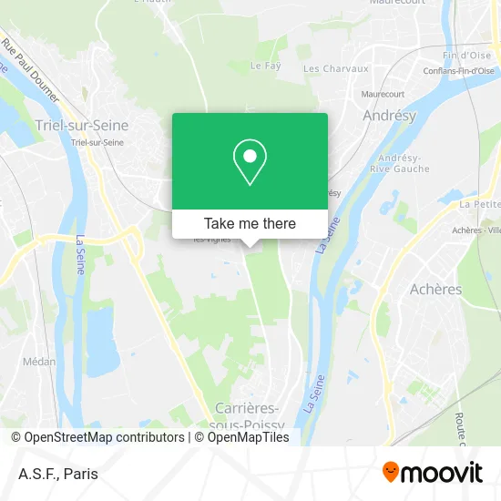
See A.S.F., Chanteloup-Les-Vignes, on the map
Public Transit to A.S.F. in Chanteloup-Les-Vignes
Wondering how to get to A.S.F. in Chanteloup-Les-Vignes? Moovit helps you find the best way to get to A.S.F. with step-by-step directions from the nearest public transit station.
Moovit provides free maps and live directions to help you navigate through your city. View schedules, routes, timetables, and find out how long does it take to get to A.S.F. in real time.
Looking for the nearest stop or station to A.S.F.? Check out this list of stops closest to your destination: Hautes Garennes; Sécurité Sociale; Gare de Chanteloup-Les-Vignes; Chanteloup-Les-Vignes; Collège Saint-Exupéry; Rue de Chanteloup.
Train: J.Bus: 6502, 6541, 5437, 6529, 6553, 6532, 5441, 6574, 6540, 6559, 6591.
Want to see if there’s another route that gets you there at an earlier time? Moovit helps you find alternative routes or times. Get directions from and directions to A.S.F. easily from the Moovit App or Website.
We make riding to A.S.F. easy, which is why over 1.5 million users, including users in Chanteloup-Les-Vignes, trust Moovit as the best app for public transit. You don’t need to download an individual bus app or train app, Moovit is your all-in-one transit app that helps you find the best bus time or train time available.
For information on prices of bus, train and RER, costs and ride fares to A.S.F., please check the Moovit app.
Use the app to navigate to popular places including to the airport, hospital, stadium, grocery store, mall, coffee shop, school, college, and university.
A.S.F. Address: 5 Rue des Frères Lumière 78570 Chanteloup-les-Vignes street in Chanteloup-Les-Vignes
- Steel France,
- Continental,
- Avenue de Poissy,
- R D V,
- 11 Rue Henri Becquerel,
- 5 Rue Panhard et Levassor,
- 7 Rue Henri Navier,
- Stade Stephane Diagana-Andresy,
- Arrêt Sécurité Sociale,
- Street Foodcourt,
- Complexe Sportif Stéphane Diagana,
- Garage de l'Avenue de Poissy,
- Casa Mia,
- Flore,
- Le Palais du Kebab,
- École Élémentaire Verlaine,
- Résidence du Manoir de Denouval,
- Zenpark,
- Cda,
- 8 Rue de l'Écho
Places Near A.S.F. (Chanteloup-Les-Vignes)
- Gare Routière Flixbus, Paris,
- Hôpital Beaujon, Clichy,
- Hôpital Pitié Salpêtrière, Paris,
- Créteil Soleil, Creteil,
- Marché Saint-Pierre, Paris,
- Beaugrenelle, Paris,
- Atelier Des Lumieres, Paris,
- Hopital Foch, Suresnes,
- Galeries Lafayette, Paris,
- 29 Rue Manin, Paris,
- Théâtre Mogador, Paris,
- Hôpital Cochin, Paris,
- Centre Hospitalier des 15/20, Paris,
- Hopital Lariboisière, Paris,
- Fondation Louis Vuitton, Paris,
- Hôpital de la Pitié-Salpêtrière, Paris,
- Hôpital Saint-Joseph, Paris,
- Galeries Lafayette Haussmann, Paris,
- Hôpital Necker, Paris,
- Hôpital Henri Mondor, Creteil
How to get to popular places in Paris with public transit
Get around Chanteloup-Les-Vignes by public transit!
Traveling around Chanteloup-Les-Vignes has never been so easy. See step by step directions as you travel to any attraction, street or major public transit station. View bus and train schedules, arrival times, service alerts and detailed routes on a map, so you know exactly how to get to anywhere in Chanteloup-Les-Vignes.
When traveling to any destination around Chanteloup-Les-Vignes use Moovit's Live Directions with Get Off Notifications to know exactly where and how far to walk, how long to wait for your line, and how many stops are left. Moovit will alert you when it's time to get off — no need to constantly re-check whether yours is the next stop.
Wondering how to use public transit in Chanteloup-Les-Vignes or how to pay for public transit in Chanteloup-Les-Vignes? Moovit public transit app can help you navigate your way with public transit easily, and at minimum cost. It includes public transit fees, ticket prices, and costs. Looking for a map of Chanteloup-Les-Vignes public transit lines? Moovit public transit app shows all public transit maps in Chanteloup-Les-Vignes with all Bus, Train, Metro, Light Rail, RER, Funicular and Gondola routes and stops on an interactive map.
Paris has 7 transit type(s), including: Bus, Train, Metro, Light Rail, RER, Funicular and Gondola, operated by several transit agencies, including RATP, RER, RER Bus de remplacement, Train, Train Bus de remplacement, Tramway Bus de remplacement, TER, ADP, Magical Shuttle, Argenteuil - Boucles de Seine, Autocars Dominique, Bièvre, Brie et 2 Morin, Le Bus - C.C. du Clermontois and Cœur d’Essonne