How to get to A V Trends by bus?
Click on the bus route to see step by step directions with maps, line arrival times and updated time schedules.
From SW 8th St / SW 62nd Ave, Miami
51 minFrom FTX Arena, Miami
47 minFrom Westland Mall, Hialeah
73 minFrom Kimpton Hotel Palomar South Beach, Miami Beach
58 minFrom Miami Shores, Miami
79 minFrom Lincoln Road Mall & Lincoln Road, Miami Beach
53 minFrom Brickell Key Trolley Stop, Miami
62 minFrom 2655 S Le Jeune Rd, Miami
46 minFrom watsco center, Miami
67 minFrom Knight Center Metromover Station, Miami
50 min
How to get to A V Trends by train?
Click on the train route to see step by step directions with maps, line arrival times and updated time schedules.
Bus stops near A V Trends in Miami
Train stations near A V Trends in Miami
Bus lines to A V Trends in Miami
What are the closest stations to A V Trends?
The closest stations to A V Trends are:
- Nw 32 Av @ Nw 34 St is 179 yards away, 3 min walk.
- Nw 21st Ter @ Nw 26th Ave is 341 yards away, 5 min walk.
- Nw 27 Av @ Nw 28 St is 396 yards away, 5 min walk.
- Brownsville Station Rail Southbound is 2544 yards away, 30 min walk.
- Hialeah Market Station is 3261 yards away, 39 min walk.
- Earlington Hts.stat.rail Northbound is 4450 yards away, 52 min walk.
Which bus lines stop near A V Trends?
These bus lines stop near A V Trends: 20, 27, 32.
Which train lines stop near A V Trends?
These train lines stop near A V Trends: GREEN, ORANGE.
What’s the nearest train station to A V Trends in Miami?
The nearest train station to A V Trends in Miami is Brownsville Station Rail Southbound. It’s a 30 min walk away.
What’s the nearest bus station to A V Trends in Miami?
The nearest bus station to A V Trends in Miami is Nw 32 Av @ Nw 34 St. It’s a 3 min walk away.
What time is the first train to A V Trends in Miami?
The TRIRAIL is the first train that goes to A V Trends in Miami. It stops nearby at 3:50 AM.
What time is the last train to A V Trends in Miami?
The GREEN is the last train that goes to A V Trends in Miami. It stops nearby at 12:44 AM.
What time is the first bus to A V Trends in Miami?
The 27 is the first bus that goes to A V Trends in Miami. It stops nearby at 3:15 AM.
What time is the last bus to A V Trends in Miami?
The 27 is the last bus that goes to A V Trends in Miami. It stops nearby at 3:28 AM.
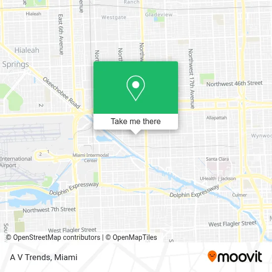
See A V Trends, Miami, on the map
Public Transit to A V Trends in Miami
Wondering how to get to A V Trends in Miami? Moovit helps you find the best way to get to A V Trends with step-by-step directions from the nearest public transit station.
Moovit provides free maps and live directions to help you navigate through your city. View schedules, routes, timetables, and find out how long does it take to get to A V Trends in real time.
Looking for the nearest stop or station to A V Trends? Check out this list of stops closest to your destination: Nw 32 Av @ Nw 34 St; Nw 21st Ter @ Nw 26th Ave; Nw 27 Av @ Nw 28 St; Brownsville Station Rail Southbound; Hialeah Market Station; Earlington Hts.stat.rail Northbound.
Bus: 20, 27, 32, MIAALP.Train: GREEN, ORANGE, TRIRAIL.
Want to see if there’s another route that gets you there at an earlier time? Moovit helps you find alternative routes or times. Get directions from and directions to A V Trends easily from the Moovit App or Website.
We make riding to A V Trends easy, which is why over 1.5 million users, including users in Miami, trust Moovit as the best app for public transit. You don’t need to download an individual bus app or train app, Moovit is your all-in-one transit app that helps you find the best bus time or train time available.
For information on prices of bus, train and light rail, costs and ride fares to A V Trends, please check the Moovit app.
Use the app to navigate to popular places including to the airport, hospital, stadium, grocery store, mall, coffee shop, school, college, and university.
A V Trends Address: 2976 NW 28th St Miami, FL 33142 street in Miami
- Venyhama,
- Unity Blvd,
- T-Mobile,
- 2626 NW 24th St Parking,
- Iglesia Evangelica Principe de Paz,
- Mariela Cayado,
- Fox Rent A Car Miami,
- SSP Steering and Suspension Parts,
- One Switch Rent A Car,
- Routes Car Rental,
- Radisson-Miami (Radisson Red Miami Airport),
- Miami Dade Transit,
- NW 30th Ave / NW 36th St,
- NW 20th St / NW 27th Ave,
- Panda Express,
- Boutique Rent A Car,
- Zezgo,
- Garcia Bros Seafood,
- Northwest 36th Street & Northwest 27th Avenue,
- NW 36th St / NW 27th Ave
Places Near A V Trends (Miami)
- Marlins Park, Miami,
- Bayside Marketplace, Miami,
- Hard Rock Stadium, Miami Gardens,
- Dolphin Mall Bus, Miami,
- Wynwood, Miami,
- Aventura Mall, Miami Beach,
- Miami VA Hospital, Miami,
- Keiser University Flagship Campus, West Palm Beach,
- Little Havana, Miami,
- Brickell City Centre, Miami,
- Sawgrass mall ( FL ), Miami Beach,
- Miami-Dade County Courthouse, Miami,
- Dolphin Mall, Miami,
- Miami Freedom Park, Miami,
- Zoo Miami, Miami,
- Richard E. Gerstein Justice Building, Miami,
- Port of Miami Cruise Terminal, Miami,
- Aventura Mall, Miami,
- Miami Design District, Miami,
- Sawgrass Mall, Miami
How to get to popular places in Miami with public transit
Get around Miami by public transit!
Traveling around Miami has never been so easy. See step by step directions as you travel to any attraction, street or major public transit station. View bus and train schedules, arrival times, service alerts and detailed routes on a map, so you know exactly how to get to anywhere in Miami.
When traveling to any destination around Miami use Moovit's Live Directions with Get Off Notifications to know exactly where and how far to walk, how long to wait for your line, and how many stops are left. Moovit will alert you when it's time to get off — no need to constantly re-check whether yours is the next stop.
Wondering how to use public transit in Miami or how to pay for public transit in Miami? Moovit public transit app can help you navigate your way with public transit easily, and at minimum cost. It includes public transit fees, ticket prices, and costs. Looking for a map of Miami public transit lines? Moovit public transit app shows all public transit maps in Miami with all Bus, Train, Light Rail and Ferry routes and stops on an interactive map.
Miami has 4 transit type(s), including: Bus, Train, Light Rail and Ferry, operated by several transit agencies, including Broward County Transit, Miami-Dade Transit, Metrorail, Palm Tran, Tri-Rail, Brightline, MARTY, City of Homestead Trolley, Key West Transit, Treasure Coast Connector, GoLine IRT, Amtrak, Greyhound-us, FlixBus-us and Aventura Express Shuttle Bus