How to get to Aafe One Flushing Community Center by bus?
Click on the bus route to see step by step directions with maps, line arrival times and updated time schedules.
From St. Raymond's Cemetery, Bronx
33 minFrom 72-06 Northern Boulevard, Queens
33 minFrom Franklin Ave, Bronx
78 minFrom Prospect Avenue, Bronx
74 minFrom Rider Avenue, Bronx
93 minFrom Throgs Neck, Bronx
49 minFrom MTA-21st St-Queensbridge, Queens
60 minFrom Calvary Hospital, Bronx
58 minFrom Costco, Manhattan
65 min
How to get to Aafe One Flushing Community Center by train?
Click on the train route to see step by step directions with maps, line arrival times and updated time schedules.
How to get to Aafe One Flushing Community Center by subway?
Click on the subway route to see step by step directions with maps, line arrival times and updated time schedules.
Bus stops near Aafe One Flushing Community Center in Queens
- Main St/Kissena Blvd, 3 min walk,VIEW
- Kissena Blvd/Main St, 4 min walk,VIEW
- Queens Flushing (Kissena Blvd/Main St), 4 min walk,VIEW
- Main St/40 Rd, 4 min walk,VIEW
- 41 Rd/Main St, 4 min walk,VIEW
- Main St/Roosevelt Av, 4 min walk,VIEW
- Roosevelt Av/Main St, 5 min walk,VIEW
- Roosevelt Av/Prince St, 6 min walk,VIEW
Train station near Aafe One Flushing Community Center in Queens
- Murray Hill, 13 min walk,VIEW
Subway station near Aafe One Flushing Community Center in Queens
- Flushing-Main St, 19 min walk,VIEW
Bus lines to Aafe One Flushing Community Center in Queens
- Q20, College Point,VIEW
- Q44-SBS, Select Bus Jamaica Via Main St,VIEW
- Q17, Fresh Meadows H Harding Exy-188 St,VIEW
- FLIXBUS 2612, Queens Jamaica (144th Pl/Archer Ave),VIEW
- Q25, College Point 5 Av,VIEW
- Q58, Ridgewood Terminal Via Corona Av,VIEW
- Q98, Limited Flushing,VIEW
- Q50, Limited Pelham Bay,VIEW
- Q26, Fresh Meadows,VIEW
- Q65, Jamaica LIRR Via 164 St,VIEW
- Q19, Astoria,VIEW
- Q63, Rush Court Square Via Northern Bl,VIEW
- Q66, Queens Plaza Via Northern Bl,VIEW
- Q90, Limited Flushing,VIEW
What are the closest stations to Aafe One Flushing Community Center?
The closest stations to Aafe One Flushing Community Center are:
- Main St/Kissena Blvd is 182 yards away, 3 min walk.
- Kissena Blvd/Main St is 261 yards away, 4 min walk.
- Queens Flushing (Kissena Blvd/Main St) is 264 yards away, 4 min walk.
- Main St/40 Rd is 265 yards away, 4 min walk.
- 41 Rd/Main St is 267 yards away, 4 min walk.
- Main St/Roosevelt Av is 290 yards away, 4 min walk.
- Roosevelt Av/Main St is 363 yards away, 5 min walk.
- Roosevelt Av/Prince St is 443 yards away, 6 min walk.
- Murray Hill is 1091 yards away, 13 min walk.
- Flushing-Main St is 1561 yards away, 19 min walk.
Which bus lines stop near Aafe One Flushing Community Center?
These bus lines stop near Aafe One Flushing Community Center: Q19, Q44-SBS, Q50, Q63, Q66, Q98.
Which train line stops near Aafe One Flushing Community Center?
PORT WASHINGTON BRANCH (Port Washington)
Which subway lines stop near Aafe One Flushing Community Center?
These subway lines stop near Aafe One Flushing Community Center: 7, M.
What’s the nearest subway station to Aafe One Flushing Community Center in Queens?
The nearest subway station to Aafe One Flushing Community Center in Queens is Flushing-Main St. It’s a 19 min walk away.
What’s the nearest train station to Aafe One Flushing Community Center in Queens?
The nearest train station to Aafe One Flushing Community Center in Queens is Murray Hill. It’s a 13 min walk away.
What’s the nearest bus station to Aafe One Flushing Community Center in Queens?
The nearest bus station to Aafe One Flushing Community Center in Queens is Main St/Kissena Blvd. It’s a 3 min walk away.
What time is the first subway to Aafe One Flushing Community Center in Queens?
The 7 is the first subway that goes to Aafe One Flushing Community Center in Queens. It stops nearby at 3:00 AM.
What time is the last subway to Aafe One Flushing Community Center in Queens?
The 7 is the last subway that goes to Aafe One Flushing Community Center in Queens. It stops nearby at 3:31 AM.
What time is the first train to Aafe One Flushing Community Center in Queens?
The PORT WASHINGTON BRANCH is the first train that goes to Aafe One Flushing Community Center in Queens. It stops nearby at 3:35 AM.
What time is the last train to Aafe One Flushing Community Center in Queens?
The PORT WASHINGTON BRANCH is the last train that goes to Aafe One Flushing Community Center in Queens. It stops nearby at 2:39 AM.
What time is the first bus to Aafe One Flushing Community Center in Queens?
The Q65 is the first bus that goes to Aafe One Flushing Community Center in Queens. It stops nearby at 3:00 AM.
What time is the last bus to Aafe One Flushing Community Center in Queens?
The Q44-SBS is the last bus that goes to Aafe One Flushing Community Center in Queens. It stops nearby at 3:22 AM.
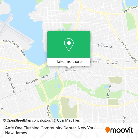
See Aafe One Flushing Community Center, Queens, on the map
Public Transit to Aafe One Flushing Community Center in Queens
Wondering how to get to Aafe One Flushing Community Center in Queens? Moovit helps you find the best way to get to Aafe One Flushing Community Center with step-by-step directions from the nearest public transit station.
Moovit provides free maps and live directions to help you navigate through your city. View schedules, routes, timetables, and find out how long does it take to get to Aafe One Flushing Community Center in real time.
Looking for the nearest stop or station to Aafe One Flushing Community Center? Check out this list of stops closest to your destination: Main St/Kissena Blvd; Kissena Blvd/Main St; Queens Flushing (Kissena Blvd/Main St); Main St/40 Rd; 41 Rd/Main St; Main St/Roosevelt Av; Roosevelt Av/Main St; Roosevelt Av/Prince St; Murray Hill; Flushing-Main St.
Bus: Q19, Q44-SBS, Q50, Q63, Q66, Q98, Q20, Q17, FLIXBUS 2612, Q25.Train: PORT WASHINGTON BRANCH.Subway: 7, M, 7X.
Want to see if there’s another route that gets you there at an earlier time? Moovit helps you find alternative routes or times. Get directions from and directions to Aafe One Flushing Community Center easily from the Moovit App or Website.
We make riding to Aafe One Flushing Community Center easy, which is why over 1.5 million users, including users in Queens, trust Moovit as the best app for public transit. You don’t need to download an individual bus app or train app, Moovit is your all-in-one transit app that helps you find the best bus time or train time available.
For information on prices of bus, subway and train, costs and ride fares to Aafe One Flushing Community Center, please check the Moovit app.
Use the app to navigate to popular places including to the airport, hospital, stadium, grocery store, mall, coffee shop, school, college, and university.
Aafe One Flushing Community Center Address: 133-29 41st Ave street in Queens
- Winnie Foot Spa,
- Glow Cultural Center,
- Blue Ray Internet Cafe,
- Zhong Huang Massage,
- Eyesmate Vision Care,
- Minkwon Center For Community Action,
- Afc Urgent Care Flushing,
- Chun Yang Tea Flushing,
- Heartland NY,
- Flushing Main Street Station LIRR,
- Dr. Xue Li,
- Top Notch Massage Spa,
- Dr. Ji-Yeon Chung,
- Lins Classical Acupuncture,
- Chinatown Bus (Flushing),
- Flushing,
- American Family Care,
- Eastern NY Corp,
- Afc Flushing Primary Care,
- Best Therapy For Pain
Places Near Aafe One Flushing Community Center (Queens)
- 3 Stone St, Manhattan,
- 66 John Street, Manhattan,
- 26 Federal Plaza, Manhattan,
- Chinatown, Manhattan,
- SoHo, Manhattan,
- Katz's Deli, Manhattan,
- Queens Center Mall, Queens,
- 911 Memorial, Manhattan,
- 1 Police Plaza, Manhattan,
- Hudson Yards, Manhattan,
- Wall Street, Manhattan,
- Rockefeller Center, Manhattan,
- San Gennaro Feast, Manhattan,
- 111 Centre New York City Supreme Court, Manhattan,
- qqqq, Manhattan,
- Mountainside Hospital, Glen Ridge,
- 376 Hudson Street, Manhattan,
- Times Square, Manhattan,
- Bellevue Hospital, Manhattan,
- Pier 83, Manhattan
How to get to popular places in New York - New Jersey with public transit
Get around Queens by public transit!
Traveling around Queens has never been so easy. See step by step directions as you travel to any attraction, street or major public transit station. View bus and train schedules, arrival times, service alerts and detailed routes on a map, so you know exactly how to get to anywhere in Queens.
When traveling to any destination around Queens use Moovit's Live Directions with Get Off Notifications to know exactly where and how far to walk, how long to wait for your line, and how many stops are left. Moovit will alert you when it's time to get off — no need to constantly re-check whether yours is the next stop.
Wondering how to use public transit in Queens or how to pay for public transit in Queens? Moovit public transit app can help you navigate your way with public transit easily, and at minimum cost. It includes public transit fees, ticket prices, and costs. Looking for a map of Queens public transit lines? Moovit public transit app shows all public transit maps in Queens with all Bus, Train, Subway, Light Rail, Ferry and Cable Car routes and stops on an interactive map.
New York - New Jersey has 6 transit type(s), including: Bus, Train, Subway, Light Rail, Ferry and Cable Car, operated by several transit agencies, including MTA Subway, Metro-North Railroad, LIRR, PATH, MTA New York City Transit - Express routes, MTA Bus, NJ Transit, NYC Ferry, NICE bus, Bee-Line Bus, NJ Transit Rail, Norwalk Transit District, Hartford Line, River Valley Transit and HART