Directions to Aapp (Wichita) with public transportation
The following transit lines have routes that pass near Aapp
 Bus: ROUTE11: MAPLE-R, ROUTE12: DOUGLAS.
How to get to Aapp by bus?
Click on the bus route to see step by step directions with maps, line arrival times and updated time schedules.
From Cbiz, Wichita
46 minFrom Love Your Community, Wichita
47 minFrom Snowman Village, Wichita
68 minFrom FedEx, Wichita
46 minFrom Bowers Plumbing Company, Wichita
47 minFrom Wichita Public Library, Wichita
63 minFrom Komugi, Wichita
62 minFrom S Broadway Wichita KS, Wichita
56 minFrom Gi'Sgi's Beauty Shop, Wichita
67 minFrom Vivint, Wichita
53 min
Bus stop near Aapp in Wichita
- Ridge And Maple Ib, 4 min walk,VIEW
Bus lines to Aapp in Wichita
- ROUTE11: MAPLE-R, Rouet 11 Outboun,VIEW
What are the closest stations to Aapp?
The closest stations to Aapp are:
- Ridge And Maple Ib is 294 yards away, 4 min walk.
Which bus lines stop near Aapp?
These bus lines stop near Aapp: ROUTE11: MAPLE-R, ROUTE12: DOUGLAS.
What’s the nearest bus station to Aapp in Wichita?
The nearest bus station to Aapp in Wichita is Ridge And Maple Ib. It’s a 4 min walk away.
What time is the first bus to Aapp in Wichita?
The ROUTE11: MAPLE-R is the first bus that goes to Aapp in Wichita. It stops nearby at 5:17 AM.
What time is the last bus to Aapp in Wichita?
The ROUTE11: MAPLE-R is the last bus that goes to Aapp in Wichita. It stops nearby at 7:04 PM.
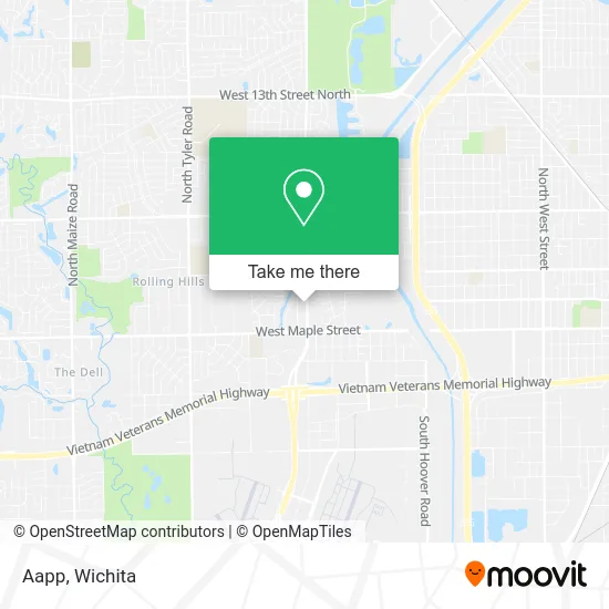
See Aapp, Wichita, on the map
Public Transit to Aapp in Wichita
Wondering how to get to Aapp in Wichita? Moovit helps you find the best way to get to Aapp with step-by-step directions from the nearest public transit station.
Moovit provides free maps and live directions to help you navigate through your city. View schedules, routes, timetables, and find out how long does it take to get to Aapp in real time.
Looking for the nearest stop or station to Aapp? Check out this list of stops closest to your destination: Ridge And Maple Ib.
Bus: ROUTE11: MAPLE-R, ROUTE12: DOUGLAS.
Want to see if there’s another route that gets you there at an earlier time? Moovit helps you find alternative routes or times. Get directions from and directions to Aapp easily from the Moovit App or Website.
We make riding to Aapp easy, which is why over 1.7 million users, including users in Wichita, trust Moovit as the best app for public transit. You don’t need to download an individual bus app or train app, Moovit is your all-in-one transit app that helps you find the best bus time or train time available.
For information on prices of bus, costs and ride fares to Aapp, please check the Moovit app.
Use the app to navigate to popular places including to the airport, hospital, stadium, grocery store, mall, coffee shop, school, college, and university.
Aapp Address: 101 S Ridge Rd Wichita, KS 67209 street in Wichita
- Tru-Building,
- United Bio Energy,
- C Hope Collection,
- Maple Ridge,
- Wichita Lifeline,
- Kansas Pipeline Association,
- Double B Dozer,
- Ashley Park, Kansas,
- Jennifer Sizemore: Allstate Insurance,
- Warhammer,
- Salon Bam,
- Kadyn B Beauty,
- Forever Yours Jewelry & Boutique (Forever Yours Jewlery),
- Ml Shopping and Retail,
- Your Favorite Plumber,
- Boss Tea Ict,
- Wichita Gift Co.,
- 7 Brew Coffee,
- Stroud's Construction Company,
- World Ventures
Places Near Aapp (Wichita)
- Hubb's glory hole, Wichita,
- Wichita Dwight D. Eisenhower National Airport (ICT) (Wichita Eisenhower National Airport), Wichita,
- McConnell Air Force Base, Mcconnell Afb,
- Afghan Halal Market, Wichita,
- 21st & Maize, Wichita,
- Sena African Hair Braiding LLC, Wichita,
- Paige Place Apartments, Wichita,
- Four Corners Cafe @ Wesley Medical Center, Wichita,
- Ascencion Via Christi Hospital St Francis, Wichita,
- North High School, Wichita,
- East 21st Street North and Webb Road, Wichita,
- Spirit AeroSystems, Bldg 2-280J (Section 9),
- Total Card Solutions, Wichita,
- Ratcliff Auto and Truck Repair, Wichita,
- Spirit Aerosystems Inc, Building 1-198D,
- Bmer Tech Automotive, Wichita,
- Towne East Mall, Wichita,
- Westside Athletic Field (Friends University Baseball Field), Wichita,
- Lopez Services, Wichita,
- Spirit Aerosystems
How to get to popular places in Wichita with public transit
Get around Wichita by public transit!
Traveling around Wichita has never been so easy. See step by step directions as you travel to any attraction, street or major public transit station. View bus and train schedules, arrival times, service alerts and detailed routes on a map, so you know exactly how to get to anywhere in Wichita.
When traveling to any destination around Wichita use Moovit's Live Directions with Get Off Notifications to know exactly where and how far to walk, how long to wait for your line, and how many stops are left. Moovit will alert you when it's time to get off — no need to constantly re-check whether yours is the next stop.
Wondering how to use public transit in Wichita or how to pay for public transit in Wichita? Moovit public transit app can help you navigate your way with public transit easily, and at minimum cost. It includes public transit fees, ticket prices, and costs. Looking for a map of Wichita public transit lines? Moovit public transit app shows all public transit maps in Wichita with all bus routes and stops on an interactive map.
Wichita has 1 transit type(s), including: bus, operated by several transit agencies, including Wichita Transit, Greyhound-us and FlixBus-us