How to get to Aarons Locksmith Co by bus?
Click on the bus route to see step by step directions with maps, line arrival times and updated time schedules.
From Florida Keys Outlet Marketplace, Homestead
58 minFrom Baptist Health South Florida Homestead Hospital, Homestead
44 minFrom South Dade Senior High School, Homestead
37 minFrom Zoo Miami, Kendale Lakes-Tamiami
86 minFrom Miccosukee Casino, Kendall-Palmetto Bay
51 minFrom Walmart (Walmart Florida City), Homestead
48 minFrom Cutler Bay, FL, Princeton-Goulds
71 minFrom Florida Keys Outlet Center, Homestead
58 minFrom Eureka Drive & U.S. 1, Kendall-Palmetto Bay
29 minFrom Exit 1/Florida City/S, Homestead
63 min
Bus stops near Aarons Locksmith Co in Princeton-Goulds
Bus lines to Aarons Locksmith Co in Princeton-Goulds
What are the closest stations to Aarons Locksmith Co?
The closest stations to Aarons Locksmith Co are:
- Sw 248 St & Sw 134 Av is 103 yards away, 2 min walk.
- Transitway & Sw 244 St Station is 458 yards away, 6 min walk.
- Sw 244 St Station is 477 yards away, 7 min walk.
Which bus lines stop near Aarons Locksmith Co?
These bus lines stop near Aarons Locksmith Co: 601, 602, 70.
What’s the nearest bus station to Aarons Locksmith Co in Princeton-Goulds?
The nearest bus station to Aarons Locksmith Co in Princeton-Goulds is Sw 248 St & Sw 134 Av. It’s a 2 min walk away.
What time is the first bus to Aarons Locksmith Co in Princeton-Goulds?
The 602 is the first bus that goes to Aarons Locksmith Co in Princeton-Goulds. It stops nearby at 3:11 AM.
What time is the last bus to Aarons Locksmith Co in Princeton-Goulds?
The 602 is the last bus that goes to Aarons Locksmith Co in Princeton-Goulds. It stops nearby at 3:10 AM.
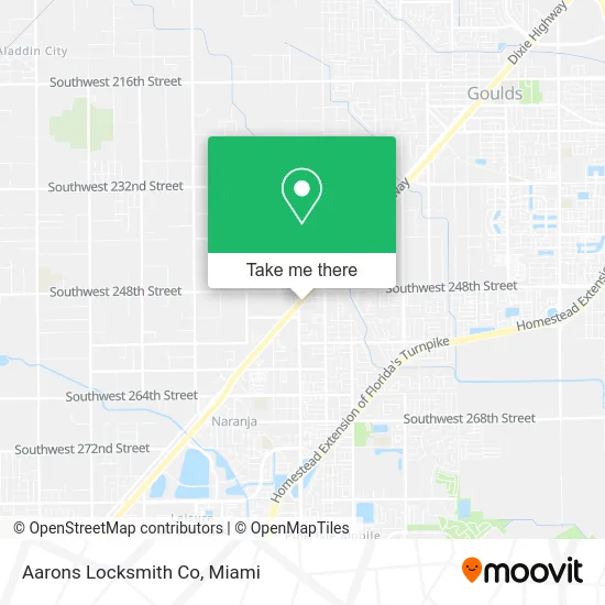
See Aarons Locksmith Co, Princeton-Goulds, on the map
Public Transit to Aarons Locksmith Co in Princeton-Goulds
Wondering how to get to Aarons Locksmith Co in Princeton-Goulds? Moovit helps you find the best way to get to Aarons Locksmith Co with step-by-step directions from the nearest public transit station.
Moovit provides free maps and live directions to help you navigate through your city. View schedules, routes, timetables, and find out how long does it take to get to Aarons Locksmith Co in real time.
Looking for the nearest stop or station to Aarons Locksmith Co? Check out this list of stops closest to your destination: Sw 248 St & Sw 134 Av; Transitway & Sw 244 St Station; Sw 244 St Station.
Bus: 601, 602, 70.
Want to see if there’s another route that gets you there at an earlier time? Moovit helps you find alternative routes or times. Get directions from and directions to Aarons Locksmith Co easily from the Moovit App or Website.
We make riding to Aarons Locksmith Co easy, which is why over 1.5 million users, including users in Princeton-Goulds, trust Moovit as the best app for public transit. You don’t need to download an individual bus app or train app, Moovit is your all-in-one transit app that helps you find the best bus time or train time available.
For information on prices of bus, costs and ride fares to Aarons Locksmith Co, please check the Moovit app.
Use the app to navigate to popular places including to the airport, hospital, stadium, grocery store, mall, coffee shop, school, college, and university.
Aarons Locksmith Co Address: 24961 S Dixie Hwy Homestead, FL 33032 street in Princeton-Goulds
- SW 137th Ave / US-1,
- Post Office,
- Antojitos Maria,
- El Monte RV Rentals,
- Sabory by Salvi Cafe,
- Dixie Hwy Locksmith Company,
- Macro Auto Sales,
- Real Palm Trees,
- Iglesia Casa de Adoracion,
- Emc Jewelry,
- Tacos El Manfre,
- Bargain Town Flea Market,
- US 1@SW 248 St,
- Huarachera Sabrosona,
- Lunamaes Cakes and Pastries,
- Susie Q Gourmet Hot Dogs,
- A1 Market,
- Sunny Hills Assisted Living Facility of Homestead,
- Sunshine Villas Apartments,
- Dixie Hwy Locksmith Company
Places Near Aarons Locksmith Co (Princeton-Goulds)
- Dolphin Mall Bus, Miami,
- Port of Miami Cruise Terminal, Miami,
- Zoo Miami, Miami,
- Richard E. Gerstein Justice Building, Miami,
- Marlins Park, Miami,
- Little Havana, Miami,
- Miami Freedom Park, Miami,
- Brickell City Centre, Miami,
- Sawgrass mall ( FL ), Miami Beach,
- Dolphin Mall, Miami,
- Miami VA Hospital, Miami,
- Keiser University Flagship Campus, West Palm Beach,
- Bayside Marketplace, Miami,
- Aventura Mall, Miami Beach,
- Hard Rock Stadium, Miami Gardens,
- Wynwood, Miami,
- Sawgrass Mall, Miami,
- Aventura Mall, Miami,
- Miami Design District, Miami,
- Miami-Dade County Courthouse, Miami
How to get to popular places in Miami with public transit
Get around Princeton-Goulds by public transit!
Traveling around Princeton-Goulds has never been so easy. See step by step directions as you travel to any attraction, street or major public transit station. View bus and train schedules, arrival times, service alerts and detailed routes on a map, so you know exactly how to get to anywhere in Princeton-Goulds.
When traveling to any destination around Princeton-Goulds use Moovit's Live Directions with Get Off Notifications to know exactly where and how far to walk, how long to wait for your line, and how many stops are left. Moovit will alert you when it's time to get off — no need to constantly re-check whether yours is the next stop.
Wondering how to use public transit in Princeton-Goulds or how to pay for public transit in Princeton-Goulds? Moovit public transit app can help you navigate your way with public transit easily, and at minimum cost. It includes public transit fees, ticket prices, and costs. Looking for a map of Princeton-Goulds public transit lines? Moovit public transit app shows all public transit maps in Princeton-Goulds with all Bus, Train, Light Rail and Ferry routes and stops on an interactive map.
Miami has 4 transit type(s), including: Bus, Train, Light Rail and Ferry, operated by several transit agencies, including Broward County Transit, Miami-Dade Transit, Metrorail, Palm Tran, Tri-Rail, Brightline, MARTY, City of Homestead Trolley, Key West Transit, Treasure Coast Connector, GoLine IRT, Amtrak, Greyhound-us, FlixBus-us and Aventura Express Shuttle Bus