How to get to Abarrotes Pin by bus?
Click on the bus route to see step by step directions with maps, line arrival times and updated time schedules.
From Glorieta El Quijote, Aguascalientes
33 minFrom Centro de Estudios de Bachillerato Aguascalientes, Aguascalientes
51 minFrom Bodega Aurrera Haciendas, Aguascalientes
63 minFrom Ejido Cumbres II, Aguascalientes
57 minFrom Av Ignacio T. Chávez, Aguascalientes
43 minFrom Secundaria Tecnica, 22, Nazario S. Ortiz Garza, Aguascalientes
47 minFrom Aguascalientes, Aguascalientes
50 minFrom Fracc Miradores de Santa Elena, Aguascalientes
58 minFrom Misa Dominical Rancho Santa Monica, Aguascalientes
79 min
Bus stop near Abarrotes Pin in Aguascalientes
- Avenida Eugenio Garza Sada, 603, 3 min walk,VIEW
What are the closest stations to Abarrotes Pin?
The closest stations to Abarrotes Pin are:
- Avenida Eugenio Garza Sada, 603 is 159 meters away, 3 min walk.
Which bus lines stop near Abarrotes Pin?
These bus lines stop near Abarrotes Pin: RUTA 19, RUTA 28.
What’s the nearest bus station to Abarrotes Pin in Aguascalientes?
The nearest bus station to Abarrotes Pin in Aguascalientes is Avenida Eugenio Garza Sada, 603. It’s a 3 min walk away.
What time is the first bus to Abarrotes Pin in Aguascalientes?
The RUTA 19 is the first bus that goes to Abarrotes Pin in Aguascalientes. It stops nearby at 6:10 AM.
What time is the last bus to Abarrotes Pin in Aguascalientes?
The RUTA 19 is the last bus that goes to Abarrotes Pin in Aguascalientes. It stops nearby at 10:04 PM.
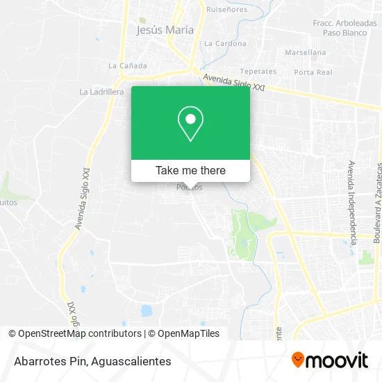
See Abarrotes Pin, Aguascalientes, on the map
Public Transit to Abarrotes Pin in Aguascalientes
Wondering how to get to Abarrotes Pin in Aguascalientes? Moovit helps you find the best way to get to Abarrotes Pin with step-by-step directions from the nearest public transit station.
Moovit provides free maps and live directions to help you navigate through your city. View schedules, routes, timetables, and find out how long does it take to get to Abarrotes Pin in real time.
Looking for the nearest stop or station to Abarrotes Pin? Check out this list of stops closest to your destination: Avenida Eugenio Garza Sada.
Bus: RUTA 19, RUTA 28.
Want to see if there’s another route that gets you there at an earlier time? Moovit helps you find alternative routes or times. Get directions from and directions to Abarrotes Pin easily from the Moovit App or Website.
We make riding to Abarrotes Pin easy, which is why over 1.5 million users, including users in Aguascalientes, trust Moovit as the best app for public transit. You don’t need to download an individual bus app or train app, Moovit is your all-in-one transit app that helps you find the best bus time or train time available.
For information on prices of bus, costs and ride fares to Abarrotes Pin, please check the Moovit app.
Use the app to navigate to popular places including to the airport, hospital, stadium, grocery store, mall, coffee shop, school, college, and university.
Abarrotes Pin Address: Abarrotes Pin, Avenida Eugenio Garza Sada, Fracc Lomas de San Jose de Pocitos, 20328 Pocitos, Aguas street in Aguascalientes
- Softtek,
- Cafezzito Aguascalientes,
- Jardín Las Palmas,
- Preparatoria Batent,
- La Cocina de Mamá,
- Pidesol Ags,
- Global Trip Curso de Verano,
- La Talavera Cocina Mexicana,
- Telebachillerato Comunitario Pocitos,
- Ares Barber Shop,
- Cafioca,
- Neveria Ruso Ice,
- Plaza San Ignacio,
- Obrador Pocitos,
- Pocitos,
- Fracc Lomas de San Jose de Pocitos,
- Las Chiquiadas Ags,
- Tacos Chosky,
- WESTERN UNION,
- Pro Jardín
Places Near Abarrotes Pin (Aguascalientes)
- Villas de Nuestra Señora de la Asunción, Aguascalientes,
- Terminal De Combis, Aguascalientes,
- Centro Comercial Altaria, Aguascalientes,
- Central De Autobuses, Aguascalientes,
- Ciudad industrial, Aguascalientes,
- Universidad Autónoma de Aguascalientes, Aguascalientes,
- Blvd. Luis Donaldo Colosio, Aguascalientes,
- Jesús María, Aguascalientes,
- Agropecuario, Aguascalientes,
- Imss Clinica 1, Aguascalientes,
- La Isla San Marcos, Aguascalientes,
- Villasuncion, Aguascalientes,
- Hospital Imss No. 3, Aguascalientes,
- ESPACIOS, Aguascalientes,
- Aeropuerto de Aguascalientes S.A. de C.V., Aguascalientes,
- Nuevo Hospital Hidalgo, Aguascalientes,
- clinica 3 uaa, Aguascalientes,
- Isla San Marcos, Aguascalientes,
- Centro, Aguascalientes,
- Parque Las Tres Centurias, Aguascalientes
How to get to popular places in Aguascalientes with public transit
Get around Aguascalientes by public transit!
Traveling around Aguascalientes has never been so easy. See step by step directions as you travel to any attraction, street or major public transit station. View bus and train schedules, arrival times, service alerts and detailed routes on a map, so you know exactly how to get to anywhere in Aguascalientes.
When traveling to any destination around Aguascalientes use Moovit's Live Directions with Get Off Notifications to know exactly where and how far to walk, how long to wait for your line, and how many stops are left. Moovit will alert you when it's time to get off — no need to constantly re-check whether yours is the next stop.
Wondering how to use public transit in Aguascalientes or how to pay for public transit in Aguascalientes? Moovit public transit app can help you navigate your way with public transit easily, and at minimum cost. It includes public transit fees, ticket prices, and costs. Looking for a map of Aguascalientes public transit lines? Moovit public transit app shows all public transit maps in Aguascalientes with all bus routes and stops on an interactive map.
Aguascalientes has 1 transit type(s), including: bus, operated by several transit agencies, including Coordinación General de Movilidad