How to get to Absolute Chiropractic by bus?
Click on the bus route to see step by step directions with maps, line arrival times and updated time schedules.
From Ambleside, Edmonton
66 minFrom Cherry Lane Brick & Stone, Edmonton
107 minFrom Iskcon Edmonton, Edmonton
98 minFrom Steinhauer United CH Tenant Centre, Edmonton
57 minFrom Deol Insurance & Financial Services, Edmonton
93 minFrom ETS Bus Route 590 (Leduc C-Line), Edmonton
42 minFrom Riverbend Square Road Northwest, Edmonton
72 minFrom Bismillah Meat LTD, Edmonton
93 minFrom Wal Mart Southpark, Edmonton
77 minFrom Keswick, Edmonton
98 min
Bus stops near Absolute Chiropractic in Edmonton
Bus lines to Absolute Chiropractic in Edmonton
What are the closest stations to Absolute Chiropractic?
The closest stations to Absolute Chiropractic are:
- Chappelle Vista & Chappelle Road SW is 377 meters away, 5 min walk.
- Chappelle Drive & Claxton Loop SW is 834 meters away, 11 min walk.
Which bus lines stop near Absolute Chiropractic?
These bus lines stop near Absolute Chiropractic: 719, 721.
What’s the nearest bus station to Absolute Chiropractic in Edmonton?
The nearest bus station to Absolute Chiropractic in Edmonton is Chappelle Vista & Chappelle Road SW. It’s a 5 min walk away.
What time is the first bus to Absolute Chiropractic in Edmonton?
The 719 is the first bus that goes to Absolute Chiropractic in Edmonton. It stops nearby at 5:58 AM.
What time is the last bus to Absolute Chiropractic in Edmonton?
The 719 is the last bus that goes to Absolute Chiropractic in Edmonton. It stops nearby at 11:31 PM.
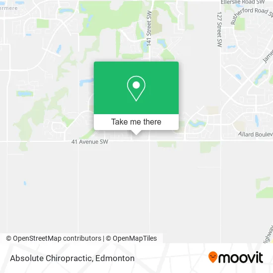
See Absolute Chiropractic, Edmonton, on the map
Public Transit to Absolute Chiropractic in Edmonton
Wondering how to get to Absolute Chiropractic in Edmonton? Moovit helps you find the best way to get to Absolute Chiropractic with step-by-step directions from the nearest public transit station.
Moovit provides free maps and live directions to help you navigate through your city. View schedules, routes, timetables, and find out how long does it take to get to Absolute Chiropractic in real time.
Looking for the nearest stop or station to Absolute Chiropractic? Check out this list of stops closest to your destination: Chappelle Vista & Chappelle Road SW; Chappelle Drive & Claxton Loop SW.
Bus: 719, 721, 727, 663, 668.
Want to see if there’s another route that gets you there at an earlier time? Moovit helps you find alternative routes or times. Get directions from and directions to Absolute Chiropractic easily from the Moovit App or Website.
We make riding to Absolute Chiropractic easy, which is why over 1.5 million users, including users in Edmonton, trust Moovit as the best app for public transit. You don’t need to download an individual bus app or train app, Moovit is your all-in-one transit app that helps you find the best bus time or train time available.
For information on prices of bus, costs and ride fares to Absolute Chiropractic, please check the Moovit app.
Use the app to navigate to popular places including to the airport, hospital, stadium, grocery store, mall, coffee shop, school, college, and university.
Absolute Chiropractic Address: Cartmell Pl SW Edmonton, AB T6W street in Edmonton
- Tipsy Moose,
- Apollo Medical Clinic,
- Stellar Integrated Eye,
- Deccani,
- John Yun,
- Gelli Nails,
- Glenwood Radiology,
- Amal Ebrahim Professio,
- Acupuncture and Massag,
- The Co-Operators,
- Smokey's,
- Stellar Optometrist,
- OG Tattoo Studio,
- Naan & Beyond,
- Prime Denture,
- Vape Inn Cigar & Smoke,
- The Shoppes at Chappelle Crossing,
- Play and Fun Daycare,
- Touched by Light Photography,
- Departure Photography
Places Near Absolute Chiropractic (Edmonton)
- University of Alberta, Edmonton,
- Cross Cancer Institute, Edmonton,
- Edmonton VIA Rail Station, Edmonton,
- Edmonton EXPO Centre, Edmonton,
- Kaye Edmonton Clinic, Edmonton,
- Grey Nuns Community Hospital, Edmonton,
- West Edmonton Mall, Edmonton,
- MacEwan University, Edmonton,
- Edmonton Valley Zoo, Edmonton,
- Londonderry Mall, Edmonton,
- Rogers Place, Edmonton,
- Fort Edmonton Park, Edmonton,
- Northgate Centre, Edmonton,
- Royal Alexandra Hospital, Edmonton,
- Edmonton Commonwealth Stadium, Edmonton,
- Alberta Legislature Building, Edmonton,
- Canada Place Service Canada Centre, Edmonton,
- Borden Park, Edmonton,
- Whyte Avenue, Edmonton,
- Kingsway Mall, Edmonton
How to get to popular places in Edmonton with public transit
Get around Edmonton by public transit!
Traveling around Edmonton has never been so easy. See step by step directions as you travel to any attraction, street or major public transit station. View bus and train schedules, arrival times, service alerts and detailed routes on a map, so you know exactly how to get to anywhere in Edmonton.
When traveling to any destination around Edmonton use Moovit's Live Directions with Get Off Notifications to know exactly where and how far to walk, how long to wait for your line, and how many stops are left. Moovit will alert you when it's time to get off — no need to constantly re-check whether yours is the next stop.
Wondering how to use public transit in Edmonton or how to pay for public transit in Edmonton? Moovit public transit app can help you navigate your way with public transit easily, and at minimum cost. It includes public transit fees, ticket prices, and costs. Looking for a map of Edmonton public transit lines? Moovit public transit app shows all public transit maps in Edmonton with all Bus and Light Rail routes and stops on an interactive map.
Edmonton has 2 transit type(s), including: Bus and Light Rail, operated by several transit agencies, including ETS LRT, ETS, Strathcona County Transit, St. Albert Transit, Spruce Grove Transit, Fort Saskatchewan Transit, Beaumont Transit and Leduc Transit