How to get to Acari by bus?
Click on the bus route to see step by step directions with maps, line arrival times and updated time schedules.
How to get to Acari by train?
Click on the train route to see step by step directions with maps, line arrival times and updated time schedules.
How to get to Acari by metro?
Click on the metro route to see step by step directions with maps, line arrival times and updated time schedules.
Bus stops near Acari
- Avenida Pastor Martin Luther King Junior, 8971-9031, 6 min walk,VIEW
- Avenida Pastor Martin Luther King Junior, 467, 6 min walk,VIEW
- Avenida Brasil | Coelho Neto / Ciep Antônio Candeia Filho, 8 min walk,VIEW
- Rua Araçatuba, 213, 13 min walk,VIEW
- Avenida Brasil - Passarela 27 (Conjunto Amarelinho), 13 min walk,VIEW
- Avenida Brasil | Passarela 27 / Assaí Ceasa, 14 min walk,VIEW
- Praça Professora Virgínia Cidade, 13, 15 min walk,VIEW
- Rua Embaú, 1246-1438, 22 min walk,VIEW
Metro station near Acari
- Acari / Fazenda Botafogo, 10 min walk,VIEW
Train station near Acari
- Barros Filho, 41 min walk,VIEW
Bus lines to Acari
- 298, Acari - Castelo (Brs 4 - Via Norte Shopping),VIEW
- SN 298, Acari - Castelo (Brs 4 - Via Norte Shopping / Terminal Gentileza),VIEW
- 362, Honório - Castelo (Brs 4),VIEW
- SR 362, Honório - Castelo (Rápido),VIEW
- 428L, Nova Aurora - Bonsucesso (Via Pavuna),VIEW
- 665, Pavuna - Saens Peña (Via Coelho Neto),VIEW
- SVA 685, Irajá - Méier (Via Rua Embaú),VIEW
- 687, Pavuna - Méier (Via Est. Velha da Pavuna),VIEW
- 688, Pavuna - Méier (Via Álvaro de Miranda),VIEW
- 713L, Cosmorama - Cascadura (Via Pavuna),VIEW
- 715L, Santa Marta - Cascadura (Via Jardim Redentor),VIEW
- 720L, Novo Rio - Cascadura (Via Madureira / Pavuna),VIEW
- 729L, São Vicente - Méier (Via Pavuna),VIEW
- 734L, Vila Norma - Cascadura (Via Vila Tiradentes),VIEW
- 736L, Jardim Botânico - Cascadura (Via Praça da Bandeira),VIEW
- 738L, Jardim Metrópoles - Cascadura (Via Prefeitura),VIEW
- 785, Cascadura - Marechal Hermes (via Coelho Neto e BRT Jardim Guadalupe),VIEW
- 919, Pavuna - Maré (via Carioca Shopping / Bonsucesso),VIEW
- SN 919, Pavuna - Maré (via Carioca Shopping / Bonsucesso),VIEW
- 920, Pavuna - Bonsucesso (Via Fazenda Botafogo),VIEW
What are the closest stations to Acari?
The closest stations to Acari are:
- Avenida Pastor Martin Luther King Junior, 8971-9031 is 393 meters away, 6 min walk.
- Avenida Pastor Martin Luther King Junior, 467 is 421 meters away, 6 min walk.
- Avenida Brasil | Coelho Neto / Ciep Antônio Candeia Filho is 543 meters away, 8 min walk.
- Acari / Fazenda Botafogo is 736 meters away, 10 min walk.
- Rua Araçatuba, 213 is 1009 meters away, 13 min walk.
- Avenida Brasil - Passarela 27 (Conjunto Amarelinho) is 1016 meters away, 13 min walk.
- Avenida Brasil | Passarela 27 / Assaí Ceasa is 1098 meters away, 14 min walk.
- Praça Professora Virgínia Cidade, 13 is 1146 meters away, 15 min walk.
- Rua Embaú, 1246-1438 is 1713 meters away, 22 min walk.
- Barros Filho is 3175 meters away, 41 min walk.
Which bus lines stop near Acari?
These bus lines stop near Acari: 124, 388, 428L, 444B, 687, 688, 800L, 946.
Which metro line stops near Acari?
L2 (Pavuna)
Which train line stops near Acari?
RAMAL BELFORD ROXO (Belford Roxo)
What’s the nearest metro station to Acari?
The nearest metro station to Acari is Acari / Fazenda Botafogo. It’s a 10 min walk away.
What’s the nearest bus station to Acari?
The nearest bus stations to Acari are Avenida Pastor Martin Luther King Junior, 8971-9031 and Avenida Pastor Martin Luther King Junior, 467. The closest one is a 6 min walk away.
What time is the first metro to Acari?
The L2 is the first metro that goes to Acari. It stops nearby at 5:01 AM.
What time is the last metro to Acari?
The L2 is the last metro that goes to Acari. It stops nearby at 12:49 AM.
What time is the first train to Acari?
The RAMAL BELFORD ROXO is the first train that goes to Acari. It stops nearby at 5:07 AM.
What time is the last train to Acari?
The RAMAL BELFORD ROXO is the last train that goes to Acari. It stops nearby at 10:09 PM.
What time is the first bus to Acari?
The 759 is the first bus that goes to Acari. It stops nearby at 3:00 AM.
What time is the last bus to Acari?
The 388 is the last bus that goes to Acari. It stops nearby at 4:13 AM.
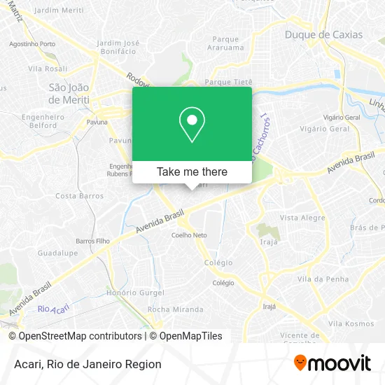
See Acari on the map
Public Transportation to Acari
Wondering how to get to Acari? Moovit helps you find the best way to get to Acari with step-by-step directions from the nearest public transit station.
Moovit provides free maps and live directions to help you navigate through your city. View schedules, routes, timetables, and find out how long does it take to get to Acari in real time.
Looking for the nearest stop or station to Acari? Check out this list of stops closest to your destination: Avenida Pastor Martin Luther King Junior; Avenida Pastor Martin Luther King Junior; Avenida Brasil | Coelho Neto / Ciep Antônio Candeia Filho; Acari / Fazenda Botafogo; Rua Araçatuba; Avenida Brasil - Passarela 27 (Conjunto Amarelinho); Avenida Brasil | Passarela 27 / Assaí Ceasa; Praça Professora Virgínia Cidade; Rua Embaú; Barros Filho.
Bus: 124, 388, 428L, 444B, 687, 688, 800L, 946, 298, SN 298, 362, SR 362, 300, SR 300, SN 388, 407T, 112B, 113D, 119T, 121T.Metro: L2.Train: RAMAL BELFORD ROXO.
Want to see if there’s another route that gets you there at an earlier time? Moovit helps you find alternative routes or times. Get directions from and directions to Acari easily from the Moovit App or Website.
We make riding to Acari easy, which is why over 1.5 million users, including users in Acari, trust Moovit as the best app for public transit. You don’t need to download an individual bus app or train app, Moovit is your all-in-one transit app that helps you find the best bus time or train time available.
For information on prices of bus, train and metro, costs and ride fares to Acari, please check the Moovit app.
Use the app to navigate to popular places including to the airport, hospital, stadium, grocery store, mall, coffee shop, school, college, and university.
Acari Address: Rio de Janeiro-RJ street in Acari
- Salão de Festas Rei Davi,
- Churrascaria Boi Bom Na Brasa,
- Padaria da Rua Nova,
- Travessa Pereira Silva,
- Rua Nova SN,
- Rua Valão,
- Vila Rica De Irajá,
- Ifb Moto Shopping,
- Guaravan Industria e Comercio,
- Sorveteria Ravis,
- Praça Roberto Carlos,
- Bg Rações,
- Rua Olária,
- Estrada Engenheiro Edgard Soutelo / Rua Carlos,
- Creche Municipal Edna Lotte,
- Restaurante do Chaguinha,
- Karen Distribuidora,
- Rua Guaiuba 150,
- Sorveteria Doce Mel,
- Conjunto Amarelinho
Places Near Acari
- Hospital Municipal Ronaldo Gazolla, Acari,
- Shopping Downtown, Barra Da Tijuca,
- Hospital Federal Cardoso Fontes, Jacarepaguá,
- Norte Shopping, Cachambi,
- Avenida Venezuela 134, Saúde,
- Shopping RioSul, Botafogo,
- Rua Ulysses Guimarães 16, Cidade Nova,
- Hospital Pedro Ernesto, Vila Isabel,
- Museu Do Amanhã, Centro,
- Hospital Federal Do Andaraí, Andaraí,
- Feirão De Malhas, Duque De Caxias,
- Shopping Rio Sul, Botafogo,
- Rio De Janeiro,
- Avenida Rio Branco, Centro,
- Niterói, Niterói,
- Rua Licínio Cardoso, São Francisco Xavier,
- Praia do Arpoador, Ipanema,
- Rodoviária Novo Rio (Rodoviária do Rio de Janeiro), Santo Cristo,
- Shopping Nova América, Del Castilho,
- Feira Livre da Gloria, Glória
How to get to popular places in Rio de Janeiro Region with public transit
Get around Acari by public transit!
Traveling around Acari has never been so easy. See step by step directions as you travel to any attraction, street or major public transit station. View bus and train schedules, arrival times, service alerts and detailed routes on a map, so you know exactly how to get to anywhere in Acari.
When traveling to any destination around Acari use Moovit's Live Directions with Get Off Notifications to know exactly where and how far to walk, how long to wait for your line, and how many stops are left. Moovit will alert you when it's time to get off — no need to constantly re-check whether yours is the next stop.
Wondering how to use public transit in Acari or how to pay for public transit in Acari? Moovit public transit app can help you navigate your way with public transit easily, and at minimum cost. It includes public transit fees, ticket prices, and costs. Looking for a map of Acari public transit lines? Moovit public transit app shows all public transit maps in Acari with all Bus, Train, Metro, Light Rail, Ferry, Cable Car, Gondola and Funicular routes and stops on an interactive map.
Rio de Janeiro Region has 8 transit type(s), including: Bus, Train, Metro, Light Rail, Ferry, Cable Car, Gondola and Funicular, operated by several transit agencies, including TrensRJ, Metrô Rio, VLT Carioca, Barcas Rio, BRT MOBI-Rio, Auto Viação Alpha, Auto Viação Tijuca, Gire Transportes, Transurb, Viação Nossa Senhora das Graças, Consórcio INTERSUL, Braso Lisboa (Municipal), Caprichosa Auto Ônibus, Auto Viação Três Amigos and Rodoviária Âncora Matias