How to get to Accelya by bus?
Click on the bus route to see step by step directions with maps, line arrival times and updated time schedules.
From Biltmore Hotel Miami Coral Gables, Miami
75 minFrom Walmart Supercenter, Hialeah
91 minFrom Ada M Barreto P A, North Westside
53 minFrom SW 8th St / SW 67th Ave, Miami
44 minFrom SW 88th St / SW 107th Ave, Kendall-Palmetto Bay
51 minFrom Rapids Water Park, Miami
57 minFrom G. Holmes Braddock Senior High School, Kendale Lakes-Tamiami
53 minFrom Comfort Suites Miami Airport North, Miami
54 minFrom SW 8th St / SW 62nd Ave, Miami
46 minFrom Terminal Aeropuerto Internacional del Miami, Miami
118 min
Bus stops near Accelya in North Westside
Bus lines to Accelya in North Westside
What are the closest stations to Accelya?
The closest stations to Accelya are:
- Nw 7 St @ Nw 107 Ave is 374 yards away, 5 min walk.
- Fountainebleau Bd & Nw 107 Av is 418 yards away, 6 min walk.
- Nw 107 Av @ Fountainebleau Bd is 436 yards away, 6 min walk.
- Nw 107 Av @ Nw 7 St is 444 yards away, 6 min walk.
Which bus lines stop near Accelya?
These bus lines stop near Accelya: 107, 7, 8, DLOOP4.
What’s the nearest bus station to Accelya in North Westside?
The nearest bus station to Accelya in North Westside is Nw 7 St @ Nw 107 Ave. It’s a 5 min walk away.
What time is the first bus to Accelya in North Westside?
The 7 is the first bus that goes to Accelya in North Westside. It stops nearby at 4:56 AM.
What time is the last bus to Accelya in North Westside?
The 107 is the last bus that goes to Accelya in North Westside. It stops nearby at 12:44 AM.
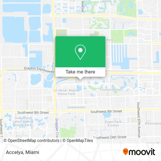
See Accelya, North Westside, on the map
Public Transit to Accelya in North Westside
Wondering how to get to Accelya in North Westside? Moovit helps you find the best way to get to Accelya with step-by-step directions from the nearest public transit station.
Moovit provides free maps and live directions to help you navigate through your city. View schedules, routes, timetables, and find out how long does it take to get to Accelya in real time.
Looking for the nearest stop or station to Accelya? Check out this list of stops closest to your destination: Nw 7 St @ Nw 107 Ave; Fountainebleau Bd & Nw 107 Av; Nw 107 Av @ Fountainebleau Bd; Nw 107 Av @ Nw 7 St.
Bus: 107, 7, 8, DLOOP4, SWTWTA, SWTWTB, 137.
Want to see if there’s another route that gets you there at an earlier time? Moovit helps you find alternative routes or times. Get directions from and directions to Accelya easily from the Moovit App or Website.
We make riding to Accelya easy, which is why over 1.5 million users, including users in North Westside, trust Moovit as the best app for public transit. You don’t need to download an individual bus app or train app, Moovit is your all-in-one transit app that helps you find the best bus time or train time available.
For information on prices of bus and light rail, costs and ride fares to Accelya, please check the Moovit app.
Use the app to navigate to popular places including to the airport, hospital, stadium, grocery store, mall, coffee shop, school, college, and university.
Accelya Address: 790 NW 107th Ave Miami, FL 33172 street in North Westside
- Consul Experience,
- Hermes Alvarez, Comparion Insurance Agent,
- Rafael Ventura at Comparion Insurance Agency,
- Inc Farelogix,
- Saul Fermin, Liberty Mutual Insurance Agent,
- FedEx,
- NW 107th Ave Ext Sweetwater,
- IVX Health Infusion Center,
- Andrade Group,
- Barbara Matute at Comparion Insurance Agency,
- Miami Car Locksmith Near Me,
- Consulate General of Bangladesh, Miami,
- Unlimited Real Estate,
- Snatched Plastic Surgery,
- Coastal Construction Group of S Fla,
- Tip Top Freight,
- Rialto Capital Management,
- Cal Trade,
- Uriarte Law,
- Florida New Vision
Places Near Accelya (North Westside)
- Brickell City Centre, Miami,
- Zoo Miami, Miami,
- 1351 NW 12th St, Miami,
- Miami Design District, Miami,
- Sawgrass Mall, Miami,
- Aventura Mall, Miami Beach,
- Little Havana, Miami,
- Keiser University Flagship Campus, West Palm Beach,
- Miami-Dade County Courthouse, Miami,
- Bayside Marketplace, Miami,
- Hard Rock Stadium, Miami Gardens,
- Wynwood, Miami,
- Port of Miami Cruise Terminal, Miami,
- Dolphin Mall Bus, Miami,
- Sawgrass mall ( FL ), Miami Beach,
- Dolphin Mall, Miami,
- Richard E. Gerstein Justice Building, Miami,
- Aventura Mall, Miami,
- Marlins Park, Miami,
- Miami Freedom Park, Miami
How to get to popular places in Miami with public transit
Get around North Westside by public transit!
Traveling around North Westside has never been so easy. See step by step directions as you travel to any attraction, street or major public transit station. View bus and train schedules, arrival times, service alerts and detailed routes on a map, so you know exactly how to get to anywhere in North Westside.
When traveling to any destination around North Westside use Moovit's Live Directions with Get Off Notifications to know exactly where and how far to walk, how long to wait for your line, and how many stops are left. Moovit will alert you when it's time to get off — no need to constantly re-check whether yours is the next stop.
Wondering how to use public transit in North Westside or how to pay for public transit in North Westside? Moovit public transit app can help you navigate your way with public transit easily, and at minimum cost. It includes public transit fees, ticket prices, and costs. Looking for a map of North Westside public transit lines? Moovit public transit app shows all public transit maps in North Westside with all Bus, Train, Light Rail and Ferry routes and stops on an interactive map.
Miami has 4 transit type(s), including: Bus, Train, Light Rail and Ferry, operated by several transit agencies, including Broward County Transit, Miami-Dade Transit, Metrorail, Palm Tran, Tri-Rail, Brightline, MARTY, City of Homestead Trolley, Key West Transit, Treasure Coast Connector, GoLine IRT, Amtrak, Greyhound-us, FlixBus-us and Aventura Express Shuttle Bus