How to get to Accesorios Tips by bus?
Click on the bus route to see step by step directions with maps, line arrival times and updated time schedules.
From Corral de Barrancos, Aguascalientes
34 minFrom Pintores Mexicanos Colonia, Aguascalientes
30 minFrom Rancho Santa Mónica, Aguascalientes
40 minFrom Gómez Morín, Aguascalientes
37 minFrom Unidad Deportiva Jesús María, Aguascalientes
40 minFrom Vista las Cumbres, Aguascalientes
40 minFrom Paso Blanco, Aguascalientes
47 minFrom Universidad Autónoma de Aguascalientes Campus Sur, Aguascalientes
43 minFrom Hacienda San Martín, Aguascalientes
42 min
Bus stops near Accesorios Tips in Aguascalientes
Bus lines to Accesorios Tips in Aguascalientes
- RUTA 04, Jesús María - Mahatma Gandhi,VIEW
- RUTA 09, Mahatma Gandhi - Los Laureles,VIEW
- RUTA 12, Vicente Guerrero - Lunaria,VIEW
- RUTA 16, Bellavista - Hacienda Nueva,VIEW
- RUTA 19, Vistas de Oriente - Pocitos,VIEW
- RUTA 27, Vicente Guerrero - Valle de los Cactus,VIEW
- RUTA 28, Chichimeco - Mahatma Gandhi,VIEW
- RUTA 36, Lunaria - Centro (Mercado Terán),VIEW
- RUTA 37, UTMA - Hacienda San Marcos,VIEW
- RUTA 43, UTMA - Lomas de New York - San Antonio,VIEW
- RUTA 43, San Antonio - UTMA,VIEW
- RUTA 46, Vicente Guerrero - Calvillito,VIEW
- RUTA 48, Bellavista - Centro (Panteón de la Cruz),VIEW
- RUTA 03, La Ribera,VIEW
- RUTA 47, Clínica 10,VIEW
- RUTA 01, Vicente Guerrero - Margaritas,VIEW
- RUTA 06, Jesús María - Mahatma Gandhi,VIEW
- RUTA 07, Villas Las Palmas - Centro (Jardínde Zaragoza),VIEW
- RUTA 29, Lomas del Ajedrez -Centro (Jardínde Zaragoza),VIEW
- RUTA 34, Villa Montaña - UPA,VIEW
What are the closest stations to Accesorios Tips?
The closest stations to Accesorios Tips are:
- Ortega, 125 is 79 meters away, 2 min walk.
- Licenciado Benito Juárez 304 is 144 meters away, 2 min walk.
- Licenciado Benito Juárez, 423 is 211 meters away, 3 min walk.
- Oriente, 109 is 252 meters away, 4 min walk.
- José María Morelos Y Pavón, 401 is 273 meters away, 4 min walk.
- General Guadalupe Victoria, 408 is 282 meters away, 4 min walk.
Which bus lines stop near Accesorios Tips?
These bus lines stop near Accesorios Tips: RUTA 01, RUTA 03, RUTA 04, RUTA 37, RUTA 38, RUTA 43, RUTA 48.
What’s the nearest bus station to Accesorios Tips in Aguascalientes?
The nearest bus stations to Accesorios Tips in Aguascalientes are Ortega, 125 and Licenciado Benito Juárez 304. The closest one is a 2 min walk away.
What time is the first bus to Accesorios Tips in Aguascalientes?
The RUTA 29 is the first bus that goes to Accesorios Tips in Aguascalientes. It stops nearby at 6:00 AM.
What time is the last bus to Accesorios Tips in Aguascalientes?
The RUTA 07 is the last bus that goes to Accesorios Tips in Aguascalientes. It stops nearby at 10:45 PM.
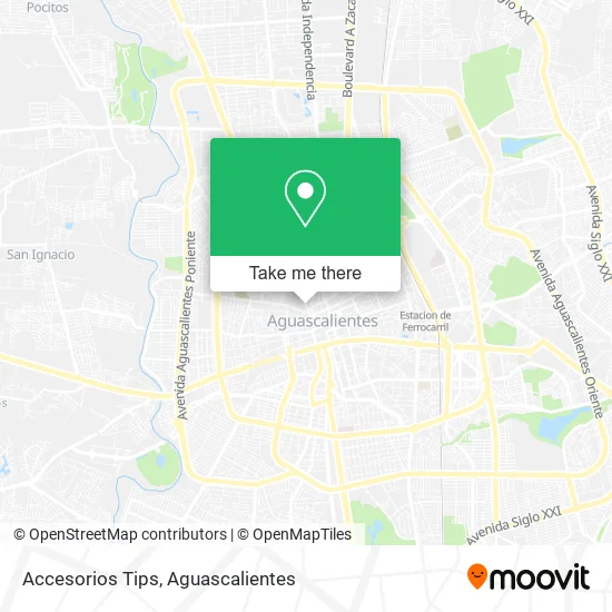
See Accesorios Tips, Aguascalientes, on the map
Public Transit to Accesorios Tips in Aguascalientes
Wondering how to get to Accesorios Tips in Aguascalientes? Moovit helps you find the best way to get to Accesorios Tips with step-by-step directions from the nearest public transit station.
Moovit provides free maps and live directions to help you navigate through your city. View schedules, routes, timetables, and find out how long does it take to get to Accesorios Tips in real time.
Looking for the nearest stop or station to Accesorios Tips? Check out this list of stops closest to your destination: Ortega; Licenciado Benito Juárez 304; Licenciado Benito Juárez; Oriente; José María Morelos Y Pavón; General Guadalupe Victoria.
Bus: RUTA 01, RUTA 03, RUTA 04, RUTA 37, RUTA 38, RUTA 43, RUTA 48, RUTA 09, RUTA 12, RUTA 16, RUTA 19, RUTA 47, RUTA 06, RUTA 07, RUTA 29, RUTA 34, RUTA 05, RUTA 09, RUTA 10, RUTA 11, RUTA 08.
Want to see if there’s another route that gets you there at an earlier time? Moovit helps you find alternative routes or times. Get directions from and directions to Accesorios Tips easily from the Moovit App or Website.
We make riding to Accesorios Tips easy, which is why over 1.5 million users, including users in Aguascalientes, trust Moovit as the best app for public transit. You don’t need to download an individual bus app or train app, Moovit is your all-in-one transit app that helps you find the best bus time or train time available.
For information on prices of bus, costs and ride fares to Accesorios Tips, please check the Moovit app.
Use the app to navigate to popular places including to the airport, hospital, stadium, grocery store, mall, coffee shop, school, college, and university.
Accesorios Tips Address: Calle General Guadalupe Victoria 318, Aguascalientes Centro, 20000 Aguascalientes, Aguascalientes street in Aguascalientes
- Casa Muro Herbolaria y Semillas y Cereales,
- Artículos Desechables,
- Novedades Lupita,
- Papeleria Axi,
- La Tía,
- Novedades Ruba,
- Pensión Juárez,
- Skandia,
- Muro Lara Salvador,
- Casa Muro - Herbolaria, semillas, cereales y Productos Naurales.,
- Muebles Montoya,
- Jeshua,
- Loncheria Nebraska,
- Golden Star Bag Packs,
- Mundoenvolutura,
- Reparadora de Calzado del Centro,
- Dulcerías El Pariente,
- Renovadora de Calzado Ruiz,
- Birrieria El Lago,
- Venta de Artículos de Mascota
Places Near Accesorios Tips (Aguascalientes)
- Blvd. Luis Donaldo Colosio, Aguascalientes,
- Aeropuerto de Aguascalientes S.A. de C.V., Aguascalientes,
- Imss Clinica 1, Aguascalientes,
- Centro, Aguascalientes,
- Hospital Imss No. 3, Aguascalientes,
- Nuevo Hospital Hidalgo, Aguascalientes,
- Terminal De Combis, Aguascalientes,
- Centro Comercial Altaria, Aguascalientes,
- Parque Las Tres Centurias, Aguascalientes,
- Agropecuario, Aguascalientes,
- clinica 3 uaa, Aguascalientes,
- Jesús María, Aguascalientes,
- La Isla San Marcos, Aguascalientes,
- Central De Autobuses, Aguascalientes,
- Villasuncion, Aguascalientes,
- Ciudad industrial, Aguascalientes,
- Villas de Nuestra Señora de la Asunción, Aguascalientes,
- Isla San Marcos, Aguascalientes,
- ESPACIOS, Aguascalientes,
- Universidad Autónoma de Aguascalientes, Aguascalientes
How to get to popular places in Aguascalientes with public transit
Get around Aguascalientes by public transit!
Traveling around Aguascalientes has never been so easy. See step by step directions as you travel to any attraction, street or major public transit station. View bus and train schedules, arrival times, service alerts and detailed routes on a map, so you know exactly how to get to anywhere in Aguascalientes.
When traveling to any destination around Aguascalientes use Moovit's Live Directions with Get Off Notifications to know exactly where and how far to walk, how long to wait for your line, and how many stops are left. Moovit will alert you when it's time to get off — no need to constantly re-check whether yours is the next stop.
Wondering how to use public transit in Aguascalientes or how to pay for public transit in Aguascalientes? Moovit public transit app can help you navigate your way with public transit easily, and at minimum cost. It includes public transit fees, ticket prices, and costs. Looking for a map of Aguascalientes public transit lines? Moovit public transit app shows all public transit maps in Aguascalientes with all bus routes and stops on an interactive map.
Aguascalientes has 1 transit type(s), including: bus, operated by several transit agencies, including Coordinación General de Movilidad