How to get to ACI Point by bus?
Click on the bus route to see step by step directions with maps, line arrival times and updated time schedules.
From Green Cross Farewell Chapels, Pistoia
71 minFrom A. Gramsci and J. M. Keynes, Prato
86 minFrom Prato Hospital, Prato
84 minFrom Pistoia Zoo, Pistoia
110 minFrom Adua Avenue, Pistoia
34 minFrom Central Meadow (Central Railway Station), Prato
61 minFrom Marconi Street 50, Prato
85 minFrom Mondo Convenienza, Prato
130 minFrom Mezzana, Prato
81 minFrom Poggio A Caiano, Poggio A Caiano
105 min
How to get to ACI Point by train?
Click on the train route to see step by step directions with maps, line arrival times and updated time schedules.
Bus stops near ACI Point in Agliana
Train station near ACI Point in Agliana
- Montale-Agliana, 49 min walk,VIEW
Bus lines to ACI Point in Agliana
What are the closest stations to ACI Point?
The closest stations to ACI Point are:
- Agliana Bellini Street is 265 meters away, 4 min walk.
- Roma 3 is 296 meters away, 4 min walk.
- Agliana Bridge at Trave is 554 meters away, 8 min walk.
- Montale-Agliana is 3836 meters away, 49 min walk.
Which bus lines stop near ACI Point?
These bus lines stop near ACI Point: 12, 207.
Which train line stops near ACI Point?
R (Pistoia/Pisa)
What’s the nearest bus station to ACI Point in Agliana?
The nearest bus stations to ACI Point in Agliana are Agliana Bellini Street and Roma 3. The closest one is a 4 min walk away.
What time is the first train to ACI Point in Agliana?
The R is the first train that goes to ACI Point in Agliana. It stops nearby at 5:27 AM.
What time is the last train to ACI Point in Agliana?
The R is the last train that goes to ACI Point in Agliana. It stops nearby at 1:06 AM.
What time is the first bus to ACI Point in Agliana?
The 12 is the first bus that goes to ACI Point in Agliana. It stops nearby at 9:16 AM.
What time is the last bus to ACI Point in Agliana?
The 901 is the last bus that goes to ACI Point in Agliana. It stops nearby at 11:26 PM.
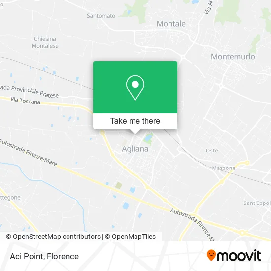
See ACI Point, Agliana, on the map
Public Transit to ACI Point in Agliana
Wondering how to get to ACI Point in Agliana? Moovit helps you find the best way to get to ACI Point with step-by-step directions from the nearest public transit station.
Moovit provides free maps and live directions to help you navigate through your city. View schedules, routes, timetables, and find out how long does it take to get to ACI Point in real time.
Looking for the nearest stop or station to ACI Point? Check out this list of stops closest to your destination: Agliana Bellini Street; Roma 3; Agliana Bridge at Trave; Montale-Agliana.
Bus: 12, 207, 61, 901.Train: R.
Want to see if there’s another route that gets you there at an earlier time? Moovit helps you find alternative routes or times. Get directions from and directions to ACI Point easily from the Moovit App or Website.
We make riding to ACI Point easy, which is why over 1.5 million users, including users in Agliana, trust Moovit as the best app for public transit. You don’t need to download an individual bus app or train app, Moovit is your all-in-one transit app that helps you find the best bus time or train time available.
For information on prices of bus and train, costs and ride fares to ACI Point, please check the Moovit app.
Use the app to navigate to popular places including to the airport, hospital, stadium, grocery store, mall, coffee shop, school, college, and university.
ACI Point Address: 51031 Agliana street in Agliana
- Cpp-Ex,
- Lo Stregatto Stationery,
- Alta Toscana Cooperative Credit Bank - San Piero Agliana Branch,
- Cgn Agliana Tax Assistance Center - Dr. Dania Mazzini,
- Data Leasing,
- BRB Condominium Administrations by Daniele Bruni & C.,
- Restostore,
- Francesco Felci Accounting Office,
- D'Agostino Transports,
- Once Upon a Time by Silvia Masi,
- The New Aglianese by Francolino Liliana,
- At System by Alberto Marini & Tiziano Masoni,
- Garden Floriculture,
- La Barcaccina Fun,
- Ovidio Sgatti Gardens,
- Body & Soul by Pronti Ilaria,
- Public Fountain - Publiacqua, Agliana Municipality,
- Ammirati Gius,
- Nannucci Photography Studio by Marisa Sepe,
- Giovanni Mazzini
Places Near ACI Point (Agliana)
- Field of Mars, Florence,
- Torregalli Hospital Scandicci *, Scandicci,
- Visarno Hippodrome, Florence,
- OOO, Florence,
- Asmana, Campi Bisenzio,
- Tobacco Manufacture, Florence,
- Santa Maria Novella Station, Florence,
- Nelson Mandela Forum, Florence,
- Michelangelo Square, Florence,
- Verdi Theater, Florence,
- Visarno Arena, Florence,
- Michelangelo Square, Florence,
- Piero Palagi Hospital Facility-Florence, Florence,
- Mandela Forum (Nelson Mandela Forum), Florence,
- Campi Bisenzio, Campi Bisenzio,
- IKEA Florence, Sesto Fiorentino,
- Cascine Park, Florence,
- I Gigli, Campi Bisenzio,
- Artemio Franchi Municipal Stadium, Florence,
- Santa Maria Nuova Hospital, Florence
How to get to popular places in Florence with public transit
Get around Agliana by public transit!
Traveling around Agliana has never been so easy. See step by step directions as you travel to any attraction, street or major public transit station. View bus and train schedules, arrival times, service alerts and detailed routes on a map, so you know exactly how to get to anywhere in Agliana.
When traveling to any destination around Agliana use Moovit's Live Directions with Get Off Notifications to know exactly where and how far to walk, how long to wait for your line, and how many stops are left. Moovit will alert you when it's time to get off — no need to constantly re-check whether yours is the next stop.
Wondering how to use public transit in Agliana or how to pay for public transit in Agliana? Moovit public transit app can help you navigate your way with public transit easily, and at minimum cost. It includes public transit fees, ticket prices, and costs. Looking for a map of Agliana public transit lines? Moovit public transit app shows all public transit maps in Agliana with all Bus, Train, Light Rail, Ferry and Funicular routes and stops on an interactive map.
Florence has 5 transit type(s), including: Bus, Train, Light Rail, Ferry and Funicular, operated by several transit agencies, including Florence Urban - Tuscan Bus Lines, GEST, Livorno and Province - Tuscan Bus Lines, Arezzo, Florence and Provinces - Tuscan Bus Lines, Prato and Province - Tuscan Bus Lines, Lucca and Province - Tuscan Bus Lines, Massa, Carrara and Province - Tuscan Bus Lines, Pisa and Province - Tuscan Bus Lines, Grosseto, Siena and Provinces - Tuscan Bus Lines, Arezzo, Siena and Provinces - Tuscan Bus Lines, Florence and Province - Tuscan Bus Lines, Pistoia and Province - Tuscan Bus Lines, Siena and Province - Tuscan Bus Lines, Arezzo and Province - Tuscan Bus Lines and Trenitalia