How to get to Acuario by bus?
Click on the bus route to see step by step directions with maps, line arrival times and updated time schedules.
From CLUB CAMPESTRE DE AGUASCALIENTES AC, Aguascalientes
60 minFrom Salida Mexico, Aguascalientes
34 minFrom Fracc. Colinas del Sol, Aguascalientes
46 minFrom Fracc. Loma Bonita, Aguascalientes
43 minFrom Copy Dos, Aguascalientes
37 minFrom Rancho Santa Mónica, Aguascalientes
63 minFrom Residencial Punta Del Cielo, Aguascalientes
74 minFrom Fracc. Paso de Argenta, Aguascalientes
41 minFrom Glorieta a Benito Juárez, Aguascalientes
31 minFrom Jalpa, Aguascalientes
49 min
Bus stops near Acuario in Aguascalientes
Bus lines to Acuario in Aguascalientes
What are the closest stations to Acuario?
The closest stations to Acuario are:
- Avenida Rodolfo Landeros Gallegos 410 is 156 meters away, 3 min walk.
- Avenida Siglo Xxi, 822b is 165 meters away, 3 min walk.
- Avenida Ojocaliente, 1103 is 447 meters away, 6 min walk.
Which bus lines stop near Acuario?
These bus lines stop near Acuario: RUTA 16, RUTA 23, RUTA 42, RUTA 45, RUTA 50.
What’s the nearest bus station to Acuario in Aguascalientes?
The nearest bus stations to Acuario in Aguascalientes are Avenida Rodolfo Landeros Gallegos 410 and Avenida Siglo Xxi, 822b. The closest one is a 3 min walk away.
What time is the first bus to Acuario in Aguascalientes?
The RUTA 40 is the first bus that goes to Acuario in Aguascalientes. It stops nearby at 5:50 AM.
What time is the last bus to Acuario in Aguascalientes?
The RUTA 45 is the last bus that goes to Acuario in Aguascalientes. It stops nearby at 10:29 PM.
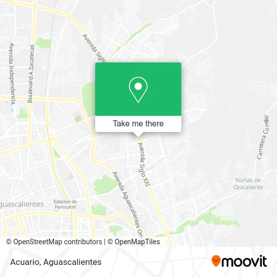
See Acuario, Aguascalientes, on the map
Public Transit to Acuario in Aguascalientes
Wondering how to get to Acuario in Aguascalientes? Moovit helps you find the best way to get to Acuario with step-by-step directions from the nearest public transit station.
Moovit provides free maps and live directions to help you navigate through your city. View schedules, routes, timetables, and find out how long does it take to get to Acuario in real time.
Looking for the nearest stop or station to Acuario? Check out this list of stops closest to your destination: Avenida Rodolfo Landeros Gallegos 410; Avenida Siglo Xxi; Avenida Ojocaliente.
Bus: RUTA 16, RUTA 23, RUTA 42, RUTA 45, RUTA 50, RUTA 40.
Want to see if there’s another route that gets you there at an earlier time? Moovit helps you find alternative routes or times. Get directions from and directions to Acuario easily from the Moovit App or Website.
We make riding to Acuario easy, which is why over 1.5 million users, including users in Aguascalientes, trust Moovit as the best app for public transit. You don’t need to download an individual bus app or train app, Moovit is your all-in-one transit app that helps you find the best bus time or train time available.
For information on prices of bus, costs and ride fares to Acuario, please check the Moovit app.
Use the app to navigate to popular places including to the airport, hospital, stadium, grocery store, mall, coffee shop, school, college, and university.
Acuario Address: Acuario, 3er Anillo Periférico, Fracc Rodolfo Landeros Gallegos, 20170 Aguascalientes, Aguascalient street in Aguascalientes
- Farmacia Lindavista,
- Farmacia San José,
- Venta y Rep. de Amortiguadores,
- Promociones Lucio,
- Pinturas Zuniga,
- Pasteleria La Gran Fiesta,
- Tortillas de Harina Monarca,
- Vulcanizadora Laguna 2,
- Muebles Rusticos Sinai,
- Nk Systems Boutique Automotriz,
- Servicio Automotriz Flores,
- Rosticeria Riky Rikon 3,
- Trigo y Miel Ags,
- Auto Climas Zuñiga,
- Talabartería La Guadalupana,
- pastelería Cryfer,
- Taller de Hojalateria y Pintura,
- Iron & Box Gym,
- Calza Piel,
- Centro de Bienestar y Desarrollo Social
Places Near Acuario (Aguascalientes)
- Central De Autobuses, Aguascalientes,
- Hospital Imss No. 3, Aguascalientes,
- Aeropuerto de Aguascalientes S.A. de C.V., Aguascalientes,
- Parque Las Tres Centurias, Aguascalientes,
- Jesús María, Aguascalientes,
- Blvd. Luis Donaldo Colosio, Aguascalientes,
- Villasuncion, Aguascalientes,
- Centro Comercial Altaria, Aguascalientes,
- Villas de Nuestra Señora de la Asunción, Aguascalientes,
- Nuevo Hospital Hidalgo, Aguascalientes,
- Terminal De Combis, Aguascalientes,
- La Isla San Marcos, Aguascalientes,
- Ciudad industrial, Aguascalientes,
- Isla San Marcos, Aguascalientes,
- clinica 3 uaa, Aguascalientes,
- Centro, Aguascalientes,
- Agropecuario, Aguascalientes,
- Imss Clinica 1, Aguascalientes,
- ESPACIOS, Aguascalientes,
- Universidad Autónoma de Aguascalientes, Aguascalientes
How to get to popular places in Aguascalientes with public transit
Get around Aguascalientes by public transit!
Traveling around Aguascalientes has never been so easy. See step by step directions as you travel to any attraction, street or major public transit station. View bus and train schedules, arrival times, service alerts and detailed routes on a map, so you know exactly how to get to anywhere in Aguascalientes.
When traveling to any destination around Aguascalientes use Moovit's Live Directions with Get Off Notifications to know exactly where and how far to walk, how long to wait for your line, and how many stops are left. Moovit will alert you when it's time to get off — no need to constantly re-check whether yours is the next stop.
Wondering how to use public transit in Aguascalientes or how to pay for public transit in Aguascalientes? Moovit public transit app can help you navigate your way with public transit easily, and at minimum cost. It includes public transit fees, ticket prices, and costs. Looking for a map of Aguascalientes public transit lines? Moovit public transit app shows all public transit maps in Aguascalientes with all bus routes and stops on an interactive map.
Aguascalientes has 1 transit type(s), including: bus, operated by several transit agencies, including Coordinación General de Movilidad