How to get to Adc Towing, Recovery by bus?
Click on the bus route to see step by step directions with maps, line arrival times and updated time schedules.
From Long Bridge Park, Arlington County
105 minFrom Le Diplomate, Washington
65 minFrom Embassy Of Sweden, Washington
76 minFrom Islamic Center of Washington, Washington
68 minFrom State Department, Washington
71 minFrom The Churchill Hotel, Washington
74 minFrom L'Enfant VRE Station, Washington
67 minFrom Rock Creek Tennis Center, Washington
86 minFrom Rock Creek Park Tennis Center (William Hg Fitzgerald), Washington
83 minFrom Vue Rooftop, Washington
58 min
How to get to Adc Towing, Recovery by metro?
Click on the metro route to see step by step directions with maps, line arrival times and updated time schedules.
From Long Bridge Park, Arlington County
52 minFrom Le Diplomate, Washington
46 minFrom Embassy Of Sweden, Washington
46 minFrom Islamic Center of Washington, Washington
54 minFrom State Department, Washington
46 minFrom The Churchill Hotel, Washington
45 minFrom L'Enfant VRE Station, Washington
25 minFrom Vue Rooftop, Washington
36 min
Bus stops near Adc Towing, Recovery in Washington
Metro stations near Adc Towing, Recovery in Washington
Bus lines to Adc Towing, Recovery in Washington
What are the closest stations to Adc Towing, Recovery?
The closest stations to Adc Towing, Recovery are:
- Kenilworth Av Ne+Lane Pl NE is 68 yards away, 1 min walk.
- Minnesota Av Ne+N H Burroughs Av NE is 448 yards away, 6 min walk.
- N H Burroughs Av Ne+Minnesota Av NE is 470 yards away, 6 min walk.
- Deanwood Metro Station is 997 yards away, 12 min walk.
- Benning Rd Metro Station is 2137 yards away, 26 min walk.
Which bus lines stop near Adc Towing, Recovery?
These bus lines stop near Adc Towing, Recovery: C31, C35, D20.
Which metro lines stop near Adc Towing, Recovery?
These metro lines stop near Adc Towing, Recovery: ORANGE, SILVER.
What’s the nearest metro station to Adc Towing, Recovery in Washington?
The nearest metro station to Adc Towing, Recovery in Washington is Deanwood Metro Station. It’s a 12 min walk away.
What’s the nearest bus station to Adc Towing, Recovery in Washington?
The nearest bus station to Adc Towing, Recovery in Washington is Kenilworth Av Ne+Lane Pl NE. It’s a 1 min walk away.
What time is the first metro to Adc Towing, Recovery in Washington?
The BLUE is the first metro that goes to Adc Towing, Recovery in Washington. It stops nearby at 5:01 AM.
What time is the last metro to Adc Towing, Recovery in Washington?
The ORANGE is the last metro that goes to Adc Towing, Recovery in Washington. It stops nearby at 12:30 AM.
What time is the first bus to Adc Towing, Recovery in Washington?
The C31 is the first bus that goes to Adc Towing, Recovery in Washington. It stops nearby at 3:05 AM.
What time is the last bus to Adc Towing, Recovery in Washington?
The C31 is the last bus that goes to Adc Towing, Recovery in Washington. It stops nearby at 3:11 AM.
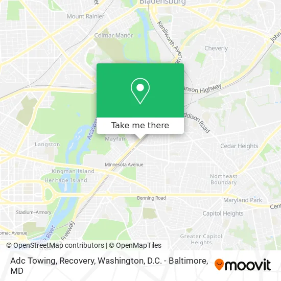
See Adc Towing, Recovery, Washington, on the map
Public Transit to Adc Towing, Recovery in Washington
Wondering how to get to Adc Towing, Recovery in Washington? Moovit helps you find the best way to get to Adc Towing, Recovery with step-by-step directions from the nearest public transit station.
Moovit provides free maps and live directions to help you navigate through your city. View schedules, routes, timetables, and find out how long does it take to get to Adc Towing, Recovery in real time.
Looking for the nearest stop or station to Adc Towing, Recovery? Check out this list of stops closest to your destination: Kenilworth Av Ne+Lane Pl NE; Minnesota Av Ne+N H Burroughs Av NE; N H Burroughs Av Ne+Minnesota Av NE; Deanwood Metro Station; Benning Rd Metro Station.
Bus: C31, C35, D20, C33.Metro: ORANGE, SILVER, BLUE.
Want to see if there’s another route that gets you there at an earlier time? Moovit helps you find alternative routes or times. Get directions from and directions to Adc Towing, Recovery easily from the Moovit App or Website.
We make riding to Adc Towing, Recovery easy, which is why over 1.5 million users, including users in Washington, trust Moovit as the best app for public transit. You don’t need to download an individual bus app or train app, Moovit is your all-in-one transit app that helps you find the best bus time or train time available.
For information on prices of bus and metro, costs and ride fares to Adc Towing, Recovery, please check the Moovit app.
Use the app to navigate to popular places including to the airport, hospital, stadium, grocery store, mall, coffee shop, school, college, and university.
Adc Towing, Recovery Address: 1075 Kenilworth Ave NE Washington, DC 20019 street in Washington
- Big Chair Chess Club (Dean Wood Chess Club),
- First Baptist Church,
- DC Bookdiva's Mobile Bookstore,
- Idea Public Charter School ,
- Metabank,
- Kenilworth Recreation Center,
- Marvin Gaye Park,
- Surpassing the Average Rehabilitation Services,
- Mayfair Mansions Apartments,
- Paradise at Parkside Apartments,
- Hayes St NE & Parkwood Pl NE,
- Unity Health Care,
- Unity Health Care - Parkside Health Center,
- Deanwood,
- Cesar Chavez Charter HS-Parkside,
- Parkside Health Center,
- Ron Brown Middle School,
- Ronald H Brown Middle School (Ron Brown College Preparatory High School),
- Deanwood Recreation Center,
- Friendship Collegiate Academy
Places Near Adc Towing, Recovery (Washington)
- Museum Of The Bible, Washington,
- Washington DC VA Medical Center, Washington,
- Washington National Cathedral, Washington,
- Marriott Marquis Washington, DC, Washington,
- Basilica of the National Shrine, Washington,
- Amazon Hq2, Arlington County,
- Pennsylvania Ave NW (3rd st and pennsylvania), Washington,
- The Anthem, Washington,
- Rock Creek Tennis Center, Washington,
- National Mall, Washington,
- National Museum of African American History and Culture, Washington,
- PG Mall, Prince George's County,
- Sibley Memorial Hospital, Washington,
- Georgetown, Washington,
- Capital One Arena, Washington,
- National Zoo, Washington,
- M&T Bank Stadium, Baltimore,
- Westfield Montgomery Mall, Montgomery County,
- Camden Yards, Baltimore,
- Warner Theatre, Washington
How to get to popular places in Washington, D.C. - Baltimore, MD with public transit
Get around Washington by public transit!
Traveling around Washington has never been so easy. See step by step directions as you travel to any attraction, street or major public transit station. View bus and train schedules, arrival times, service alerts and detailed routes on a map, so you know exactly how to get to anywhere in Washington.
When traveling to any destination around Washington use Moovit's Live Directions with Get Off Notifications to know exactly where and how far to walk, how long to wait for your line, and how many stops are left. Moovit will alert you when it's time to get off — no need to constantly re-check whether yours is the next stop.
Wondering how to use public transit in Washington or how to pay for public transit in Washington? Moovit public transit app can help you navigate your way with public transit easily, and at minimum cost. It includes public transit fees, ticket prices, and costs. Looking for a map of Washington public transit lines? Moovit public transit app shows all public transit maps in Washington with all Bus, Train, Metro, Light Rail and Ferry routes and stops on an interactive map.
Washington, D.C. - Baltimore, MD has 5 transit type(s), including: Bus, Train, Metro, Light Rail and Ferry, operated by several transit agencies, including WMATA, Montgomery County Ride On, Fairfax Connector, TheBus, PRTC, DASH - Alexandria, Arlington Transit (ART), RTA of Central Maryland, MDOT MTA, MDOT MTA Light RailLink, MDOT MTA Commuter Bus, MDOT MTA Local Bus, FXBGO!, Virginia Railway Express (VRE) and MARC