How to get to Addenda Software by bus?
Click on the bus route to see step by step directions with maps, line arrival times and updated time schedules.
From Rue Claude Bernard, Paris
84 minFrom Hôpital Saint-Louis, Paris
84 minFrom Cirque d'Hiver Bouglione, Paris
95 minFrom Angelina, Paris
55 minFrom Paris, Avenue de la Republique, Paris
100 minFrom Consulat Général Du Royaume Du Maroc, Paris
53 minFrom Rue Georges Bizet, Paris
56 minFrom Place des Vosges, Paris
86 minFrom Rue Amelot, Paris
97 minFrom Au Vieux Campeur, Paris
70 min
How to get to Addenda Software by train?
Click on the train route to see step by step directions with maps, line arrival times and updated time schedules.
Bus stops near Addenda Software in Suresnes
Light Rail stations near Addenda Software in Suresnes
- Belvédère, 7 min walk,VIEW
Train station near Addenda Software in Suresnes
- Suresnes Mont Valérien, 25 min walk,VIEW
Bus lines to Addenda Software in Suresnes
- 175, Les Bruyères,VIEW
- 93, Suresnes de Gaulle,VIEW
- 40, Commandant Rivière,VIEW
- 144, Rueil-Malmaison RER,VIEW
- 70, Suresnes - De Gaulle - Hôtel De Ville,VIEW
- 241, Porte D'auteuil - Métro - Rueil-Malmaison Rer,VIEW
- 244, Rueil-Malmaison Rer - Porte Maillot - Métro - Rer,VIEW
- N53, Gare Saint-Lazare - Nanterre - Anatole France,VIEW
- AS, De Gaulle,VIEW
What are the closest stations to Addenda Software?
The closest stations to Addenda Software are:
- Nieuport is 33 meters away, 1 min walk.
- Pont de Suresnes is 183 meters away, 3 min walk.
- Henri IV is 290 meters away, 4 min walk.
- Rue Des Bourets - Pont de Suresnes is 378 meters away, 6 min walk.
- Mairie Desbassayns is 441 meters away, 6 min walk.
- Belvédère is 514 meters away, 7 min walk.
- Suresnes Mont Valérien is 1866 meters away, 25 min walk.
Which train line stops near Addenda Software?
L (Cergy-le-Haut/ Versailles-Rive-Droite/ Saint-Nom-la-Bretèche - Forêt de Marly)
Which bus lines stop near Addenda Software?
These bus lines stop near Addenda Software: 175, 70, 93.
Which light rail line stops near Addenda Software?
T2 (Pont de Bezons)
What’s the nearest light rail station to Addenda Software in Suresnes?
The nearest light rail station to Addenda Software in Suresnes is Belvédère. It’s a 7 min walk away.
What’s the nearest train station to Addenda Software in Suresnes?
The nearest train station to Addenda Software in Suresnes is Suresnes Mont Valérien. It’s a 25 min walk away.
What’s the nearest bus station to Addenda Software in Suresnes?
The nearest bus station to Addenda Software in Suresnes is Nieuport. It’s a 1 min walk away.
What time is the first light rail to Addenda Software in Suresnes?
The T2 is the first light rail that goes to Addenda Software in Suresnes. It stops nearby at 5:17 AM.
What time is the last light rail to Addenda Software in Suresnes?
The T2 is the last light rail that goes to Addenda Software in Suresnes. It stops nearby at 12:55 AM.
What time is the first train to Addenda Software in Suresnes?
The L is the first train that goes to Addenda Software in Suresnes. It stops nearby at 5:06 AM.
What time is the last train to Addenda Software in Suresnes?
The L is the last train that goes to Addenda Software in Suresnes. It stops nearby at 10:30 PM.
What time is the first bus to Addenda Software in Suresnes?
The N53 is the first bus that goes to Addenda Software in Suresnes. It stops nearby at 3:00 AM.
What time is the last bus to Addenda Software in Suresnes?
The N53 is the last bus that goes to Addenda Software in Suresnes. It stops nearby at 3:01 AM.
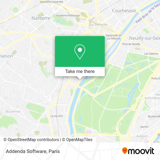
See Addenda Software, Suresnes, on the map
Public Transit to Addenda Software in Suresnes
Wondering how to get to Addenda Software in Suresnes? Moovit helps you find the best way to get to Addenda Software with step-by-step directions from the nearest public transit station.
Moovit provides free maps and live directions to help you navigate through your city. View schedules, routes, timetables, and find out how long does it take to get to Addenda Software in real time.
Looking for the nearest stop or station to Addenda Software? Check out this list of stops closest to your destination: Nieuport; Pont de Suresnes; Henri IV; Rue Des Bourets - Pont de Suresnes; Mairie Desbassayns; Belvédère; Suresnes Mont Valérien.
Train: L, U.Bus: 175, 70, 93, 40, 144, 241, 244, N53, AS.Light Rail: T2.
Want to see if there’s another route that gets you there at an earlier time? Moovit helps you find alternative routes or times. Get directions from and directions to Addenda Software easily from the Moovit App or Website.
We make riding to Addenda Software easy, which is why over 1.5 million users, including users in Suresnes, trust Moovit as the best app for public transit. You don’t need to download an individual bus app or train app, Moovit is your all-in-one transit app that helps you find the best bus time or train time available.
For information on prices of bus, metro, train, light rail and RER, costs and ride fares to Addenda Software, please check the Moovit app.
Use the app to navigate to popular places including to the airport, hospital, stadium, grocery store, mall, coffee shop, school, college, and university.
Addenda Software Address: 22 Quai Gallieni 92150 Suresnes street in Suresnes
- Intermec Technologies,
- Intellique,
- Les Trophees des Achats,
- E*Message,
- Sophiae,
- Stanley Security,
- Ensiate,
- Canon Médical Systems France,
- Michel Richard,
- Cls Pharma,
- 7 Rue du Port aux Vins,
- NOVOTEL Café,
- Quai Gallieni,
- Cohéris,
- Efficience Santé au Travail,
- Pixys,
- United Kitchens,
- Novotel Paris Suresnes Longcha,
- Information Builders France,
- Arrêt de Bus 175 - Nieport
Places Near Addenda Software (Suresnes)
- Hôpital Necker, Paris,
- Hôpital Pitié Salpêtrière, Paris,
- Hôpital Saint-Joseph, Paris,
- 29 Rue Manin, Paris,
- Fondation Louis Vuitton, Paris,
- Marché Saint-Pierre, Paris,
- Galeries Lafayette Haussmann, Paris,
- Hôpital Cochin, Paris,
- Gare Routière Flixbus, Paris,
- Centre Hospitalier des 15/20, Paris,
- Théâtre Mogador, Paris,
- Créteil Soleil, Creteil,
- Hôpital Henri Mondor, Creteil,
- Hôpital Beaujon, Clichy,
- Beaugrenelle, Paris,
- Galeries Lafayette, Paris,
- Atelier Des Lumieres, Paris,
- Hopital Lariboisière, Paris,
- Hopital Foch, Suresnes,
- Hôpital de la Pitié-Salpêtrière, Paris
How to get to popular places in Paris with public transit
Get around Suresnes by public transit!
Traveling around Suresnes has never been so easy. See step by step directions as you travel to any attraction, street or major public transit station. View bus and train schedules, arrival times, service alerts and detailed routes on a map, so you know exactly how to get to anywhere in Suresnes.
When traveling to any destination around Suresnes use Moovit's Live Directions with Get Off Notifications to know exactly where and how far to walk, how long to wait for your line, and how many stops are left. Moovit will alert you when it's time to get off — no need to constantly re-check whether yours is the next stop.
Wondering how to use public transit in Suresnes or how to pay for public transit in Suresnes? Moovit public transit app can help you navigate your way with public transit easily, and at minimum cost. It includes public transit fees, ticket prices, and costs. Looking for a map of Suresnes public transit lines? Moovit public transit app shows all public transit maps in Suresnes with all Bus, Train, Metro, Light Rail, RER, Funicular and Gondola routes and stops on an interactive map.
Paris has 7 transit type(s), including: Bus, Train, Metro, Light Rail, RER, Funicular and Gondola, operated by several transit agencies, including RATP, RER, RER Bus de remplacement, Train, Train Bus de remplacement, Tramway Bus de remplacement, TER, ADP, Magical Shuttle, Argenteuil - Boucles de Seine, Autocars Dominique, Bièvre, Brie et 2 Morin, Le Bus - C.C. du Clermontois and Cœur d’Essonne