How to get to Addictive Tours by bus?
Click on the bus route to see step by step directions with maps, line arrival times and updated time schedules.
From Fracc. La Ribera, Aguascalientes
45 minFrom Universidad Panamericana Bonaterra, Aguascalientes
58 minFrom Fiscalía General Del Edo. De Ags, Aguascalientes
31 minFrom Clínica Santuario, Aguascalientes
50 minFrom Sedesol, Aguascalientes
25 minFrom Jesús María, Aguascalientes
50 minFrom Parque Industrial ALTEC, Aguascalientes
53 minFrom Universidad Tecnologica De Aguascalientes, Aguascalientes
46 min
Bus stops near Addictive Tours in Aguascalientes
Bus lines to Addictive Tours in Aguascalientes
- RUTA 02, Centro (Jardín Carpio) - Los Cactus,VIEW
- RUTA 12, Vicente Guerrero - Lunaria,VIEW
- RUTA 16, Bellavista - Hacienda Nueva,VIEW
- RUTA 19, Vistas de Oriente - Pocitos,VIEW
- RUTA 28, Chichimeco - Mahatma Gandhi,VIEW
- RUTA 43, San Antonio - UTMA,VIEW
- RUTA 43, UTMA - Lomas de New York - San Antonio,VIEW
- RUTA 46, Vicente Guerrero - Calvillito,VIEW
- RUTA 47, Hacienda San Marcos - Clínica 10,VIEW
- RUTA 48, Bellavista - Centro (Panteón de la Cruz),VIEW
- RUTA 27, Vicente Guerrero,VIEW
- RUTA 36, Lunaria,VIEW
- RUTA 37, Hacienda San Marcos,VIEW
- RUTA 11, Chichimeco,VIEW
- RUTA 18, Uaa,VIEW
What are the closest stations to Addictive Tours?
The closest stations to Addictive Tours are:
- Francisco I. Madero, 538 is 176 meters away, 3 min walk.
- General Álvaro Obregón, 460 is 323 meters away, 5 min walk.
- Zaragoza Pagina 24 is 356 meters away, 5 min walk.
- Avenida Héroe De Nacozari, 548 is 483 meters away, 7 min walk.
Which bus lines stop near Addictive Tours?
These bus lines stop near Addictive Tours: RUTA 03, RUTA 27, RUTA 28, RUTA 36, RUTA 43.
What’s the nearest bus station to Addictive Tours in Aguascalientes?
The nearest bus station to Addictive Tours in Aguascalientes is Francisco I. Madero, 538. It’s a 3 min walk away.
What time is the first bus to Addictive Tours in Aguascalientes?
The RUTA 37 is the first bus that goes to Addictive Tours in Aguascalientes. It stops nearby at 6:16 AM.
What time is the last bus to Addictive Tours in Aguascalientes?
The RUTA 02 is the last bus that goes to Addictive Tours in Aguascalientes. It stops nearby at 10:30 PM.
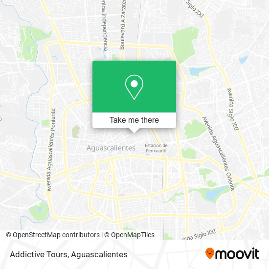
See Addictive Tours, Aguascalientes, on the map
Public Transit to Addictive Tours in Aguascalientes
Wondering how to get to Addictive Tours in Aguascalientes? Moovit helps you find the best way to get to Addictive Tours with step-by-step directions from the nearest public transit station.
Moovit provides free maps and live directions to help you navigate through your city. View schedules, routes, timetables, and find out how long does it take to get to Addictive Tours in real time.
Looking for the nearest stop or station to Addictive Tours? Check out this list of stops closest to your destination: Francisco I. Madero; General Álvaro Obregón; Zaragoza Pagina 24; Avenida Héroe De Nacozari.
Bus: RUTA 03, RUTA 27, RUTA 28, RUTA 36, RUTA 43, RUTA 02, RUTA 12, RUTA 16, RUTA 19, RUTA 37, RUTA 11, RUTA 18.
Want to see if there’s another route that gets you there at an earlier time? Moovit helps you find alternative routes or times. Get directions from and directions to Addictive Tours easily from the Moovit App or Website.
We make riding to Addictive Tours easy, which is why over 1.5 million users, including users in Aguascalientes, trust Moovit as the best app for public transit. You don’t need to download an individual bus app or train app, Moovit is your all-in-one transit app that helps you find the best bus time or train time available.
For information on prices of bus, costs and ride fares to Addictive Tours, please check the Moovit app.
Use the app to navigate to popular places including to the airport, hospital, stadium, grocery store, mall, coffee shop, school, college, and university.
Addictive Tours Address: Vázquez del Mercado 203 street in Aguascalientes
- fundacion andres vazquez gloria,
- Público La Martina,
- Licenciado Francisco Primo Verdad,
- El Congal,
- Taller De Locomotoras,
- OPTICA CHALET,
- Pedro Parga #552, Col. Centro,
- Las Planchitas,
- Castillo Douglas,
- Parroquia de la Purísima,
- Fruteria El Chino,
- Grupo Promomex,
- Trazo Arte y Diseño,
- Dr Jose Delgadillo Galvan-Radiologo,
- Ulloa Lopez Juan Manuel,
- Doctor Ulloa acupuntura,
- Jardín Castillo Douglas,
- Peña Taurina Seda Y Oro,
- Universidad Británica,
- universidad Británica De Mexico
Places Near Addictive Tours (Aguascalientes)
- Universidad Autónoma de Aguascalientes, Aguascalientes,
- Villasuncion, Aguascalientes,
- Blvd. Luis Donaldo Colosio, Aguascalientes,
- Villas de Nuestra Señora de la Asunción, Aguascalientes,
- Central De Autobuses, Aguascalientes,
- Ciudad industrial, Aguascalientes,
- Jesús María, Aguascalientes,
- Centro Comercial Altaria, Aguascalientes,
- Hospital Imss No. 3, Aguascalientes,
- Agropecuario, Aguascalientes,
- Nuevo Hospital Hidalgo, Aguascalientes,
- Imss Clinica 1, Aguascalientes,
- ESPACIOS, Aguascalientes,
- Terminal De Combis, Aguascalientes,
- Isla San Marcos, Aguascalientes,
- Centro, Aguascalientes,
- Parque Las Tres Centurias, Aguascalientes,
- La Isla San Marcos, Aguascalientes,
- clinica 3 uaa, Aguascalientes,
- Aeropuerto de Aguascalientes S.A. de C.V., Aguascalientes
How to get to popular places in Aguascalientes with public transit
Get around Aguascalientes by public transit!
Traveling around Aguascalientes has never been so easy. See step by step directions as you travel to any attraction, street or major public transit station. View bus and train schedules, arrival times, service alerts and detailed routes on a map, so you know exactly how to get to anywhere in Aguascalientes.
When traveling to any destination around Aguascalientes use Moovit's Live Directions with Get Off Notifications to know exactly where and how far to walk, how long to wait for your line, and how many stops are left. Moovit will alert you when it's time to get off — no need to constantly re-check whether yours is the next stop.
Wondering how to use public transit in Aguascalientes or how to pay for public transit in Aguascalientes? Moovit public transit app can help you navigate your way with public transit easily, and at minimum cost. It includes public transit fees, ticket prices, and costs. Looking for a map of Aguascalientes public transit lines? Moovit public transit app shows all public transit maps in Aguascalientes with all bus routes and stops on an interactive map.
Aguascalientes has 1 transit type(s), including: bus, operated by several transit agencies, including Coordinación General de Movilidad