Directions to Ades Servicos de Informatica (Santa Cândida) with public transportation
The following transit lines have routes that pass near Ades Servicos de Informatica
How to get to Ades Servicos de Informatica by bus?
Click on the bus route to see step by step directions with maps, line arrival times and updated time schedules.
From Rua Brigadeiro Franco, Centro
54 minFrom Faculdades Opet, Rebouças
47 minFrom Museu Oscar Niemeyer (MON), Centro Cívico
49 minFrom Rua Doutor Pedrosa, Centro
51 minFrom Depósito da Receita Federal, Bacacheri
54 minFrom SENAC PR, Centro
37 minFrom Rua Mariano Torres, Centro
40 minFrom Pontifícia Universidade Católica do Paraná (PUCPR), Prado Velho
53 minFrom Quanta - Diagnostico e Terapia, Alto Da Rua XV
52 minFrom Estação Tubo Paiol, Prado Velho
46 min
Bus stops near Ades Servicos de Informatica in Santa Cândida
Bus lines to Ades Servicos de Informatica in Santa Cândida
- 231 BANESTADO / CALIFÓRNIA, Terminal Santa Cândida → Califórnia,VIEW
- B76 SÃO SEBASTIÃO / GUADALUPE, SÃO SEBASTIÃO / GUADALUPE,VIEW
- B78 SÃO GABRIEL / GUADALUPE, SÃO GABRIEL / GUADALUPE,VIEW
- S89 SÃO SEBASTIÃO / GUADALUPE (VIA SÃO GABRIEL), SÃO SEBASTIÃO / GUADALUPE (via SÃO GABRIEL),VIEW
- 233 OLARIA, OLARIA,VIEW
- S01 ROÇA GRANDE / GUADALUPE (VIA SANTA CÂNDIDA), Terminal Roça Grande → Terminal Guadalupe,VIEW
- S31 ROÇA GRANDE / SANTA CÂNDIDA, Terminal Roça Grande → Terminal Santa Cândida,VIEW
- B72 COLOMBO / GUADALUPE (VIA T. ROÇA GRANDE), Terminal Sede Colombo → Terminal Guadalupe,VIEW
- B73 JARDIM OSASCO / GUADALUPE, Jardim Osasco → Terminal Guadalupe,VIEW
What are the closest stations to Ades Servicos de Informatica?
The closest stations to Ades Servicos de Informatica are:
- R. Gabriel Joaquim, 221 is 211 meters away, 3 min walk.
- Estrada de Santa Cândida, 1127 is 251 meters away, 4 min walk.
- Estr. Nova de Colombo, 6123 is 749 meters away, 10 min walk.
Which bus lines stop near Ades Servicos de Informatica?
These bus lines stop near Ades Servicos de Informatica: 231 BANESTADO / CALIFÓRNIA, B76 SÃO SEBASTIÃO / GUADALUPE.
What’s the nearest bus station to Ades Servicos de Informatica in Santa Cândida?
The nearest bus station to Ades Servicos de Informatica in Santa Cândida is R. Gabriel Joaquim, 221. It’s a 3 min walk away.
What time is the first bus to Ades Servicos de Informatica in Santa Cândida?
The 231 BANESTADO / CALIFÓRNIA is the first bus that goes to Ades Servicos de Informatica in Santa Cândida. It stops nearby at 5:00 AM.
What time is the last bus to Ades Servicos de Informatica in Santa Cândida?
The B72 COLOMBO / GUADALUPE (VIA T. ROÇA GRANDE) is the last bus that goes to Ades Servicos de Informatica in Santa Cândida. It stops nearby at 12:56 AM.
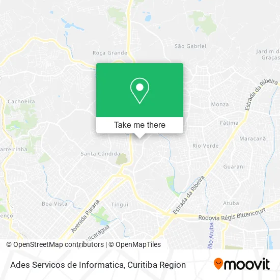
See Ades Servicos de Informatica, Santa Cândida, on the map
Public Transit to Ades Servicos de Informatica in Santa Cândida
Wondering how to get to Ades Servicos de Informatica in Santa Cândida? Moovit helps you find the best way to get to Ades Servicos de Informatica with step-by-step directions from the nearest public transit station.
Moovit provides free maps and live directions to help you navigate through your city. View schedules, routes, timetables, and find out how long does it take to get to Ades Servicos de Informatica in real time.
Looking for the nearest stop or station to Ades Servicos de Informatica? Check out this list of stops closest to your destination: R. Gabriel Joaquim; Estrada de Santa Cândida; Estr. Nova de Colombo.
Bus: 231 BANESTADO / CALIFÓRNIA, B76 SÃO SEBASTIÃO / GUADALUPE, B78 SÃO GABRIEL / GUADALUPE, S89 SÃO SEBASTIÃO / GUADALUPE (VIA SÃO GABRIEL), 233 OLARIA, S01 ROÇA GRANDE / GUADALUPE (VIA SANTA CÂNDIDA), S31 ROÇA GRANDE / SANTA CÂNDIDA, B72 COLOMBO / GUADALUPE (VIA T. ROÇA GRANDE), B73 JARDIM OSASCO / GUADALUPE.
Want to see if there’s another route that gets you there at an earlier time? Moovit helps you find alternative routes or times. Get directions from and directions to Ades Servicos de Informatica easily from the Moovit App or Website.
We make riding to Ades Servicos de Informatica easy, which is why over 1.5 million users, including users in Santa Cândida, trust Moovit as the best app for public transit. You don’t need to download an individual bus app or train app, Moovit is your all-in-one transit app that helps you find the best bus time or train time available.
For information on prices of bus, costs and ride fares to Ades Servicos de Informatica, please check the Moovit app.
Use the app to navigate to popular places including to the airport, hospital, stadium, grocery store, mall, coffee shop, school, college, and university.
Ades Servicos de Informatica Address: Rua Jair do Nascimento César, 202 Santa Cândida Curitiba-PR 82630-560 street in Santa Cândida
- Mauredi,
- Mercearia Ledane,
- Acesso,
- Encanto Kit Festa,
- J a Distribuidora,
- Armazém Da Pesca,
- Vanfer Construcoes,
- Eloti,
- Malibu Hookan Longe,
- Estrada Santa Cândida, 1169 - Tingui,
- Butcher Neto, Frederico,
- Karen Kobayashi Reabilitacao e Psicologia,
- Restaurante e Lanches Mel,
- Burbela's Pizzaria,
- Guilherme Francisco Pereira,
- Castro e Pereira Construtora,
- Instituto Ciclo Clube Romeo,
- Moradias Faxinal,
- Aline Costa Souza,
- Xp Personaliza
Places Near Ades Servicos de Informatica (Santa Cândida)
- Jardim Botânico de Curitiba PR, Centro,
- Park Shopping Barigüi, Mossunguê,
- Campo Largo, Campo,
- Arena Da Baixada - Curitiba,
- Hospital Da Cruz Vermelha, Batel,
- Hhhhh, Fazendinha,
- Rua Martim Afonso 558, Mercês,
- Hospital Angelina Caron, Campina Grande Do Sul,
- Pontifícia Universidade Católica do Paraná (PUCPR), Prado Velho,
- Hospital do Rocio, Campo,
- Hospital Nossa Senhora Das Graças, Mercês,
- Parque Barigui, Mercês,
- Hospital Universitário Evangélico de Curitiba, Bigorrilho,
- Shopping Estação, Rebouças,
- Shopping Palladium, Portão,
- Hospital de Clínicas (HC - UFPR), Centro,
- Hospital Madalena Sofia, Bairro Alto,
- Rua General Mário Tourinho, Campina Do Siqueira,
- Hospital Erasto Gaertner, Jardim Das Américas,
- Jockey Plaza Shopping Center, Tarumã
How to get to popular places in Curitiba Region with public transit
Get around Santa Cândida by public transit!
Traveling around Santa Cândida has never been so easy. See step by step directions as you travel to any attraction, street or major public transit station. View bus and train schedules, arrival times, service alerts and detailed routes on a map, so you know exactly how to get to anywhere in Santa Cândida.
When traveling to any destination around Santa Cândida use Moovit's Live Directions with Get Off Notifications to know exactly where and how far to walk, how long to wait for your line, and how many stops are left. Moovit will alert you when it's time to get off — no need to constantly re-check whether yours is the next stop.
Wondering how to use public transit in Santa Cândida or how to pay for public transit in Santa Cândida? Moovit public transit app can help you navigate your way with public transit easily, and at minimum cost. It includes public transit fees, ticket prices, and costs. Looking for a map of Santa Cândida public transit lines? Moovit public transit app shows all public transit maps in Santa Cândida with all Bus and Cable Car routes and stops on an interactive map.
Curitiba Region has 2 transit type(s), including: Bus and Cable Car, operated by several transit agencies, including Sistema Integrado de Mobilidade (URBS), Sistema Integrado de Mobilidade (AMEP), URBS (Cartões bancários e Dinheiro), URBS (Cartões bancários / Cartão URBS), AMEP (Cartões bancários / Cartão MetroCard), AMEP (Cartões bancários / Cartão MetroCard / Dinheiro), Viação Colombo (Dinheiro), TRIAR (Cartão TRIAR / Dinheiro), Empresa Curitiba Cerro Azul (Dinheiro), Expresso Nossa Senhora da Penha (Dinheiro), Empresa Campo Alto Tijucas (Dinheiro), Auto Viação São José (Cartão VEM / Dinheiro), BRT S/A (Cartão VEM / Dinheiro), TransPiedade (Cartão Cidadão / Dinheiro) and Oceânica Sul (Cartão Transporte / Dinheiro)