How to get to Adhap by bus?
Click on the bus route to see step by step directions with maps, line arrival times and updated time schedules.
From Grimme France, Feuchy
70 minFrom Cote France, Wancourt
61 minFrom Monchy-Le-Preux, Monchy-Le-Preux
54 minFrom Hénin Crucifix Cemetery, Hénin-Sur-Cojeul
68 minFrom Estaminet de la Place, Monchy-Le-Preux
55 minFrom Sogitex, Athies
55 minFrom Bibliothèque de Wancourt, Wancourt
62 minFrom Carrefour Location, Beaurains
43 minFrom Boréal Parc, Beaurains
45 minFrom Apraddistri, Mercatel
58 min
Bus stops near Adhap in Sainte-Catherine
Bus lines to Adhap in Sainte-Catherine
What are the closest stations to Adhap?
The closest stations to Adhap are:
- Brunehaut is 302 meters away, 4 min walk.
- Calvaire De Ste-Catherine is 343 meters away, 5 min walk.
- Hauts De Côte is 626 meters away, 9 min walk.
- Mairie De Ste-Catherine is 659 meters away, 9 min walk.
- 08/05/2020 is 1568 meters away, 21 min walk.
Which bus line stops near Adhap?
L10 (Gare - Quai I→Anzin-St-Aubin Cazin)
What’s the nearest bus station to Adhap in Sainte-Catherine?
The nearest bus station to Adhap in Sainte-Catherine is Brunehaut. It’s a 4 min walk away.
What time is the first bus to Adhap in Sainte-Catherine?
The L3 is the first bus that goes to Adhap in Sainte-Catherine. It stops nearby at 6:13 AM.
What time is the last bus to Adhap in Sainte-Catherine?
The L10 is the last bus that goes to Adhap in Sainte-Catherine. It stops nearby at 7:56 PM.
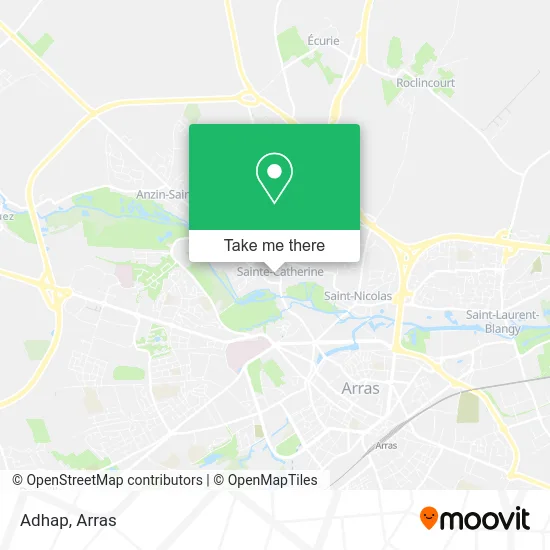
See Adhap, Sainte-Catherine, on the map
Public Transit to Adhap in Sainte-Catherine
Wondering how to get to Adhap in Sainte-Catherine? Moovit helps you find the best way to get to Adhap with step-by-step directions from the nearest public transit station.
Moovit provides free maps and live directions to help you navigate through your city. View schedules, routes, timetables, and find out how long does it take to get to Adhap in real time.
Looking for the nearest stop or station to Adhap? Check out this list of stops closest to your destination: Brunehaut; Calvaire De Ste-Catherine; Hauts De Côte; Mairie De Ste-Catherine; 08/05/2020.
Bus: L10, C6, C10, C9, DIM, L3, L11, C24.
Want to see if there’s another route that gets you there at an earlier time? Moovit helps you find alternative routes or times. Get directions from and directions to Adhap easily from the Moovit App or Website.
We make riding to Adhap easy, which is why over 1.5 million users, including users in Sainte-Catherine, trust Moovit as the best app for public transit. You don’t need to download an individual bus app or train app, Moovit is your all-in-one transit app that helps you find the best bus time or train time available.
For information on prices of bus, costs and ride fares to Adhap, please check the Moovit app.
Use the app to navigate to popular places including to the airport, hospital, stadium, grocery store, mall, coffee shop, school, college, and university.
Adhap Address: 8 Place de la République 62223 Sainte-Catherine street in Sainte-Catherine
- Crcam Nord de France,
- Maison De Santé Pluriprofessionnelle,
- De la Mairie,
- Dr Camille Jourdain,
- Charcuterie Volailles,
- Agence Auto-Ecole Renoir,
- Mairie de Sainte-Catherine les Arras,
- École Primaire Claudie Haigneré,
- Intermède,
- Résidence Les Terrasses De Brunehaut,
- Chrysalide Graphiste,
- Made by Sam,
- L'Auberge du Moulin,
- Idstock Sainte-Catherine,
- Parc De La Pècherie,
- Rte Reseau de Transport d'Electricite,
- Stade de Football,
- Sébastien Dubois,
- Les Grandes Prairies,
- Résidence Les Saules
Places Near Adhap (Sainte-Catherine)
- Lycée Privé Baudimont Saint-Charles, Arras,
- Lycée Du Bâtiment Jacques Le Caron, Arras,
- Lycée Général Gambetta Carnot, Arras,
- Centre Hospitalier D'Arras, Arras,
- Caf, Arras,
- Artois-Expo, Saint-Laurent-Blangy,
- Auchan Arras, Arras,
- Lycée Robespierre, Arras,
- Lycée Professionnel Alain Savary, Arras,
- lycée Baudimont St-Charles, Arras,
- Centre Commercial Auchan, Arras,
- Université D'Artois, Arras,
- Hôpital Privé Arras Les Bonnettes, Arras,
- Citadelle D'Arras, Arras,
- Le Set Famous Club Roclincourt, Arras,
- Grand'Place, Arras,
- Lfb Group Arras, Bailleul-Sir-Berthoult,
- Main Square Festival, Arras,
- Marché De Noël, Arras,
- Lycée Polyvalent Guy Mollet, Arras
How to get to popular places in Arras with public transit
Get around Sainte-Catherine by public transit!
Traveling around Sainte-Catherine has never been so easy. See step by step directions as you travel to any attraction, street or major public transit station. View bus and train schedules, arrival times, service alerts and detailed routes on a map, so you know exactly how to get to anywhere in Sainte-Catherine.
When traveling to any destination around Sainte-Catherine use Moovit's Live Directions with Get Off Notifications to know exactly where and how far to walk, how long to wait for your line, and how many stops are left. Moovit will alert you when it's time to get off — no need to constantly re-check whether yours is the next stop.
Wondering how to use public transit in Sainte-Catherine or how to pay for public transit in Sainte-Catherine? Moovit public transit app can help you navigate your way with public transit easily, and at minimum cost. It includes public transit fees, ticket prices, and costs. Looking for a map of Sainte-Catherine public transit lines? Moovit public transit app shows all public transit maps in Sainte-Catherine with all bus routes and stops on an interactive map.
Arras has 1 transit type(s), including: bus, operated by several transit agencies, including Artis