How to get to Adiy Auto Service Center by bus?
Click on the bus route to see step by step directions with maps, line arrival times and updated time schedules.
From I-695 @ Exit 17 (Security Blvd/MD 122), Baltimore County
42 minFrom Topgolf, Baltimore
35 minFrom Eastern Ave (eastern avenue and dundalk av), Baltimore
60 minFrom Towson, MD, Baltimore County
57 minFrom Guinness Open Gate Brewery & Barrel House, Baltimore County
78 minFrom Walmart, Baltimore County
56 minFrom Baltimore Soundstage, Baltimore
29 minFrom Patterson Park, Baltimore
44 minFrom Towson Town Center, Baltimore County
59 minFrom Johns Hopkins Bayview Medical Center, Baltimore
56 min
How to get to Adiy Auto Service Center by train?
Click on the train route to see step by step directions with maps, line arrival times and updated time schedules.
How to get to Adiy Auto Service Center by metro?
Click on the metro route to see step by step directions with maps, line arrival times and updated time schedules.
Bus stops near Adiy Auto Service Center in Baltimore
Light Rail stations near Adiy Auto Service Center in Baltimore
- Woodberry, 15 min walk,VIEW
Metro station near Adiy Auto Service Center in Baltimore
- Mondawmin Metro, 31 min walk,VIEW
Train station near Adiy Auto Service Center in Baltimore
- West Baltimore Marc Sb, 35 min walk,VIEW
Bus lines to Adiy Auto Service Center in Baltimore
What are the closest stations to Adiy Auto Service Center?
The closest stations to Adiy Auto Service Center are:
- Gwynns Falls Pkwy & Tioga Pkwy Eb FS is 266 yards away, 4 min walk.
- Gwynns Falls Pkwy & Tioga Pkwy is 294 yards away, 4 min walk.
- Gwynns Falls Pkwy & Warwick Ave is 435 yards away, 6 min walk.
- Due Bard High School is 529 yards away, 7 min walk.
- Woodberry is 1246 yards away, 15 min walk.
- Mondawmin Metro is 2547 yards away, 31 min walk.
- West Baltimore Marc Sb is 2930 yards away, 35 min walk.
Which bus lines stop near Adiy Auto Service Center?
These bus lines stop near Adiy Auto Service Center: 22, 26, 79, CITYLINK NAVY.
Which train line stops near Adiy Auto Service Center?
MARC (Inbound - Penn)
Which metro line stops near Adiy Auto Service Center?
METRO (Towards Owing Mills)
What’s the nearest light rail station to Adiy Auto Service Center in Baltimore?
The nearest light rail station to Adiy Auto Service Center in Baltimore is Woodberry. It’s a 15 min walk away.
What’s the nearest bus station to Adiy Auto Service Center in Baltimore?
The nearest bus stations to Adiy Auto Service Center in Baltimore are Gwynns Falls Pkwy & Tioga Pkwy Eb FS and Gwynns Falls Pkwy & Tioga Pkwy. The closest one is a 4 min walk away.
What time is the first light rail to Adiy Auto Service Center in Baltimore?
The LIGHT RAILLINK is the first light rail that goes to Adiy Auto Service Center in Baltimore. It stops nearby at 4:26 AM.
What time is the last light rail to Adiy Auto Service Center in Baltimore?
The LIGHT RAILLINK is the last light rail that goes to Adiy Auto Service Center in Baltimore. It stops nearby at 12:47 AM.
What time is the first metro to Adiy Auto Service Center in Baltimore?
The METRO is the first metro that goes to Adiy Auto Service Center in Baltimore. It stops nearby at 5:01 AM.
What time is the last metro to Adiy Auto Service Center in Baltimore?
The METRO is the last metro that goes to Adiy Auto Service Center in Baltimore. It stops nearby at 12:20 AM.
What time is the first train to Adiy Auto Service Center in Baltimore?
The MARC is the first train that goes to Adiy Auto Service Center in Baltimore. It stops nearby at 4:39 AM.
What time is the last train to Adiy Auto Service Center in Baltimore?
The MARC is the last train that goes to Adiy Auto Service Center in Baltimore. It stops nearby at 8:53 PM.
What time is the first bus to Adiy Auto Service Center in Baltimore?
The CITYLINK NAVY is the first bus that goes to Adiy Auto Service Center in Baltimore. It stops nearby at 3:00 AM.
What time is the last bus to Adiy Auto Service Center in Baltimore?
The CITYLINK NAVY is the last bus that goes to Adiy Auto Service Center in Baltimore. It stops nearby at 3:36 AM.
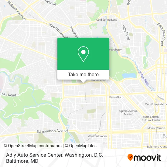
See Adiy Auto Service Center, Baltimore, on the map
Public Transit to Adiy Auto Service Center in Baltimore
Wondering how to get to Adiy Auto Service Center in Baltimore? Moovit helps you find the best way to get to Adiy Auto Service Center with step-by-step directions from the nearest public transit station.
Moovit provides free maps and live directions to help you navigate through your city. View schedules, routes, timetables, and find out how long does it take to get to Adiy Auto Service Center in real time.
Looking for the nearest stop or station to Adiy Auto Service Center? Check out this list of stops closest to your destination: Gwynns Falls Pkwy & Tioga Pkwy Eb FS; Gwynns Falls Pkwy & Tioga Pkwy; Gwynns Falls Pkwy & Warwick Ave; Due Bard High School; Woodberry; Mondawmin Metro; West Baltimore Marc Sb.
Bus: 22, 26, 79, CITYLINK NAVY, 82, 29, CITYLINK GOLD.Train: MARC.Metro: METRO.
Want to see if there’s another route that gets you there at an earlier time? Moovit helps you find alternative routes or times. Get directions from and directions to Adiy Auto Service Center easily from the Moovit App or Website.
We make riding to Adiy Auto Service Center easy, which is why over 1.5 million users, including users in Baltimore, trust Moovit as the best app for public transit. You don’t need to download an individual bus app or train app, Moovit is your all-in-one transit app that helps you find the best bus time or train time available.
For information on prices of bus, train and metro, costs and ride fares to Adiy Auto Service Center, please check the Moovit app.
Use the app to navigate to popular places including to the airport, hospital, stadium, grocery store, mall, coffee shop, school, college, and university.
Adiy Auto Service Center Address: 2631 Gwynns Falls Pkwy street in Baltimore
- Gwynns Falls Auto,
- Network Auto Group,
- Caribbean Auto Repair,
- Frank's Auto Repairs,
- Gulf Gas Station,
- Henshel Properties,
- Locksmith Services,
- Family Food Market Deli Grocery Lottery & Phone Fix,
- Innacity Vapes,
- Poinsette Bus Service,
- Integrity Auto Repair Center,
- Grissom's Automotive,
- Tioga Pkwy,
- Row Clothing Enterprises,
- Gwynns Falls Elementary,
- Unique Travel Services,
- Gwynns Falls Pkwy & Dukeland St WB,
- Mondawmin Mall,
- Ross,
- Amazon Locker-Businessman
Places Near Adiy Auto Service Center (Baltimore)
- National Zoo, Washington,
- Washington DC VA Medical Center, Washington,
- The Anthem, Washington,
- National Mall, Washington,
- Warner Theatre, Washington,
- Camden Yards, Baltimore,
- Westfield Montgomery Mall, Montgomery County,
- Amazon Hq2, Arlington County,
- Rock Creek Tennis Center, Washington,
- National Museum of African American History and Culture, Washington,
- Georgetown, Washington,
- Museum Of The Bible, Washington,
- PG Mall, Prince George's County,
- Pennsylvania Ave NW (3rd st and pennsylvania), Washington,
- Washington National Cathedral, Washington,
- Basilica of the National Shrine, Washington,
- M&T Bank Stadium, Baltimore,
- Marriott Marquis Washington, DC, Washington,
- Capital One Arena, Washington,
- Sibley Memorial Hospital, Washington
How to get to popular places in Washington, D.C. - Baltimore, MD with public transit
Get around Baltimore by public transit!
Traveling around Baltimore has never been so easy. See step by step directions as you travel to any attraction, street or major public transit station. View bus and train schedules, arrival times, service alerts and detailed routes on a map, so you know exactly how to get to anywhere in Baltimore.
When traveling to any destination around Baltimore use Moovit's Live Directions with Get Off Notifications to know exactly where and how far to walk, how long to wait for your line, and how many stops are left. Moovit will alert you when it's time to get off — no need to constantly re-check whether yours is the next stop.
Wondering how to use public transit in Baltimore or how to pay for public transit in Baltimore? Moovit public transit app can help you navigate your way with public transit easily, and at minimum cost. It includes public transit fees, ticket prices, and costs. Looking for a map of Baltimore public transit lines? Moovit public transit app shows all public transit maps in Baltimore with all Bus, Train, Metro, Light Rail and Ferry routes and stops on an interactive map.
Washington, D.C. - Baltimore, MD has 5 transit type(s), including: Bus, Train, Metro, Light Rail and Ferry, operated by several transit agencies, including WMATA, Montgomery County Ride On, Fairfax Connector, TheBus, PRTC, DASH - Alexandria, Arlington Transit (ART), RTA of Central Maryland, MDOT MTA, MDOT MTA Light RailLink, MDOT MTA Commuter Bus, MDOT MTA Local Bus, FXBGO!, Virginia Railway Express (VRE) and MARC