How to get to Adrimpex by bus?
Click on the bus route to see step by step directions with maps, line arrival times and updated time schedules.
From Av. Venezuela con av. Universitaria, San Miguel
45 minFrom Av Los Chancas de Andahuaylas 224 Santa Anita, Santa Anit
54 minFrom Polideportivo Villa El Salvador, Villa El S
55 minFrom Centro Comercial Las Malvinas, Lima
46 minFrom emancipacion, Lima
45 minFrom Policlínico Juan José Rodríguez Lazo - EsSalud, Chorrillos
34 minFrom Gamarra - La Victoria, La Victori
28 minFrom Panamericana Norte, Lima
42 minFrom Mercado Unicachi, Villa El S
53 min
How to get to Adrimpex by metro?
Click on the metro route to see step by step directions with maps, line arrival times and updated time schedules.
Bus stops near Adrimpex in Miraflores
Metro station near Adrimpex in Miraflores
- Cabitos, 15 min walk,VIEW
Bus lines to Adrimpex in Miraflores
- 1053, Campoy (San Juan De Lurigancho) - San Genaro (Chorrillos),VIEW
- 1055, Campoy (San Juan De Lurigancho) - Delicias De Villa (Chorrillos),VIEW
- 1056, Villa El Salvador - San Juan de Lurigancho,VIEW
- 1091, S.J.M - San Isidro,VIEW
- 1092, Sebastian Barranca (La Victoria) - San Genaro (Chorrillos),VIEW
- 1123, José Gálvez (Villa María Del Triunfo) - Parque Kennedy (Miraflores),VIEW
- 1098, Wiesse (San Juan de Lurigancho) - Sumac Paccha (Lurín),VIEW
- C, Terminal Matellini (Chorrillos) - Estación Ramón Castilla (Centro De Lima),VIEW
- EX1, Estación Central (Lima) - Terminal Matellini (Chorrillos),VIEW
- EX2, Terminal Naranjal (Independencia) - Est. 28 De Julio (Miraflores),VIEW
- SX, Terminal Naranjal (Independencia) - 28 de Julio (Miraflores),VIEW
- 1043, La Molina - S.J.L.,VIEW
- 1097, Av. Santa Rosa (San Juan De Lurigancho) - Las Palmas (Pachacamac) ,VIEW
- 1110, Miraflores - VMT,VIEW
- 1118, Av. El Triunfo (Villa María Del Triunfo) - Av. Ejercito (Miraflores),VIEW
- 1180, Pamplona Alta (San Juan De Miraflores) - Torre Blanca (Carabayllo),VIEW
- 1182, San Juan de Miraflores - Carabayllo,VIEW
- 1183, Carabayllo - Surco - Carabayllo,VIEW
- 1291, Ventanilla - Chorrillos,VIEW
- 1315, Jose Galvez (Pachacamac) - Óvalo Centenario (Callao),VIEW
What are the closest stations to Adrimpex?
The closest stations to Adrimpex are:
- 28 De Julio is 56 meters away, 1 min walk.
- Ramón Ribeyro is 342 meters away, 5 min walk.
- Estación 28 De Julio is 393 meters away, 6 min walk.
- República De Panamá is 468 meters away, 7 min walk.
- Estación Plaza De Flores is 497 meters away, 7 min walk.
- Av. Alfredo Benavides is 525 meters away, 7 min walk.
- Cabitos is 1153 meters away, 15 min walk.
Which bus lines stop near Adrimpex?
These bus lines stop near Adrimpex: 1053, 1055, 1091, 1123, 1182, C.
Which metro line stops near Adrimpex?
LINEA 1 (Bayóvar (San Juan De Lurigancho) - Separadora Industrial (Villa El Salvador))
What’s the nearest metro station to Adrimpex in Miraflores?
The nearest metro station to Adrimpex in Miraflores is Cabitos. It’s a 15 min walk away.
What’s the nearest bus station to Adrimpex in Miraflores?
The nearest bus station to Adrimpex in Miraflores is 28 De Julio. It’s a 1 min walk away.
What time is the first metro to Adrimpex in Miraflores?
The LINEA 1 is the first metro that goes to Adrimpex in Miraflores. It stops nearby at 5:15 AM.
What time is the last metro to Adrimpex in Miraflores?
The LINEA 1 is the last metro that goes to Adrimpex in Miraflores. It stops nearby at 10:33 PM.
What time is the first bus to Adrimpex in Miraflores?
The 1180 is the first bus that goes to Adrimpex in Miraflores. It stops nearby at 3:52 AM.
What time is the last bus to Adrimpex in Miraflores?
The 1291 is the last bus that goes to Adrimpex in Miraflores. It stops nearby at 12:43 AM.
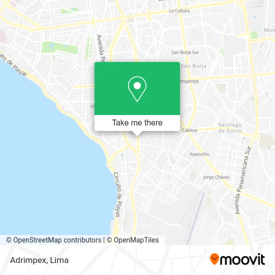
See Adrimpex, Miraflores, on the map
Public Transit to Adrimpex in Miraflores
Wondering how to get to Adrimpex in Miraflores? Moovit helps you find the best way to get to Adrimpex with step-by-step directions from the nearest public transit station.
Moovit provides free maps and live directions to help you navigate through your city. View schedules, routes, timetables, and find out how long does it take to get to Adrimpex in real time.
Looking for the nearest stop or station to Adrimpex? Check out this list of stops closest to your destination: 28 De Julio; Ramón Ribeyro; Estación 28 De Julio; República De Panamá; Estación Plaza De Flores; Av. Alfredo Benavides; Cabitos.
Bus: 1053, 1055, 1091, 1123, 1182, C, 1056, 1092, 1098, EX1, EX2, SX, 1043, 1097, 1110, 1118, 1180, EX5, EX8, EX9.Metro: LINEA 1.
Want to see if there’s another route that gets you there at an earlier time? Moovit helps you find alternative routes or times. Get directions from and directions to Adrimpex easily from the Moovit App or Website.
We make riding to Adrimpex easy, which is why over 1.5 million users, including users in Miraflores, trust Moovit as the best app for public transit. You don’t need to download an individual bus app or train app, Moovit is your all-in-one transit app that helps you find the best bus time or train time available.
For information on prices of bus and metro, costs and ride fares to Adrimpex, please check the Moovit app.
Use the app to navigate to popular places including to the airport, hospital, stadium, grocery store, mall, coffee shop, school, college, and university.
Adrimpex Address: Av. Republica de Panama 6594, Miraflores street in Miraflores
- Notaría Rosalía Mejía,
- Avenida Roosevelt,
- Jr Caraz 161 Urb San Antonio,
- Wayra,
- Calle Caraz 161 Calle Caraz 161,
- El Rincon Del Asado,
- Calle Miguel Aljovin 520,
- Cerca AV 28 DE Julio Y AV Benavides,
- AV 28 DE JULIO CDRA 15 MIRAFLORES,
- Avenida 28 de Julio & Avenida República de Panamá,
- Avenida 28 de Julio & Avenida Roosevelt,
- 28 de Julio con Rep de Panamá,
- Veterinaria Pancho Cavero,
- Hospital Veterinario Pancho Cavero,
- Avenida República de Panamá 6584,
- JR MIGUEL ALJOVIN,
- Av República de Panamá,
- La Carnicería de Tito,
- AV 28 DE JULIO 1570 DPTO 501,
- Avenida República de Panamá 6491
Places Near Adrimpex (Miraflores)
- Parque de las Leyendas, San Miguel,
- Barranco, Barranco,
- av arequipa, Lima,
- Real Plaza Puruchuco, Ate,
- Av. Salaverry, Jesus Mari,
- Parque Kennedy, Miraflores,
- Hospital Edgardo Rebagliati Martins, Jesus Mari,
- Aeropuerto Internacional Jorge Chávez, Ventanilla,
- Mall Del Sur,
- Plaza San Miguel, San Miguel,
- Jockey Plaza, Santiago D,
- Paradero Av.Brasil,
- Centro Comercial Plaza Norte, Independen,
- Miraflores, Miraflores,
- Circuito Mágico Del Agua, Lima,
- Larcomar, Miraflores,
- Real Plaza Salaverry, Jesus Mari,
- Av. La Marina, San Miguel,
- Gamarra,
- Av. Abancay, Lima
How to get to popular places in Lima with public transit
Get around Miraflores by public transit!
Traveling around Miraflores has never been so easy. See step by step directions as you travel to any attraction, street or major public transit station. View bus and train schedules, arrival times, service alerts and detailed routes on a map, so you know exactly how to get to anywhere in Miraflores.
When traveling to any destination around Miraflores use Moovit's Live Directions with Get Off Notifications to know exactly where and how far to walk, how long to wait for your line, and how many stops are left. Moovit will alert you when it's time to get off — no need to constantly re-check whether yours is the next stop.
Wondering how to use public transit in Miraflores or how to pay for public transit in Miraflores? Moovit public transit app can help you navigate your way with public transit easily, and at minimum cost. It includes public transit fees, ticket prices, and costs. Looking for a map of Miraflores public transit lines? Moovit public transit app shows all public transit maps in Miraflores with all Bus, Metro and Ferry routes and stops on an interactive map.
Lima has 3 transit type(s), including: Bus, Metro and Ferry, operated by several transit agencies, including Metro de Lima Línea 2 , Metro de Lima, Corredor Rojo, Metropolitano, Metropolitano - Alimentadores, Corredor Morado, Corredor Azul, Rutas Tradicionales, Transportes y Servicios La Esperanza S.A., Las Flores S.A., Virgen de la Asunción S.A., Consorcio HAM, Transportes y Service Canadá S.A., ETUL4SA and ETUCHISA