How to get to Ads Capture by bus?
Click on the bus route to see step by step directions with maps, line arrival times and updated time schedules.
From Palais de l'Élysée, Paris
70 minFrom Rue du Faubourg Saint-Martin, Paris
48 minFrom Rue de Maubeuge, Paris
63 minFrom Rue Saint-Maur, Paris
64 minFrom Marché des Enfants Rouges, Paris
60 minFrom Rue Saint Denis, Paris
52 minFrom Théâtre Mogador, Paris
67 minFrom Rue Manin, Paris
68 minFrom Victor Hugo, Arrondissement de Nanterre
76 minFrom Rue Charlot, Paris
60 min
How to get to Ads Capture by metro?
Click on the metro route to see step by step directions with maps, line arrival times and updated time schedules.
From Palais de l'Élysée, Paris
70 minFrom Rue du Faubourg Saint-Martin, Paris
70 minFrom Rue de Maubeuge, Paris
68 minFrom Rue Saint-Maur, Paris
66 minFrom Marché des Enfants Rouges, Paris
74 minFrom Rue Saint Denis, Paris
64 minFrom Théâtre Mogador, Paris
54 minFrom Rue Manin, Paris
79 minFrom Victor Hugo, Arrondissement de Nanterre
76 minFrom Rue Charlot, Paris
74 min
Bus stops near Ads Capture in Stains
RER station near Ads Capture in Stains
- Pierrefitte - Stains, 17 min walk,VIEW
Metro station near Ads Capture in Stains
- Saint-Denis - Université, 19 min walk,VIEW
Light Rail stations near Ads Capture in Stains
- Petit Pierrefitte, 20 min walk,VIEW
Bus lines to Ads Capture in Stains
What are the closest stations to Ads Capture?
The closest stations to Ads Capture are:
- Nelson Mandela is 147 meters away, 3 min walk.
- Clos Hanot is 576 meters away, 8 min walk.
- Lycée is 583 meters away, 9 min walk.
- Marcel Pointet is 680 meters away, 10 min walk.
- Pierrefitte - Stains is 1231 meters away, 17 min walk.
- Saint-Denis - Université is 1370 meters away, 19 min walk.
- Petit Pierrefitte is 1508 meters away, 20 min walk.
Which bus lines stop near Ads Capture?
These bus lines stop near Ads Capture: 150, 252, 255.
Which metro line stops near Ads Capture?
13 (Saint-Denis - Université)
Which RER line stops near Ads Capture?
D (Creil)
What’s the nearest light rail station to Ads Capture in Stains?
The nearest light rail station to Ads Capture in Stains is Petit Pierrefitte. It’s a 20 min walk away.
What’s the nearest metro station to Ads Capture in Stains?
The nearest metro station to Ads Capture in Stains is Saint-Denis - Université. It’s a 19 min walk away.
What’s the nearest bus station to Ads Capture in Stains?
The nearest bus station to Ads Capture in Stains is Nelson Mandela. It’s a 3 min walk away.
What’s the nearest RER station to Ads Capture in Stains?
The nearest RER station to Ads Capture in Stains is Pierrefitte - Stains. It’s a 17 min walk away.
What time is the first light rail to Ads Capture in Stains?
The T11 is the first light rail that goes to Ads Capture in Stains. It stops nearby at 5:04 AM.
What time is the last light rail to Ads Capture in Stains?
The T11 is the last light rail that goes to Ads Capture in Stains. It stops nearby at 1:23 AM.
What time is the first metro to Ads Capture in Stains?
The 13 is the first metro that goes to Ads Capture in Stains. It stops nearby at 12:00 PM.
What time is the last metro to Ads Capture in Stains?
The 13 is the last metro that goes to Ads Capture in Stains. It stops nearby at 1:15 AM.
What time is the first bus to Ads Capture in Stains?
The 356 is the first bus that goes to Ads Capture in Stains. It stops nearby at 6:04 AM.
What time is the last bus to Ads Capture in Stains?
The 255 is the last bus that goes to Ads Capture in Stains. It stops nearby at 2:17 AM.
What time is the first RER to Ads Capture in Stains?
The D is the first RER that goes to Ads Capture in Stains. It stops nearby at 5:06 AM.
What time is the last RER to Ads Capture in Stains?
The D is the last RER that goes to Ads Capture in Stains. It stops nearby at 1:06 AM.
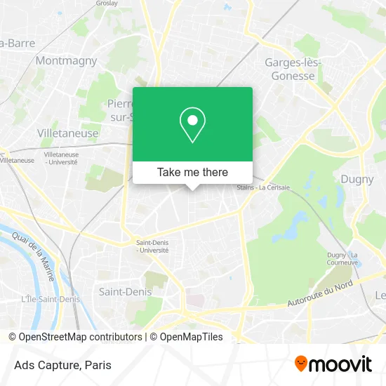
See Ads Capture, Stains, on the map
Public Transit to Ads Capture in Stains
Wondering how to get to Ads Capture in Stains? Moovit helps you find the best way to get to Ads Capture with step-by-step directions from the nearest public transit station.
Moovit provides free maps and live directions to help you navigate through your city. View schedules, routes, timetables, and find out how long does it take to get to Ads Capture in real time.
Looking for the nearest stop or station to Ads Capture? Check out this list of stops closest to your destination: Nelson Mandela; Clos Hanot; Lycée; Marcel Pointet; Pierrefitte - Stains; Saint-Denis - Université; Petit Pierrefitte.
Bus: 150, 252, 255, 253, 356, 168, 268, VITAVIL.Metro: 13.RER: D, T11.
Want to see if there’s another route that gets you there at an earlier time? Moovit helps you find alternative routes or times. Get directions from and directions to Ads Capture easily from the Moovit App or Website.
We make riding to Ads Capture easy, which is why over 1.5 million users, including users in Stains, trust Moovit as the best app for public transit. You don’t need to download an individual bus app or train app, Moovit is your all-in-one transit app that helps you find the best bus time or train time available.
For information on prices of metro, bus and RER, costs and ride fares to Ads Capture, please check the Moovit app.
Use the app to navigate to popular places including to the airport, hospital, stadium, grocery store, mall, coffee shop, school, college, and university.
Ads Capture Address: Avenue George Sand 93240 Stains street in Stains
- Kiz'Up,
- Crèche Angela Davis,
- Point Conseil Budget,
- Pmi Départementale Angela Davis,
- Domaine Shoursh,
- Terrasse,
- 2 Rue Guillaume Apollinaire,
- Maison du Temps Libre,
- Onkoud Abdelaziz,
- Boulangerie Pain et Tradition de Stains,
- Rue Jean Durand,
- 2 Square Molière,
- Lycée maurice utrillo,
- La Poste,
- Pochon Yves,
- Clos-Saint-Lazare,
- Isidore,
- Au Summum,
- Stains Clos Saint-Lazare,
- 42 Avenue Paul Vaillant Couturier
Places Near Ads Capture (Stains)
- Centre Hospitalier des 15/20, Paris,
- Institut Curie, Paris,
- Fondation Louis Vuitton, Paris,
- 29 Rue Manin, Paris,
- Théâtre Mogador, Paris,
- Hôpital Necker, Paris,
- Atelier Des Lumieres, Paris,
- Hôpital Saint-Joseph, Paris,
- Créteil Soleil, Creteil,
- Hôpital Beaujon, Clichy,
- Galeries Lafayette, Paris,
- Marché Saint-Pierre, Paris,
- Galeries Lafayette Haussmann, Paris,
- Hôpital Pitié Salpêtrière, Paris,
- Hopital Lariboisière, Paris,
- Hôpital de la Pitié-Salpêtrière, Paris,
- Hôpital Cochin, Paris,
- Hôpital Henri Mondor, Creteil,
- Hopital Foch, Suresnes,
- Gare Routière Flixbus, Paris
How to get to popular places in Paris with public transit
Get around Stains by public transit!
Traveling around Stains has never been so easy. See step by step directions as you travel to any attraction, street or major public transit station. View bus and train schedules, arrival times, service alerts and detailed routes on a map, so you know exactly how to get to anywhere in Stains.
When traveling to any destination around Stains use Moovit's Live Directions with Get Off Notifications to know exactly where and how far to walk, how long to wait for your line, and how many stops are left. Moovit will alert you when it's time to get off — no need to constantly re-check whether yours is the next stop.
Wondering how to use public transit in Stains or how to pay for public transit in Stains? Moovit public transit app can help you navigate your way with public transit easily, and at minimum cost. It includes public transit fees, ticket prices, and costs. Looking for a map of Stains public transit lines? Moovit public transit app shows all public transit maps in Stains with all Bus, Train, Metro, Light Rail, RER, Funicular and Gondola routes and stops on an interactive map.
Paris has 7 transit type(s), including: Bus, Train, Metro, Light Rail, RER, Funicular and Gondola, operated by several transit agencies, including RATP, RER, RER Bus de remplacement, Train, Train Bus de remplacement, Tramway Bus de remplacement, TER, ADP, Magical Shuttle, Argenteuil - Boucles de Seine, Autocars Dominique, Bièvre, Brie et 2 Morin, Le Bus - C.C. du Clermontois and Cœur d’Essonne