Directions to After the Fall (Prince William County) with public transportation
The following transit lines have routes that pass near After the Fall
 Bus: 92, 94, 95, 981.
- Train: NORTHEAST REGIONAL, FREDERICKSBURG LINE.
How to get to After the Fall by bus?
Click on the bus route to see step by step directions with maps, line arrival times and updated time schedules.
From U.S. Department of State SA-28, Fairfax County
76 minFrom Transportation Security Administration - TSA Headquarters, Fairfax County
67 minFrom Burke, VA, Fairfax County
208 minFrom National Geospatial-Intelligence Agency (NGA), Fairfax County
100 minFrom Franconia-Springfield Metro Station, Fairfax County
58 minFrom Department of State SA 34, Fairfax County
168 minFrom Lorton, VA, Fairfax County
111 minFrom Lorton, VA - Amtrak Auto Train Station (LOR), Fairfax County
117 minFrom Rose Gaming Resort, Prince William County
86 min
Bus stop near After the Fall in Prince William County
- Tackett's Mill Commuter Lot, 6 min walk,VIEW
Train station near After the Fall in Prince William County
- Woodbridge, 28 min walk,VIEW
Bus lines to After the Fall in Prince William County
What are the closest stations to After the Fall?
The closest stations to After the Fall are:
- Tackett's Mill Commuter Lot is 452 yards away, 6 min walk.
- Woodbridge is 2405 yards away, 28 min walk.
Which bus lines stop near After the Fall?
These bus lines stop near After the Fall: 92, 94, 95.
What’s the nearest train station to After the Fall in Prince William County?
The nearest train station to After the Fall in Prince William County is Woodbridge. It’s a 28 min walk away.
What’s the nearest bus station to After the Fall in Prince William County?
The nearest bus station to After the Fall in Prince William County is Tackett's Mill Commuter Lot. It’s a 6 min walk away.
What time is the first train to After the Fall in Prince William County?
The FREDERICKSBURG LINE is the first train that goes to After the Fall in Prince William County. It stops nearby at 5:38 AM.
What time is the last train to After the Fall in Prince William County?
The FREDERICKSBURG LINE is the last train that goes to After the Fall in Prince William County. It stops nearby at 7:39 PM.
What time is the first bus to After the Fall in Prince William County?
The 981 is the first bus that goes to After the Fall in Prince William County. It stops nearby at 5:14 AM.
What time is the last bus to After the Fall in Prince William County?
The 94 is the last bus that goes to After the Fall in Prince William County. It stops nearby at 10:31 PM.
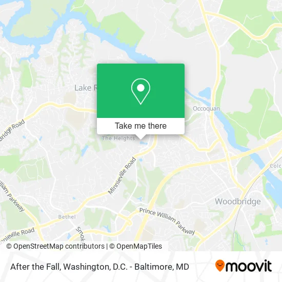
See After the Fall, Prince William County, on the map
Public Transit to After the Fall in Prince William County
Wondering how to get to After the Fall in Prince William County? Moovit helps you find the best way to get to After the Fall with step-by-step directions from the nearest public transit station.
Moovit provides free maps and live directions to help you navigate through your city. View schedules, routes, timetables, and find out how long does it take to get to After the Fall in real time.
Looking for the nearest stop or station to After the Fall? Check out this list of stops closest to your destination: Tackett's Mill Commuter Lot; Woodbridge.
Bus: 92, 94, 95, 981.Train: NORTHEAST REGIONAL, FREDERICKSBURG LINE.
Want to see if there’s another route that gets you there at an earlier time? Moovit helps you find alternative routes or times. Get directions from and directions to After the Fall easily from the Moovit App or Website.
We make riding to After the Fall easy, which is why over 1.5 million users, including users in Prince William County, trust Moovit as the best app for public transit. You don’t need to download an individual bus app or train app, Moovit is your all-in-one transit app that helps you find the best bus time or train time available.
For information on prices of bus, costs and ride fares to After the Fall, please check the Moovit app.
Use the app to navigate to popular places including to the airport, hospital, stadium, grocery store, mall, coffee shop, school, college, and university.
After the Fall Address: 2239 Tacketts Mill Dr Woodbridge, VA 22192 street in Prince William County
- Aspen Hill Assisted Living,
- Canvas Esthetic,
- Psychological & Life Skills Assoc,
- Pediatric Achievements,
- Ed Setliff - State Farm,
- Marschall, Diane E LCSW,
- Nancy Jean-Louis Real Estate,
- Riverwoods at Lake Ridge,
- Commercial Lending USA,
- Sculpt Body Lounge LLC,
- Touch Heaven Compassionate Ministries Church,
- Averyhess, Realtors Lake Ridge,
- Matthew Friedman,
- Heart Eyes Beauty,
- Redhawk It,
- Five Points Healthcare of Virgina,
- Spin Your Own Axis,
- Floor Coverings International of Burke,
- Norma M. Holmes, LPC, LMFT, BCPC,
- Abundant Life Church
Places Near After the Fall (Prince William County)
- Museum Of The Bible, Washington,
- Basilica of the National Shrine, Washington,
- Washington DC VA Medical Center, Washington,
- Georgetown, Washington,
- Washington National Cathedral, Washington,
- Westfield Montgomery Mall, Montgomery County,
- M&T Bank Stadium, Baltimore,
- Camden Yards, Baltimore,
- Capital One Arena, Washington,
- Pennsylvania Ave NW (3rd st and pennsylvania), Washington,
- Warner Theatre, Washington,
- National Zoo, Washington,
- Marriott Marquis Washington, DC, Washington,
- Sibley Memorial Hospital, Washington,
- Rock Creek Tennis Center, Washington,
- National Museum of African American History and Culture, Washington,
- Amazon Hq2, Arlington County,
- PG Mall, Prince George's County,
- The Anthem, Washington,
- National Theatre, Washington
How to get to popular places in Washington, D.C. - Baltimore, MD with public transit
Get around Prince William County by public transit!
Traveling around Prince William County has never been so easy. See step by step directions as you travel to any attraction, street or major public transit station. View bus and train schedules, arrival times, service alerts and detailed routes on a map, so you know exactly how to get to anywhere in Prince William County.
When traveling to any destination around Prince William County use Moovit's Live Directions with Get Off Notifications to know exactly where and how far to walk, how long to wait for your line, and how many stops are left. Moovit will alert you when it's time to get off — no need to constantly re-check whether yours is the next stop.
Wondering how to use public transit in Prince William County or how to pay for public transit in Prince William County? Moovit public transit app can help you navigate your way with public transit easily, and at minimum cost. It includes public transit fees, ticket prices, and costs. Looking for a map of Prince William County public transit lines? Moovit public transit app shows all public transit maps in Prince William County with all Bus, Train, Metro, Light Rail and Ferry routes and stops on an interactive map.
Washington, D.C. - Baltimore, MD has 5 transit type(s), including: Bus, Train, Metro, Light Rail and Ferry, operated by several transit agencies, including WMATA, Montgomery County Ride On, Fairfax Connector, TheBus, PRTC, DASH - Alexandria, Arlington Transit (ART), RTA of Central Maryland, MDOT MTA, MDOT MTA Light RailLink, MDOT MTA Commuter Bus, MDOT MTA Local Bus, FXBGO!, Virginia Railway Express (VRE) and MARC