Directions to Agil Comercio (Ilha De Itamaraca) with public transportation
The following transit lines have routes that pass near Agil Comercio
How to get to Agil Comercio by bus?
Click on the bus route to see step by step directions with maps, line arrival times and updated time schedules.
From Veneza Water Park, Paulista
142 minFrom Praia de Maria Farinha, Paulista
144 minFrom Igarassu, Igarassu
57 minFrom Ponta De Pedras, Ponta De Pedras
139 minFrom Shopping Igarassu, Igarassu
49 minFrom Praia De Mangue Seco, Igarassu
89 minFrom Forte Orange, Ilha De Itamaraca
22 minFrom Rod. BR-101, Km 37,5 s/n, Itapissuma
96 minFrom Memorial Vale da Saudade, Igarassu
57 min
Bus stop near Agil Comercio in Ilha De Itamaraca
- Av. João Pessoa Guerra, 956 | Palácio Pedra Que Canta, 2 min walk,VIEW
Bus lines to Agil Comercio in Ilha De Itamaraca
- 1968 ILHA DE ITAMARACÁ / TI IGARASSU, Ilha De Itamaracá / Ti Igarassu,VIEW
What are the closest stations to Agil Comercio?
The closest stations to Agil Comercio are:
- Av. João Pessoa Guerra, 956 | Palácio Pedra Que Canta is 72 meters away, 2 min walk.
Which bus line stops near Agil Comercio?
1968 ILHA DE ITAMARACÁ / TI IGARASSU (Ilha De Itamaracá / Ti Igarassu)
What’s the nearest bus station to Agil Comercio in Ilha De Itamaraca?
The nearest bus station to Agil Comercio in Ilha De Itamaraca is Av. João Pessoa Guerra, 956 | Palácio Pedra Que Canta. It’s a 2 min walk away.
What time is the first bus to Agil Comercio in Ilha De Itamaraca?
The 1968 ILHA DE ITAMARACÁ / TI IGARASSU is the first bus that goes to Agil Comercio in Ilha De Itamaraca. It stops nearby at 3:33 AM.
What time is the last bus to Agil Comercio in Ilha De Itamaraca?
The 1968 ILHA DE ITAMARACÁ / TI IGARASSU is the last bus that goes to Agil Comercio in Ilha De Itamaraca. It stops nearby at 1:12 AM.
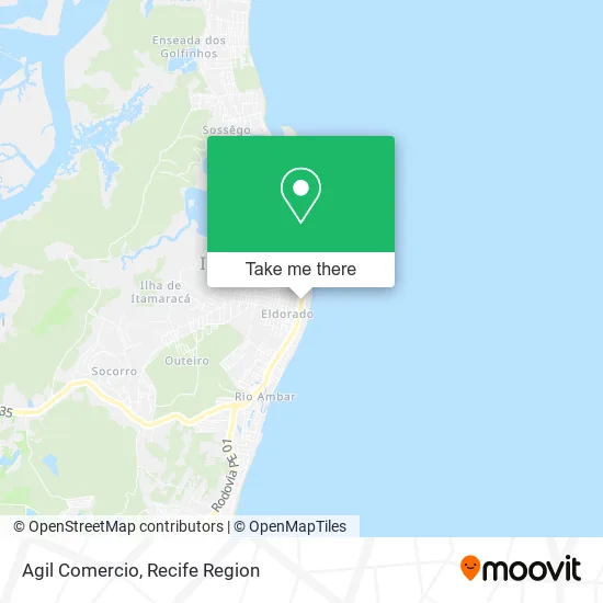
See Agil Comercio, Ilha De Itamaraca, on the map
Public Transit to Agil Comercio in Ilha De Itamaraca
Wondering how to get to Agil Comercio in Ilha De Itamaraca? Moovit helps you find the best way to get to Agil Comercio with step-by-step directions from the nearest public transit station.
Moovit provides free maps and live directions to help you navigate through your city. View schedules, routes, timetables, and find out how long does it take to get to Agil Comercio in real time.
Looking for the nearest stop or station to Agil Comercio? Check out this list of stops closest to your destination: Av. João Pessoa Guerra.
Bus: 1968 ILHA DE ITAMARACÁ / TI IGARASSU.
Want to see if there’s another route that gets you there at an earlier time? Moovit helps you find alternative routes or times. Get directions from and directions to Agil Comercio easily from the Moovit App or Website.
We make riding to Agil Comercio easy, which is why over 1.5 million users, including users in Ilha De Itamaraca, trust Moovit as the best app for public transit. You don’t need to download an individual bus app or train app, Moovit is your all-in-one transit app that helps you find the best bus time or train time available.
For information on prices of bus, costs and ride fares to Agil Comercio, please check the Moovit app.
Use the app to navigate to popular places including to the airport, hospital, stadium, grocery store, mall, coffee shop, school, college, and university.
Agil Comercio Address: Avenida João Pessoa Guerra, 480 Ilha de Itamaracá Ilha de Itamaracá-PE 53900-000 street in Ilha De Itamaraca
- Hospital Maternidade Alzira Figueiredo,
- Policlínica Ilha de Itamaracá,
- Restaurante Sabor Nordestino,
- Palácio Pedra que Canta,
- Escola João Felipe de Barros Dias,
- Fórum da Comarca de Itamaracá,
- Mercadinho e Bomboniere Global,
- Mare Moto,
- Odontoprimer,
- Banco 24 Horas,
- Farmacias Farmax,
- Julianapereirados,
- Farma Ilha,
- M & D Moveis,
- Arruda Gás,
- Flor de Lis,
- Mercadinho Santo Antônio,
- hospital de itamaracá,
- Igreja Evangelica Catedral Internacinal do Espírito Santo O Poder do Evangelho ao Mundo,
- Posto Itamaraca
Places Near Agil Comercio (Ilha De Itamaraca)
- Hospital Altino Ventura, Iputinga,
- Parque da Jaqueira, Jaqueira,
- SHOPPING GUARARAPES, Jaboatão Dos Guararapes,
- Hospital Universitário Oswaldo Cruz, Santo Amaro,
- SHOPPING TACARUNA, Santo Amaro,
- hospital otavio de freitas - UTI, Tejipió,
- Shopping Recife, Boa Viagem,
- Arena de Pernambuco, São Lourenço Da Mata,
- Hospital Agamenon Magalhães, Tamarineira,
- llll, Fundão,
- Shopping Patteo Olinda, Olinda,
- tuuuuu, Olinda,
- Imip (Instituto Materno-Infantil De Pernambuco), Coelhos,
- Shopping RioMar Recife, Pina,
- Marco Zero, Bairro Do Recife,
- Hospital Geral De Areias, Areias,
- Hospital Eduardo Campus Da Pessoa Idosa, Areias,
- Hospital Maria Lucinda, Parnamirim,
- Imbiribeira, Imbiribeira,
- Centro de Convenções de Pernambuco, Olinda
How to get to popular places in Recife Region with public transit
Get around Ilha De Itamaraca by public transit!
Traveling around Ilha De Itamaraca has never been so easy. See step by step directions as you travel to any attraction, street or major public transit station. View bus and train schedules, arrival times, service alerts and detailed routes on a map, so you know exactly how to get to anywhere in Ilha De Itamaraca.
When traveling to any destination around Ilha De Itamaraca use Moovit's Live Directions with Get Off Notifications to know exactly where and how far to walk, how long to wait for your line, and how many stops are left. Moovit will alert you when it's time to get off — no need to constantly re-check whether yours is the next stop.
Wondering how to use public transit in Ilha De Itamaraca or how to pay for public transit in Ilha De Itamaraca? Moovit public transit app can help you navigate your way with public transit easily, and at minimum cost. It includes public transit fees, ticket prices, and costs. Looking for a map of Ilha De Itamaraca public transit lines? Moovit public transit app shows all public transit maps in Ilha De Itamaraca with all Bus, Train and Subway routes and stops on an interactive map.
Recife Region has 3 transit type(s), including: Bus, Train and Subway, operated by several transit agencies, including CBTU (Metrorec), BRT (Via Livre), Grande Recife, BORBOREMA IMPERIAL (TIP), BORBOREMA IMPERIAL (B.V), RODOVIÁRIA POTENGY, EMPRESA METROPOLITANA, CONSÓRCIO RECIFE, SÃO JUDAS TADEU, Expresso 1002, Rodotur Turismo, Complementar Recife, Sistema Municipal - Jaboatão, Sistema Municipal - Cabo and Sistema Municipal - Ipojuca