How to get to Agnes Learning Club by train?
Click on the train route to see step by step directions with maps, line arrival times and updated time schedules.
Bus stops near Agnes Learning Club in Warsaw
Train station near Agnes Learning Club in Warsaw
- Gdańsk Osowa, 23 min walk,VIEW
Cable Car station near Agnes Learning Club in Warsaw
- Wielki Kack Fikakowo 01, 57 min walk,VIEW
Bus lines to Agnes Learning Club in Warsaw
What are the closest stations to Agnes Learning Club?
The closest stations to Agnes Learning Club are:
- Niedziałkowskiego 01 is 157 meters away, 3 min walk.
- Barniewicka 01 is 330 meters away, 5 min walk.
- Gdańsk Osowa is 1748 meters away, 23 min walk.
- Wielki Kack Fikakowo 01 is 4438 meters away, 57 min walk.
Which bus lines stop near Agnes Learning Club?
These bus lines stop near Agnes Learning Club: 169, 171.
Which train line stops near Agnes Learning Club?
REG (Gdańsk Wrzeszcz)
What’s the nearest train station to Agnes Learning Club in Warsaw?
The nearest train station to Agnes Learning Club in Warsaw is Gdańsk Osowa. It’s a 23 min walk away.
What’s the nearest bus station to Agnes Learning Club in Warsaw?
The nearest bus station to Agnes Learning Club in Warsaw is Niedziałkowskiego 01. It’s a 3 min walk away.
What time is the first train to Agnes Learning Club in Warsaw?
The REG is the first train that goes to Agnes Learning Club in Warsaw. It stops nearby at 4:51 AM.
What time is the last train to Agnes Learning Club in Warsaw?
The REG is the last train that goes to Agnes Learning Club in Warsaw. It stops nearby at 11:52 PM.
What time is the first bus to Agnes Learning Club in Warsaw?
The 171 is the first bus that goes to Agnes Learning Club in Warsaw. It stops nearby at 4:57 AM.
What time is the last bus to Agnes Learning Club in Warsaw?
The 171 is the last bus that goes to Agnes Learning Club in Warsaw. It stops nearby at 11:32 PM.
What time is the first cable car to Agnes Learning Club in Warsaw?
The 29 is the first cable car that goes to Agnes Learning Club in Warsaw. It stops nearby at 6:33 AM.
What time is the last cable car to Agnes Learning Club in Warsaw?
The 29 is the last cable car that goes to Agnes Learning Club in Warsaw. It stops nearby at 11:28 PM.
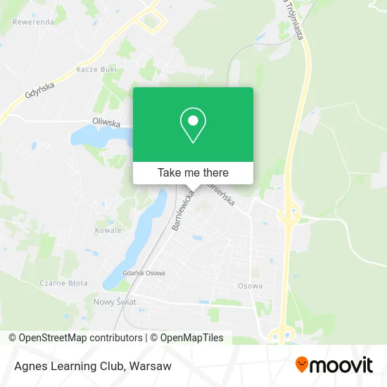
See Agnes Learning Club, Warsaw, on the map
Public Transit to Agnes Learning Club in Warsaw
Wondering how to get to Agnes Learning Club in Warsaw? Moovit helps you find the best way to get to Agnes Learning Club with step-by-step directions from the nearest public transit station.
Moovit provides free maps and live directions to help you navigate through your city. View schedules, routes, timetables, and find out how long does it take to get to Agnes Learning Club in real time.
Looking for the nearest stop or station to Agnes Learning Club? Check out this list of stops closest to your destination: Niedziałkowskiego 01; Barniewicka 01; Gdańsk Osowa; Wielki Kack Fikakowo 01.
Bus: 169, 171, 210, 269.Train: REG.Cable Car: 29, 145, 153, 710.
Want to see if there’s another route that gets you there at an earlier time? Moovit helps you find alternative routes or times. Get directions from and directions to Agnes Learning Club easily from the Moovit App or Website.
We make riding to Agnes Learning Club easy, which is why over 1.5 million users, including users in Warsaw, trust Moovit as the best app for public transit. You don’t need to download an individual bus app or train app, Moovit is your all-in-one transit app that helps you find the best bus time or train time available.
For information on prices of bus and train, costs and ride fares to Agnes Learning Club, please check the Moovit app.
Use the app to navigate to popular places including to the airport, hospital, stadium, grocery store, mall, coffee shop, school, college, and university.
Agnes Learning Club Address: ulica Siedleckiego 2A, 80-299 Gdańsk street in Warsaw
- Arsbo. Pracownia Projektowo - Handlowa,
- 12thfloor,
- Indywidualna Specjalistyczna Praktyka Lekarska w Dziedzinie Pediatrii w Miejscu Wezwania Joanna Bau,
- Alex Klaudiusz Borowiec,
- Prasa Dzielnicowa Trójmiasta,
- Sonic s.c. Mirosław i Zdzisława Falencikowscy Jolanta Rakowska,
- Studio Hokus Pokus,
- Bas Przedsiębiorstwo Motoryzacyjno-Handlowe Zbigniew Baszuro,
- Przedsiębiorstwo Usługowo - Handlowe Frost-Tech. Wiesław Głowienka,
- Biuro Ubezpieczeń Elżbieta Krawiecka,
- Fuh Andrzej Hryniewicz Kardam,
- Marzanna Stanek Kozłowska i Radosław Kozłowski S C,
- Biuro Tłumaczeń i Centrum Edukacji Kosta Radosław Kozłowski,
- Stanek-Kozlowska Marzanna, Mgr. Tlumacz Przysiegly Jez. Niemieckiego,
- Cranes-Consulting & Designing Ryszard Żmuda,
- Indywidualna Specjalistyczna Praktyka Lekarska w Miejscu Wezwania Małgorzata Szumera,
- mgr Inż Jadwiga Iwaszkiewicz Usługi Geodezyjne Wycena,
- Max Serwis Krzysztof Klasa,
- Soki i Owoce z Dżungli,
- Piotr Falkowski
Places Near Agnes Learning Club (Warsaw)
- Wołoska, Warsaw,
- Szpital Bielański, Warsaw,
- PGE Narodowy, Warsaw,
- Stare Miasto, Warsaw,
- Szpital Orłowskiego, Warsaw,
- Torwar, Warsaw,
- Szpital Czerniakowski, Warsaw,
- Cmentarz Bródnowski, Warsaw,
- Banacha - Szpital Kliniczny, Warsaw,
- Galeria Mokotów, Warsaw,
- Szpital Spartanska, Warsaw,
- Domaniewska, Warsaw,
- Postępu, Warsaw,
- Szaserów - Szpital, Warsaw,
- Centralny Szpital Kliniczny MSWiA ul. Wołoska, Warsaw,
- Sejm Rp, Warsaw,
- Galeria Północna, Warsaw,
- Instytut Kardiologii w Aninie, Warsaw,
- Wołoska-Szpital 01, Warsaw,
- CH Arkadia, Warsaw
How to get to popular places in Warsaw with public transit
Get around Warsaw by public transit!
Traveling around Warsaw has never been so easy. See step by step directions as you travel to any attraction, street or major public transit station. View bus and train schedules, arrival times, service alerts and detailed routes on a map, so you know exactly how to get to anywhere in Warsaw.
When traveling to any destination around Warsaw use Moovit's Live Directions with Get Off Notifications to know exactly where and how far to walk, how long to wait for your line, and how many stops are left. Moovit will alert you when it's time to get off — no need to constantly re-check whether yours is the next stop.
Wondering how to use public transit in Warsaw or how to pay for public transit in Warsaw? Moovit public transit app can help you navigate your way with public transit easily, and at minimum cost. It includes public transit fees, ticket prices, and costs. Looking for a map of Warsaw public transit lines? Moovit public transit app shows all public transit maps in Warsaw with all Bus, Train, Metro, Light Rail, Ferry and Cable Car routes and stops on an interactive map.
Warsaw has 6 transit type(s), including: Bus, Train, Metro, Light Rail, Ferry and Cable Car, operated by several transit agencies, including Warszawski Transport Publiczny, Warszawska Kolej Dojazdowa, Koleje Mazowieckie, ZTP Kraków, Miasto Piastów, Miasto Ząbki, Koleje Małopolskie, Komunikacja Miejska Łomianki, Gmina Pruszków, MPK Wrocław, MZDiK Radom, UM w Grodzisku Mazowieckim, UM w Nowym Dworze Mazowieckim, UM Płońsk and Koleje Dolnośląskie