Directions to Agnhardware Solucao Em Informatica (Colombo) with public transportation
The following transit lines have routes that pass near Agnhardware Solucao Em Informatica
How to get to Agnhardware Solucao Em Informatica by bus?
Click on the bus route to see step by step directions with maps, line arrival times and updated time schedules.
From Leroy Merlin Curitiba Atuba, Atuba
38 minFrom Jockey Plaza Shopping Center, Tarumã
79 minFrom Jockey Plaza Shopping Center, Tarumã
81 minFrom Jockey Plaza Shopping, Tarumã
79 minFrom Hospital Vita, Bairro Alto
45 minFrom Estação Tubo Vila Olímpica, Jardim Social
42 minFrom 20° Batalhão de Infantaria Blindado, Bacacheri
66 minFrom Bacacheri, Bacacheri
64 minFrom Campina Grande do Sul, Campina Grande Do Sul
61 minFrom Rua Joaquim da Costa Ribeiro, Bairro Alto
52 min
Bus stops near Agnhardware Solucao Em Informatica in Colombo
Bus lines to Agnhardware Solucao Em Informatica in Colombo
- B22 PALOMA, Paloma → Terminal Guaraituba,VIEW
- B90 PALOMA / COLÔNIA FARIA, Terminal Guaraituba → Colônia Faria (Circular),VIEW
- B24 COLÔNIA FARIA, COLÔNIA FARIA,VIEW
- B46 COLÔNIA FARIA / VALE DAS FLORES, COLÔNIA FARIA / VALE DAS FLORES,VIEW
- B45 BELO RINCÃO / MARACANÃ (PALMARES), Palmares / Belo Rincão → Terminal Maracanã,VIEW
What are the closest stations to Agnhardware Solucao Em Informatica?
The closest stations to Agnhardware Solucao Em Informatica are:
- Rua Cerro Azul, 251 is 137 meters away, 3 min walk.
- Rua Florindo Trevisan is 422 meters away, 6 min walk.
- Rua Formosa Do Oeste, 649 is 833 meters away, 11 min walk.
Which bus lines stop near Agnhardware Solucao Em Informatica?
These bus lines stop near Agnhardware Solucao Em Informatica: B22 PALOMA, I33 JARDIM PAULISTA / GUARAITUBA.
What’s the nearest bus station to Agnhardware Solucao Em Informatica in Colombo?
The nearest bus station to Agnhardware Solucao Em Informatica in Colombo is Rua Cerro Azul, 251. It’s a 3 min walk away.
What time is the first bus to Agnhardware Solucao Em Informatica in Colombo?
The B22 PALOMA is the first bus that goes to Agnhardware Solucao Em Informatica in Colombo. It stops nearby at 5:00 AM.
What time is the last bus to Agnhardware Solucao Em Informatica in Colombo?
The B22 PALOMA is the last bus that goes to Agnhardware Solucao Em Informatica in Colombo. It stops nearby at 12:54 AM.
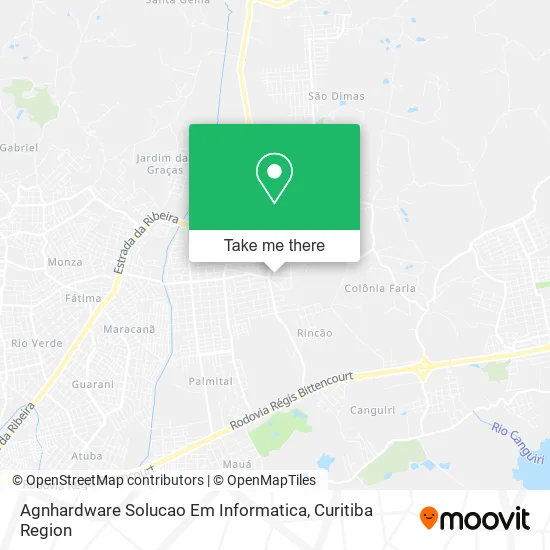
See Agnhardware Solucao Em Informatica, Colombo, on the map
Public Transit to Agnhardware Solucao Em Informatica in Colombo
Wondering how to get to Agnhardware Solucao Em Informatica in Colombo? Moovit helps you find the best way to get to Agnhardware Solucao Em Informatica with step-by-step directions from the nearest public transit station.
Moovit provides free maps and live directions to help you navigate through your city. View schedules, routes, timetables, and find out how long does it take to get to Agnhardware Solucao Em Informatica in real time.
Looking for the nearest stop or station to Agnhardware Solucao Em Informatica? Check out this list of stops closest to your destination: Rua Cerro Azul; Rua Florindo Trevisan; Rua Formosa Do Oeste.
Bus: B22 PALOMA, I33 JARDIM PAULISTA / GUARAITUBA, B90 PALOMA / COLÔNIA FARIA, B24 COLÔNIA FARIA, B46 COLÔNIA FARIA / VALE DAS FLORES, B45 BELO RINCÃO / MARACANÃ (PALMARES).
Want to see if there’s another route that gets you there at an earlier time? Moovit helps you find alternative routes or times. Get directions from and directions to Agnhardware Solucao Em Informatica easily from the Moovit App or Website.
We make riding to Agnhardware Solucao Em Informatica easy, which is why over 1.5 million users, including users in Colombo, trust Moovit as the best app for public transit. You don’t need to download an individual bus app or train app, Moovit is your all-in-one transit app that helps you find the best bus time or train time available.
For information on prices of bus, costs and ride fares to Agnhardware Solucao Em Informatica, please check the Moovit app.
Use the app to navigate to popular places including to the airport, hospital, stadium, grocery store, mall, coffee shop, school, college, and university.
Agnhardware Solucao Em Informatica Address: Rua General Carneiro, 115 Paloma Colombo-PR 83412-430 street in Colombo
- Kelfer Comercio de Utilidades Domesticas,
- Mania de Limpeza,
- Condomínio Residencial General Two,
- B M Sabores,
- Galler Construção Civil,
- F & S Entretenimento,
- Espaço Deto Almeida,
- Piriquitas,
- Los Nooboss,
- Agropecuaria e Pet Shop Dog House,
- Lancheria Galeto de Ouro,
- Dri Lanches,
- Mr Gula,
- Mm Madeiras e Lajes,
- Glamour Pink,
- Lanchonete da Eva,
- Viva Papelaria e Presentes Limitada,
- Mary Comercio de Bolsas Mochilas e Calcados,
- Santos e Fabricio,
- Asmoj Associacao dos Moradores da Vila Sao Jose
Places Near Agnhardware Solucao Em Informatica (Colombo)
- Shopping Palladium, Portão,
- Hospital Angelina Caron, Campina Grande Do Sul,
- Park Shopping Barigüi, Mossunguê,
- Hospital Da Cruz Vermelha, Batel,
- Hhhhh, Fazendinha,
- Rua General Mário Tourinho, Campina Do Siqueira,
- Rua Martim Afonso 558, Mercês,
- Hospital do Rocio, Campo,
- Campo Largo, Campo,
- Arena Da Baixada - Curitiba,
- Jardim Botânico de Curitiba PR, Centro,
- Hospital Erasto Gaertner, Jardim Das Américas,
- Hospital de Clínicas (HC - UFPR), Centro,
- Jockey Plaza Shopping Center, Tarumã,
- Parque Barigui, Mercês,
- Hospital Universitário Evangélico de Curitiba, Bigorrilho,
- Shopping Estação, Rebouças,
- Pontifícia Universidade Católica do Paraná (PUCPR), Prado Velho,
- Hospital Madalena Sofia, Bairro Alto,
- Hospital Nossa Senhora Das Graças, Mercês
How to get to popular places in Curitiba Region with public transit
Get around Colombo by public transit!
Traveling around Colombo has never been so easy. See step by step directions as you travel to any attraction, street or major public transit station. View bus and train schedules, arrival times, service alerts and detailed routes on a map, so you know exactly how to get to anywhere in Colombo.
When traveling to any destination around Colombo use Moovit's Live Directions with Get Off Notifications to know exactly where and how far to walk, how long to wait for your line, and how many stops are left. Moovit will alert you when it's time to get off — no need to constantly re-check whether yours is the next stop.
Wondering how to use public transit in Colombo or how to pay for public transit in Colombo? Moovit public transit app can help you navigate your way with public transit easily, and at minimum cost. It includes public transit fees, ticket prices, and costs. Looking for a map of Colombo public transit lines? Moovit public transit app shows all public transit maps in Colombo with all Bus and Cable Car routes and stops on an interactive map.
Curitiba Region has 2 transit type(s), including: Bus and Cable Car, operated by several transit agencies, including Sistema Integrado de Mobilidade (URBS), Sistema Integrado de Mobilidade (AMEP), URBS (Cartões bancários e Dinheiro), URBS (Cartões bancários / Cartão URBS), AMEP (Cartões bancários / Cartão MetroCard), AMEP (Cartões bancários / Cartão MetroCard / Dinheiro), Viação Colombo (Dinheiro), TRIAR (Cartão TRIAR / Dinheiro), Empresa Curitiba Cerro Azul (Dinheiro), Expresso Nossa Senhora da Penha (Dinheiro), Empresa Campo Alto Tijucas (Dinheiro), Auto Viação São José (Cartão VEM / Dinheiro), BRT S/A (Cartão VEM / Dinheiro), TransPiedade (Cartão Cidadão / Dinheiro) and Oceânica Sul (Cartão Transporte / Dinheiro)