Directions to Agua de Cheiro (Angra Dos Reis) with public transportation
The following transit lines have routes that pass near Agua de Cheiro
 Bus: 106, 207, 208, 230, T11.
- Ferry: ANGRA DOS REIS - ILHA GRANDE, ANGRA DOS REIS - ILHA GRANDE.
How to get to Agua de Cheiro by bus?
Click on the bus route to see step by step directions with maps, line arrival times and updated time schedules.
From Monsuaba, Jacuecanga
61 minFrom Praia do Sol- Monsuaba, Jacuecanga
61 minFrom Samba Angra dos Reis, Cunhambebe
83 minFrom Rua Bahia - Bracuí, Cunhambebe
71 minFrom Escola Tecnica Brasfels, Jacuecanga
47 minFrom Instituto Médico Legal - Angra dos Reis, Cunhambebe
70 minFrom Avenida Antônio Bertholdo da Silva Jordão 7346, Jacuecanga
74 minFrom Supermercado Tatais - Belém, Cunhambebe
37 minFrom Clínica Odontológica Dra. Nabila Tabet, Jacuecanga
40 minFrom Claudia Elias da Silva, Cunhambebe
37 min
Bus stops near Agua de Cheiro in Angra Dos Reis
Ferry station near Agua de Cheiro in Angra Dos Reis
- Estação Santa Luzia (Angra Dos Reis) ⛴, 7 min walk,VIEW
Bus lines to Agua de Cheiro in Angra Dos Reis
- C01, Centro (Circular),VIEW
- C01B, Circular (via Pestalozzi),VIEW
- C03, Marinas,VIEW
- C03B, Marinas (via Balneário),VIEW
- C05, Retiro,VIEW
- C05B, Retiro (via Balneário),VIEW
- T10, Divisa Mangaratiba,VIEW
- T11, Ponta Leste (via Jacuecanga),VIEW
- T20, Parque Mambucaba (via Praia Brava / Vila Histórica),VIEW
- T21, Frade,VIEW
- T21B, Praia Brava,VIEW
- T21C, Frade (via Itinga),VIEW
- 102, Caputera (via Jacuecanga),VIEW
- 103, Camorim,VIEW
- 104, Monsuaba,VIEW
- 106, Jacuecanga (via Balneário),VIEW
- B106, Jacuecanga (via Morro da Cruz),VIEW
- 202, Frade (via Sertãozinho / Beira Rio),VIEW
- 203, Serra D'Água,VIEW
- 204, Ariró,VIEW
What are the closest stations to Agua de Cheiro?
The closest stations to Agua de Cheiro are:
- Desembarque Centro / Largo Da Lapa is 37 meters away, 1 min walk.
- Ponto De Embarque 11 - Lapa is 91 meters away, 2 min walk.
- Ponto De Embarque 07 - Praça Do Porto is 219 meters away, 3 min walk.
- Estação Santa Luzia (Angra Dos Reis) ⛴ is 486 meters away, 7 min walk.
- Ponto 01 - Santa Luzia is 528 meters away, 7 min walk.
- Avenida Júlio Maria, 289-385 is 572 meters away, 8 min walk.
Which bus lines stop near Agua de Cheiro?
These bus lines stop near Agua de Cheiro: 106, 207, 208, 230, T11.
What’s the nearest bus station to Agua de Cheiro in Angra Dos Reis?
The nearest bus station to Agua de Cheiro in Angra Dos Reis is Desembarque Centro / Largo Da Lapa. It’s a 1 min walk away.
What’s the nearest ferry station to Agua de Cheiro in Angra Dos Reis?
The nearest ferry station to Agua de Cheiro in Angra Dos Reis is Estação Santa Luzia (Angra Dos Reis) ⛴. It’s a 7 min walk away.
What time is the first bus to Agua de Cheiro in Angra Dos Reis?
The T20 is the first bus that goes to Agua de Cheiro in Angra Dos Reis. It stops nearby at 4:50 AM.
What time is the last bus to Agua de Cheiro in Angra Dos Reis?
The T11 is the last bus that goes to Agua de Cheiro in Angra Dos Reis. It stops nearby at 2:01 AM.
What time is the first ferry to Agua de Cheiro in Angra Dos Reis?
The ANGRA DOS REIS - ILHA GRANDE is the first ferry that goes to Agua de Cheiro in Angra Dos Reis. It stops nearby at 8:35 AM.
What time is the last ferry to Agua de Cheiro in Angra Dos Reis?
The ANGRA DOS REIS - ILHA GRANDE is the last ferry that goes to Agua de Cheiro in Angra Dos Reis. It stops nearby at 6:30 PM.
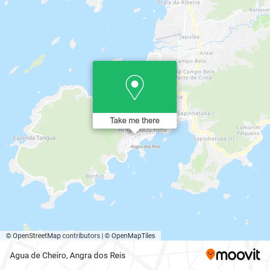
See Agua de Cheiro, Angra Dos Reis, on the map
Public Transit to Agua de Cheiro in Angra Dos Reis
Wondering how to get to Agua de Cheiro in Angra Dos Reis? Moovit helps you find the best way to get to Agua de Cheiro with step-by-step directions from the nearest public transit station.
Moovit provides free maps and live directions to help you navigate through your city. View schedules, routes, timetables, and find out how long does it take to get to Agua de Cheiro in real time.
Looking for the nearest stop or station to Agua de Cheiro? Check out this list of stops closest to your destination: Desembarque Centro / Largo Da Lapa; Ponto De Embarque 11 - Lapa; Ponto De Embarque 07 - Praça Do Porto; Estação Santa Luzia (Angra Dos Reis) ⛴; Ponto 01 - Santa Luzia; Avenida Júlio Maria.
Bus: 106, 207, 208, 230, T11, C01, C01B, C03, C03B, C05, C04, C04B, B203, 105, L407, L408.Ferry: ANGRA DOS REIS - ILHA GRANDE, ANGRA DOS REIS - ILHA GRANDE.
Want to see if there’s another route that gets you there at an earlier time? Moovit helps you find alternative routes or times. Get directions from and directions to Agua de Cheiro easily from the Moovit App or Website.
We make riding to Agua de Cheiro easy, which is why over 1.5 million users, including users in Angra Dos Reis, trust Moovit as the best app for public transit. You don’t need to download an individual bus app or train app, Moovit is your all-in-one transit app that helps you find the best bus time or train time available.
For information on prices of bus, costs and ride fares to Agua de Cheiro, please check the Moovit app.
Use the app to navigate to popular places including to the airport, hospital, stadium, grocery store, mall, coffee shop, school, college, and university.
Agua de Cheiro Address: Rua Coronel Carvalho, 352 Morro do Santo Antônio Angra dos Reis-RJ 23900-310 street in Angra Dos Reis
- K L C Comercio e Representacoes,
- Cabana do Surf,
- A Gatta de Angra Comercio de Calcados e Acessorios L,
- Griff Cacau Comercio de Alimentos e Chocolates,
- Mr Cat - Angra dos Reis,
- Papelaria e Livraria Alvorada,
- Klc Comércio Representações Ltda,
- Kwanza Calcados e Bolsas,
- Titans,
- Ceu do Mar Decoraoes,
- Miranda E Avancini Lanchonete,
- PE de Meia de Volta Redonda Comercio de Roupas,
- Bang Bang,
- Alziras Jóias e Relógios,
- Amapola,
- Paraíso da Economia,
- Organizacoes Angrense,
- Itec Pólo Angra dos Reis,
- Valle Parking,
- Academia Do Chopp De Angra
Places Near Agua de Cheiro (Angra Dos Reis)
- Vila Historica de Mambucaba, Mambucaba,
- Garatucaia, Angra Dos Reis,
- Vila Galé Eco Resort De Angra, Angra Dos Reis,
- Condominio Laranjeiras, Parati Mirim,
- Centro Histórico de Paraty, Parati,
- Mambucaba, Mambucaba,
- Praia de Paraty Mirim, Parati,
- Cachoeira do Tobogã, Parati,
- Praia do Laboratório, Angra Dos Reis,
- Rodovia Procurador Haroldo Fernandes Duarte, Km 513,5 s / n, Cunhambebe,
- Rua Prefeito João Gregório Galindo 2487, Angra Dos Reis,
- Verolme, Jacuecanga,
- Avenida Almirante Jair Carneiro Toscano de Brito 110, Angra Dos Reis,
- BR 101, Km 508 s/n, Cunhambebe,
- praia jabaquara - parati, Parati,
- Alambique Engenho D'Ouro, Parati,
- Rua Prefeito João Gregório Galindo, Cunhambebe,
- Vila Residencial De Mambucaba, Mambucaba,
- Rua Cônegos Bittencourt, Angra Dos Reis,
- Rodovia BR 101, Km 533 s/n, Mambucaba
How to get to popular places in Angra dos Reis with public transit
Get around Angra Dos Reis by public transit!
Traveling around Angra Dos Reis has never been so easy. See step by step directions as you travel to any attraction, street or major public transit station. View bus and train schedules, arrival times, service alerts and detailed routes on a map, so you know exactly how to get to anywhere in Angra Dos Reis.
When traveling to any destination around Angra Dos Reis use Moovit's Live Directions with Get Off Notifications to know exactly where and how far to walk, how long to wait for your line, and how many stops are left. Moovit will alert you when it's time to get off — no need to constantly re-check whether yours is the next stop.
Wondering how to use public transit in Angra Dos Reis or how to pay for public transit in Angra Dos Reis? Moovit public transit app can help you navigate your way with public transit easily, and at minimum cost. It includes public transit fees, ticket prices, and costs. Looking for a map of Angra Dos Reis public transit lines? Moovit public transit app shows all public transit maps in Angra Dos Reis with all Bus and Ferry routes and stops on an interactive map.
Angra dos Reis has 2 transit type(s), including: Bus and Ferry, operated by several transit agencies, including Viação Senhor do Bonfim, Colitur Transportes Rodoviários, Cooparatyense (Vans), Costa Verde Transportes, Barcas Rio, Objetiva Tour, Vilanova Tour, Rodoviário Oceano, BusUFF and Colitur (Tarifa Zero - Paraty)