Directions to Airzone Systems (Plantation) with public transportation
The following transit lines have routes that pass near Airzone Systems
 Bus: 62.
How to get to Airzone Systems by bus?
Click on the bus route to see step by step directions with maps, line arrival times and updated time schedules.
From Wilton Manors, Fort Lauderdale
77 minFrom Swap Shop, Fort Lauderdale
86 minFrom Naples, Florida, Plantation
85 minFrom Hotel Soap, Fort Lauderdale
80 minFrom Alligator Alley, Fort Lauderdale
78 minFrom Plantation, Florida, Plantation
72 minFrom State Road 7 & West Sunrise Boulevard, Plantation
83 minFrom City of Oakland Park, Fort Lauderdale
78 minFrom Blanche Ely High School, Pompano Beach
83 minFrom Holiday Inn Hotel & Suites Sawgrass Mills, Plantation
58 min
Bus stop near Airzone Systems in Plantation
- Southwest 81st Avenue/McNab Road, 14 min walk,VIEW
Bus lines to Airzone Systems in Plantation
- 62, Westview - University,VIEW
What are the closest stations to Airzone Systems?
The closest stations to Airzone Systems are:
- Southwest 81st Avenue/McNab Road is 1144 yards away, 14 min walk.
Which bus line stops near Airzone Systems?
62 (Westview - University)
What’s the nearest bus station to Airzone Systems in Plantation?
The nearest bus station to Airzone Systems in Plantation is Southwest 81st Avenue/McNab Road. It’s a 14 min walk away.
What time is the first bus to Airzone Systems in Plantation?
The 62 is the first bus that goes to Airzone Systems in Plantation. It stops nearby at 5:17 AM.
What time is the last bus to Airzone Systems in Plantation?
The 62 is the last bus that goes to Airzone Systems in Plantation. It stops nearby at 11:32 PM.
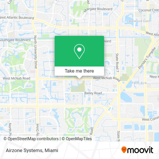
See Airzone Systems, Plantation, on the map
Public Transit to Airzone Systems in Plantation
Wondering how to get to Airzone Systems in Plantation? Moovit helps you find the best way to get to Airzone Systems with step-by-step directions from the nearest public transit station.
Moovit provides free maps and live directions to help you navigate through your city. View schedules, routes, timetables, and find out how long does it take to get to Airzone Systems in real time.
Looking for the nearest stop or station to Airzone Systems? Check out this list of stops closest to your destination: Southwest 81st Avenue/McNab Road.
Bus: 62.
Want to see if there’s another route that gets you there at an earlier time? Moovit helps you find alternative routes or times. Get directions from and directions to Airzone Systems easily from the Moovit App or Website.
We make riding to Airzone Systems easy, which is why over 1.5 million users, including users in Plantation, trust Moovit as the best app for public transit. You don’t need to download an individual bus app or train app, Moovit is your all-in-one transit app that helps you find the best bus time or train time available.
For information on prices of bus, costs and ride fares to Airzone Systems, please check the Moovit app.
Use the app to navigate to popular places including to the airport, hospital, stadium, grocery store, mall, coffee shop, school, college, and university.
Airzone Systems Address: 7546 W McNab Rd Pompano Beach, FL 33068 street in Plantation
- Infinite Communications,
- Miracle Collision,
- Gear Driven,
- Auto Simplify,
- American Auto Vinyl,
- Continental,
- Kab Customs,
- Just Auto Transport Services,
- DH Powdercoating,
- Hello Sweetness,
- Hampton Lakes,
- First Response Commercial Air Cleaners,
- BURGER KING,
- Mas Health,
- Khai,
- SBH Shonn's Blessed Hands,
- SRW Transportation,
- Food Service Solutions of South Florida,
- Arium Lauderdale,
- Cannabus Mobile SM
Places Near Airzone Systems (Plantation)
- Aventura Mall, Miami,
- Dolphin Mall Bus, Miami,
- Wynwood, Miami,
- Port of Miami Cruise Terminal, Miami,
- Little Havana, Miami,
- Brickell City Centre, Miami,
- Miami Design District, Miami,
- Keiser University Flagship Campus, West Palm Beach,
- Aventura Mall, Miami Beach,
- Miami Freedom Park, Miami,
- Hard Rock Stadium, Miami Gardens,
- Bayside Marketplace, Miami,
- Dolphin Mall, Miami,
- Sawgrass Mall, Miami,
- Sawgrass mall ( FL ), Miami Beach,
- Zoo Miami, Miami,
- Marlins Park, Miami,
- Miami-Dade County Courthouse, Miami,
- Richard E. Gerstein Justice Building, Miami,
- Miami VA Hospital, Miami
How to get to popular places in Miami with public transit
Get around Plantation by public transit!
Traveling around Plantation has never been so easy. See step by step directions as you travel to any attraction, street or major public transit station. View bus and train schedules, arrival times, service alerts and detailed routes on a map, so you know exactly how to get to anywhere in Plantation.
When traveling to any destination around Plantation use Moovit's Live Directions with Get Off Notifications to know exactly where and how far to walk, how long to wait for your line, and how many stops are left. Moovit will alert you when it's time to get off — no need to constantly re-check whether yours is the next stop.
Wondering how to use public transit in Plantation or how to pay for public transit in Plantation? Moovit public transit app can help you navigate your way with public transit easily, and at minimum cost. It includes public transit fees, ticket prices, and costs. Looking for a map of Plantation public transit lines? Moovit public transit app shows all public transit maps in Plantation with all Bus, Train, Light Rail and Ferry routes and stops on an interactive map.
Miami has 4 transit type(s), including: Bus, Train, Light Rail and Ferry, operated by several transit agencies, including Broward County Transit, Miami-Dade Transit, Metrorail, Palm Tran, Tri-Rail, Brightline, MARTY, City of Homestead Trolley, Key West Transit, Treasure Coast Connector, GoLine IRT, Amtrak, Greyhound-us, FlixBus-us and Aventura Express Shuttle Bus