Directions to Ajg Modas (Araucária) with public transportation
The following transit lines have routes that pass near Ajg Modas
How to get to Ajg Modas by bus?
Click on the bus route to see step by step directions with maps, line arrival times and updated time schedules.
From Avenida Juscelino Kubitschek de Oliveira, Cic
57 minFrom Colônia Cristina, Araucária
115 minFrom Rua João Bettega, Cic
39 minFrom Rua João Chede, Cic
52 minFrom faculdade santa cruz, Capão Raso
51 minFrom Rua Nicola Pellanda, Umbará
63 minFrom Cidade Industrial de Curitiba, Cic
25 minFrom Tatuquara, Tatuquara
60 minFrom Novo Mundo, Novo Mundo
48 minFrom Centro De Treinamento Clube Atlético Paranaense, Umbará
65 min
Bus stops near Ajg Modas in Araucária
Bus lines to Ajg Modas in Araucária
- 33 CALIFÓRNIA / IPÊS, Terminal Vila Angélica ↺ Califórnia / Ipês (Circular),VIEW
- 63 ROÇA NOVA, Terminal Vila Angélica ↺ Roça Nova (Circular),VIEW
- 09 ARVOREDO / ANGÉLICA, Terminal Vila Angélica ↺ Arvoredo (Circular),VIEW
- 11 CALIFÓRNIA / CSU, Terminal Vila Angélica → Terminal Central Araucária,VIEW
- 12 CALIFÓRNIA / VITAL BRASIL, Terminal Central Araucária → Terminal Vila Angélica,VIEW
- 02 LINHÃO 02 (ANGÉLICA / TUPY), Terminal Vila Angélica → Tupy,VIEW
- 36 CTI / ANGÉLICA, Sentido Anti-horário,VIEW
- 34 LINHA 04, Sentido Horário,VIEW
What are the closest stations to Ajg Modas?
The closest stations to Ajg Modas are:
- Rua Pelicano, 1025 is 96 meters away, 2 min walk.
- Rua Saracura, 1689 is 470 meters away, 7 min walk.
- Rua Tiriva, 743 is 1102 meters away, 15 min walk.
Which bus lines stop near Ajg Modas?
These bus lines stop near Ajg Modas: 02 LINHÃO 02 (ANGÉLICA / TUPY), 12 CALIFÓRNIA / VITAL BRASIL, 33 CALIFÓRNIA / IPÊS.
What’s the nearest bus station to Ajg Modas in Araucária?
The nearest bus station to Ajg Modas in Araucária is Rua Pelicano, 1025. It’s a 2 min walk away.
What time is the first bus to Ajg Modas in Araucária?
The 11 CALIFÓRNIA / CSU is the first bus that goes to Ajg Modas in Araucária. It stops nearby at 4:22 AM.
What time is the last bus to Ajg Modas in Araucária?
The 11 CALIFÓRNIA / CSU is the last bus that goes to Ajg Modas in Araucária. It stops nearby at 1:01 AM.
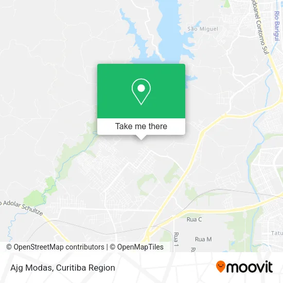
See Ajg Modas, Araucária, on the map
Public Transit to Ajg Modas in Araucária
Wondering how to get to Ajg Modas in Araucária? Moovit helps you find the best way to get to Ajg Modas with step-by-step directions from the nearest public transit station.
Moovit provides free maps and live directions to help you navigate through your city. View schedules, routes, timetables, and find out how long does it take to get to Ajg Modas in real time.
Looking for the nearest stop or station to Ajg Modas? Check out this list of stops closest to your destination: Rua Pelicano; Rua Saracura; Rua Tiriva.
Bus: 02 LINHÃO 02 (ANGÉLICA / TUPY), 12 CALIFÓRNIA / VITAL BRASIL, 33 CALIFÓRNIA / IPÊS, 63 ROÇA NOVA, 09 ARVOREDO / ANGÉLICA, 11 CALIFÓRNIA / CSU, 36 CTI / ANGÉLICA, 34 LINHA 04.
Want to see if there’s another route that gets you there at an earlier time? Moovit helps you find alternative routes or times. Get directions from and directions to Ajg Modas easily from the Moovit App or Website.
We make riding to Ajg Modas easy, which is why over 1.5 million users, including users in Araucária, trust Moovit as the best app for public transit. You don’t need to download an individual bus app or train app, Moovit is your all-in-one transit app that helps you find the best bus time or train time available.
For information on prices of bus, costs and ride fares to Ajg Modas, please check the Moovit app.
Use the app to navigate to popular places including to the airport, hospital, stadium, grocery store, mall, coffee shop, school, college, and university.
Ajg Modas Address: Rua Pelicano, 1025 Capela Velha Araucária-PR 83706-490 street in Araucária
- Família Pinturas,
- Condomínio Residencial Mirante,
- Poliseco,
- Compre Mais,
- Boutique Lua Rosa,
- Pessoni Engenharia,
- Primos Prestadora de Serviços,
- Jcs Instalacao e Manutencao Elétrica,
- Amarelos Fotografia,
- Mirante 2,
- Obra Condomínio Mirante,
- Condomínio Mirante I,
- Wz Prestservic,
- Distribuidora de Gas Santos,
- Rua Pelicano 1151,
- Rua Peru 1101,
- Larissa Zorze,
- Estilo & Requinte,
- Parque Passauna,
- Js Assessoria
Places Near Ajg Modas (Araucária)
- Arena Da Baixada - Curitiba,
- Hospital Universitário Evangélico de Curitiba, Bigorrilho,
- Rua Martim Afonso 558, Mercês,
- Pontifícia Universidade Católica do Paraná (PUCPR), Prado Velho,
- Hospital Angelina Caron, Campina Grande Do Sul,
- Shopping Palladium, Portão,
- Hospital Madalena Sofia, Bairro Alto,
- Hhhhh, Fazendinha,
- Jardim Botânico de Curitiba PR, Centro,
- Hospital Da Cruz Vermelha, Batel,
- Hospital de Clínicas (HC - UFPR), Centro,
- Hospital do Rocio, Campo,
- Campo Largo, Campo,
- Hospital Nossa Senhora Das Graças, Mercês,
- Jockey Plaza Shopping Center, Tarumã,
- Park Shopping Barigüi, Mossunguê,
- Parque Barigui, Mercês,
- Hospital Erasto Gaertner, Jardim Das Américas,
- Shopping Estação, Rebouças,
- Rua General Mário Tourinho, Campina Do Siqueira
How to get to popular places in Curitiba Region with public transit
Get around Araucária by public transit!
Traveling around Araucária has never been so easy. See step by step directions as you travel to any attraction, street or major public transit station. View bus and train schedules, arrival times, service alerts and detailed routes on a map, so you know exactly how to get to anywhere in Araucária.
When traveling to any destination around Araucária use Moovit's Live Directions with Get Off Notifications to know exactly where and how far to walk, how long to wait for your line, and how many stops are left. Moovit will alert you when it's time to get off — no need to constantly re-check whether yours is the next stop.
Wondering how to use public transit in Araucária or how to pay for public transit in Araucária? Moovit public transit app can help you navigate your way with public transit easily, and at minimum cost. It includes public transit fees, ticket prices, and costs. Looking for a map of Araucária public transit lines? Moovit public transit app shows all public transit maps in Araucária with all Bus and Cable Car routes and stops on an interactive map.
Curitiba Region has 2 transit type(s), including: Bus and Cable Car, operated by several transit agencies, including Sistema Integrado de Mobilidade (URBS), Sistema Integrado de Mobilidade (AMEP), URBS (Cartões bancários e Dinheiro), URBS (Cartões bancários / Cartão URBS), AMEP (Cartões bancários / Cartão MetroCard), AMEP (Cartões bancários / Cartão MetroCard / Dinheiro), Viação Colombo (Dinheiro), TRIAR (Cartão TRIAR / Dinheiro), Empresa Curitiba Cerro Azul (Dinheiro), Expresso Nossa Senhora da Penha (Dinheiro), Empresa Campo Alto Tijucas (Dinheiro), Auto Viação São José (Cartão VEM / Dinheiro), BRT S/A (Cartão VEM / Dinheiro), TransPiedade (Cartão Cidadão / Dinheiro) and Oceânica Sul (Cartão Transporte / Dinheiro)