How to get to Albalabuda Alba Labuda by train?
Click on the train route to see step by step directions with maps, line arrival times and updated time schedules.
Bus stops near Albalabuda Alba Labuda in Warsaw
Light Rail stations near Albalabuda Alba Labuda in Warsaw
- Grochowska, 7 min walk,VIEW
Bus lines to Albalabuda Alba Labuda in Warsaw
What are the closest stations to Albalabuda Alba Labuda?
The closest stations to Albalabuda Alba Labuda are:
- Grochowska is 497 meters away, 7 min walk.
- Rycerska is 671 meters away, 9 min walk.
- Marszałkowska is 712 meters away, 10 min walk.
Which bus line stops near Albalabuda Alba Labuda?
145 (Kacza)
Which train lines stop near Albalabuda Alba Labuda?
These train lines stop near Albalabuda Alba Labuda: EIC 17004, IC 1812, IC 57000, PKM 4.
Which light rail line stops near Albalabuda Alba Labuda?
6 (Budziszyńska)
What’s the nearest light rail station to Albalabuda Alba Labuda in Warsaw?
The nearest light rail station to Albalabuda Alba Labuda in Warsaw is Grochowska. It’s a 7 min walk away.
What’s the nearest bus station to Albalabuda Alba Labuda in Warsaw?
The nearest bus station to Albalabuda Alba Labuda in Warsaw is Grochowska. It’s a 7 min walk away.
What time is the first light rail to Albalabuda Alba Labuda in Warsaw?
The 1 is the first light rail that goes to Albalabuda Alba Labuda in Warsaw. It stops nearby at 4:36 AM.
What time is the last light rail to Albalabuda Alba Labuda in Warsaw?
The 13 is the last light rail that goes to Albalabuda Alba Labuda in Warsaw. It stops nearby at 11:31 PM.
What time is the first bus to Albalabuda Alba Labuda in Warsaw?
The 212 is the first bus that goes to Albalabuda Alba Labuda in Warsaw. It stops nearby at 3:08 AM.
What time is the last bus to Albalabuda Alba Labuda in Warsaw?
The 222 is the last bus that goes to Albalabuda Alba Labuda in Warsaw. It stops nearby at 3:39 AM.
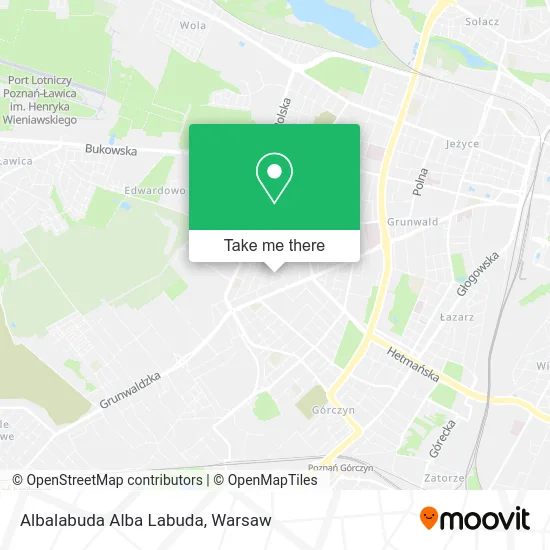
See Albalabuda Alba Labuda, Warsaw, on the map
Public Transit to Albalabuda Alba Labuda in Warsaw
Wondering how to get to Albalabuda Alba Labuda in Warsaw? Moovit helps you find the best way to get to Albalabuda Alba Labuda with step-by-step directions from the nearest public transit station.
Moovit provides free maps and live directions to help you navigate through your city. View schedules, routes, timetables, and find out how long does it take to get to Albalabuda Alba Labuda in real time.
Looking for the nearest stop or station to Albalabuda Alba Labuda? Check out this list of stops closest to your destination: Grochowska; Rycerska; Marszałkowska.
Bus: 145, 214, 224, 169, 182, 163, 212, 222, 191, 193, 148.Train: EIC 17004, IC 1812, IC 57000, PKM 4.Light Rail: 6.
Want to see if there’s another route that gets you there at an earlier time? Moovit helps you find alternative routes or times. Get directions from and directions to Albalabuda Alba Labuda easily from the Moovit App or Website.
We make riding to Albalabuda Alba Labuda easy, which is why over 1.5 million users, including users in Warsaw, trust Moovit as the best app for public transit. You don’t need to download an individual bus app or train app, Moovit is your all-in-one transit app that helps you find the best bus time or train time available.
For information on prices of train, bus and light rail, costs and ride fares to Albalabuda Alba Labuda, please check the Moovit app.
Use the app to navigate to popular places including to the airport, hospital, stadium, grocery store, mall, coffee shop, school, college, and university.
Albalabuda Alba Labuda Address: ulica Kanclerska 8, 60-327 Poznań street in Warsaw
- Piotr Wulf,
- Skup Rol Lucyna Zawadzka,
- Stomatolog Piotr Gerre,
- Casolla,
- Zielone Ogrody. Piwnicki W.,
- Sergiusz Brzostowicz Przedsiębiorstwo Usług Geodezyjnych i Kartograficznych,
- Wiktor Suchy Medycyna Estetyczna,
- Heget,
- Sylwia Cieluch,
- Totu,
- To Tu. Internetowe Centrum Handlowe,
- Syner Tech Waldemar Koseda,
- Biogaz Turostowo Sp z o O,
- Paypro S A,
- Dialcom24 Sp z o O,
- Małgorzata Pinczyńska,
- Przedstawiciel Finansowy Piotr Przymusiński,
- Bobi PPHU Katarzyna Matusiewicz Poznań,
- Gabinet Lekarski ul. Kasztelańska,
- Makar. PW
Places Near Albalabuda Alba Labuda (Warsaw)
- Galeria Mokotów, Warsaw,
- Szpital Czerniakowski, Warsaw,
- Cmentarz Bródnowski, Warsaw,
- Centralny Szpital Kliniczny MSWiA ul. Wołoska, Warsaw,
- PGE Narodowy, Warsaw,
- Postępu, Warsaw,
- Banacha - Szpital Kliniczny, Warsaw,
- Domaniewska, Warsaw,
- Wołoska-Szpital 01, Warsaw,
- Szaserów - Szpital, Warsaw,
- Szpital Spartanska, Warsaw,
- Torwar, Warsaw,
- Sejm Rp, Warsaw,
- Szpital Orłowskiego, Warsaw,
- CH Arkadia, Warsaw,
- Instytut Kardiologii w Aninie, Warsaw,
- Galeria Północna, Warsaw,
- Szpital Bielański, Warsaw,
- Stare Miasto, Warsaw,
- Wołoska, Warsaw
How to get to popular places in Warsaw with public transit
Get around Warsaw by public transit!
Traveling around Warsaw has never been so easy. See step by step directions as you travel to any attraction, street or major public transit station. View bus and train schedules, arrival times, service alerts and detailed routes on a map, so you know exactly how to get to anywhere in Warsaw.
When traveling to any destination around Warsaw use Moovit's Live Directions with Get Off Notifications to know exactly where and how far to walk, how long to wait for your line, and how many stops are left. Moovit will alert you when it's time to get off — no need to constantly re-check whether yours is the next stop.
Wondering how to use public transit in Warsaw or how to pay for public transit in Warsaw? Moovit public transit app can help you navigate your way with public transit easily, and at minimum cost. It includes public transit fees, ticket prices, and costs. Looking for a map of Warsaw public transit lines? Moovit public transit app shows all public transit maps in Warsaw with all Bus, Train, Metro, Light Rail, Ferry and Cable Car routes and stops on an interactive map.
Warsaw has 6 transit type(s), including: Bus, Train, Metro, Light Rail, Ferry and Cable Car, operated by several transit agencies, including Warszawski Transport Publiczny, Warszawska Kolej Dojazdowa, Koleje Mazowieckie, ZTP Kraków, Miasto Piastów, Miasto Ząbki, Koleje Małopolskie, Komunikacja Miejska Łomianki, Gmina Pruszków, MPK Wrocław, MZDiK Radom, UM w Grodzisku Mazowieckim, UM w Nowym Dworze Mazowieckim, UM Płońsk and Koleje Dolnośląskie