Directions to Alexmaciel (Santo Inácio) with public transportation
The following transit lines have routes that pass near Alexmaciel
How to get to Alexmaciel by bus?
Click on the bus route to see step by step directions with maps, line arrival times and updated time schedules.
From Rua Comendador Macedo, Centro
24 minFrom Rua Alferes Poli, Rebouças
29 minFrom Hospital e Maternidade Santa Madalena Sofia, Bairro Alto
48 minFrom Rua João Bettega, Portão
33 minFrom Rua Manoel Eufrásio, Juvevê
37 minFrom UPA 24h - Unidade de Pronto Atendimento Boa Vista, Bacacheri
49 minFrom Rua Mariano Torres, Centro
25 minFrom Rua Frederico Maurer, Boqueirão
50 minFrom Jockey Club do Paraná, Tarumã
42 minFrom Avenida Victor Ferreira do Amaral, Tarumã
41 min
Bus stops near Alexmaciel in Santo Inácio
Bus lines to Alexmaciel in Santo Inácio
- 815 REFORÇO TUIUTI, Terminal Campina do Siqueira ↺ Universidade Tuiuti (Circular),VIEW
- 816 CAMPINA DO SIQUEIRA / SANTA FELICIDADE, Terminal Santa Felicidade → Terminal Campina do Siqueira,VIEW
- 875 BIGORRILHO, Bigorrilho → Praça Tiradentes,VIEW
- 812 MONTANA, Montana → Terminal Campina Do Siqueira,VIEW
- 817 SATURNO / VENEZA, Terminal Santa Felicidade → Terminal Campina do Siqueira,VIEW
- J62 CAMPO LARGO / GUADALUPE, Terminal Guadalupe → Terminal Campo Largo,VIEW
- 814 MOSSUNGUÊ, Terminal Campina do Siqueira → Mossunguê,VIEW
- 870 SÃO BRAZ, Praça Tiradentes → São Braz,VIEW
- 889 MAD. SÃO BRAZ, Praça Rui Barbosa ↺ São Braz (Circular),VIEW
- 725 BATEL / MOSSUNGUÊ, Batel → Mossunguê,VIEW
What are the closest stations to Alexmaciel?
The closest stations to Alexmaciel are:
- R. Padre Ladislau Kula, 831 is 82 meters away, 2 min walk.
- R. Padre Ladislau Kula, 861 is 100 meters away, 2 min walk.
- R. Padre Ladislau Kula, 591 is 172 meters away, 3 min walk.
- Rua Tobias De Macedo Júnior, 72 is 280 meters away, 4 min walk.
- Rod. BR-277, 914 is 402 meters away, 6 min walk.
- Rod. BR-277, 500 (Parque Barigui) is 609 meters away, 8 min walk.
Which bus lines stop near Alexmaciel?
These bus lines stop near Alexmaciel: 815 REFORÇO TUIUTI, 816 CAMPINA DO SIQUEIRA / SANTA FELICIDADE, J62 CAMPO LARGO / GUADALUPE.
What’s the nearest bus station to Alexmaciel in Santo Inácio?
The nearest bus stations to Alexmaciel in Santo Inácio are R. Padre Ladislau Kula, 831 and R. Padre Ladislau Kula, 861. The closest one is a 2 min walk away.
What time is the first bus to Alexmaciel in Santo Inácio?
The 889 MAD. SÃO BRAZ is the first bus that goes to Alexmaciel in Santo Inácio. It stops nearby at 3:15 AM.
What time is the last bus to Alexmaciel in Santo Inácio?
The 889 MAD. SÃO BRAZ is the last bus that goes to Alexmaciel in Santo Inácio. It stops nearby at 2:21 AM.
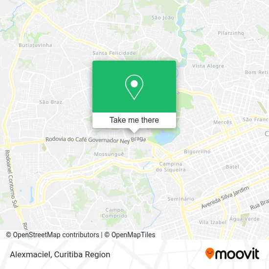
See Alexmaciel, Santo Inácio, on the map
Public Transit to Alexmaciel in Santo Inácio
Wondering how to get to Alexmaciel in Santo Inácio? Moovit helps you find the best way to get to Alexmaciel with step-by-step directions from the nearest public transit station.
Moovit provides free maps and live directions to help you navigate through your city. View schedules, routes, timetables, and find out how long does it take to get to Alexmaciel in real time.
Looking for the nearest stop or station to Alexmaciel? Check out this list of stops closest to your destination: R. Padre Ladislau Kula; R. Padre Ladislau Kula; R. Padre Ladislau Kula; Rua Tobias De Macedo Júnior; Rod. BR-277; Rod. BR-277.
Bus: 815 REFORÇO TUIUTI, 816 CAMPINA DO SIQUEIRA / SANTA FELICIDADE, J62 CAMPO LARGO / GUADALUPE, 875 BIGORRILHO, 812 MONTANA, 817 SATURNO / VENEZA, 814 MOSSUNGUÊ, 870 SÃO BRAZ, 889 MAD. SÃO BRAZ, 725 BATEL / MOSSUNGUÊ.
Want to see if there’s another route that gets you there at an earlier time? Moovit helps you find alternative routes or times. Get directions from and directions to Alexmaciel easily from the Moovit App or Website.
We make riding to Alexmaciel easy, which is why over 1.7 million users, including users in Santo Inácio, trust Moovit as the best app for public transit. You don’t need to download an individual bus app or train app, Moovit is your all-in-one transit app that helps you find the best bus time or train time available.
For information on prices of bus, costs and ride fares to Alexmaciel, please check the Moovit app.
Use the app to navigate to popular places including to the airport, hospital, stadium, grocery store, mall, coffee shop, school, college, and university.
Alexmaciel Address: Rua Padre Ladislau Kula, 800 Santo Inácio Curitiba-PR 82010-210 street in Santo Inácio
- Olga S. Quadros Participações Societarias,
- Salão Marly Barigui,
- Brød Bakery Curitiba,
- Indusparquet Curitiba,
- Wm Bike Store,
- I Ndusparquet,
- Residencial Barigui Garden,
- Kundalini,
- Igor Gomes Lachowski Serviços de Apoio Administrativo,
- Esg Institute,
- Marquesini Assessoria Corporativa,
- Matsumura Studio,
- IP 20 - 45,
- Grafica Jota S,
- Rua José Sikorski 46,
- Mansão Belloni,
- Decathlon,
- Ponto Final Do Onibus Bogorrilho,
- Jorge Tucholski Artigos Para Viagem,
- Rodrigo Ricabone Mura
Places Near Alexmaciel (Santo Inácio)
- Hospital Erasto Gaertner, Jardim Das Américas,
- Park Shopping Barigüi, Mossunguê,
- Hhhhh, Fazendinha,
- Parque Barigui, Mercês,
- Hospital Madalena Sofia, Bairro Alto,
- Pontifícia Universidade Católica do Paraná (PUCPR), Prado Velho,
- Campo Largo, Campo,
- Hospital do Rocio, Campo,
- Hospital Universitário Evangélico de Curitiba, Bigorrilho,
- Jardim Botânico de Curitiba PR, Centro,
- Shopping Estação, Rebouças,
- Rua Martim Afonso 558, Mercês,
- Arena Da Baixada - Curitiba,
- Hospital Nossa Senhora Das Graças, Mercês,
- Hospital Da Cruz Vermelha, Batel,
- Shopping Palladium, Portão,
- Jockey Plaza Shopping Center, Tarumã,
- Rua General Mário Tourinho, Campina Do Siqueira,
- Hospital Angelina Caron, Campina Grande Do Sul,
- Hospital de Clínicas (HC - UFPR), Centro
How to get to popular places in Curitiba Region with public transit
Get around Santo Inácio by public transit!
Traveling around Santo Inácio has never been so easy. See step by step directions as you travel to any attraction, street or major public transit station. View bus and train schedules, arrival times, service alerts and detailed routes on a map, so you know exactly how to get to anywhere in Santo Inácio.
When traveling to any destination around Santo Inácio use Moovit's Live Directions with Get Off Notifications to know exactly where and how far to walk, how long to wait for your line, and how many stops are left. Moovit will alert you when it's time to get off — no need to constantly re-check whether yours is the next stop.
Wondering how to use public transit in Santo Inácio or how to pay for public transit in Santo Inácio? Moovit public transit app can help you navigate your way with public transit easily, and at minimum cost. It includes public transit fees, ticket prices, and costs. Looking for a map of Santo Inácio public transit lines? Moovit public transit app shows all public transit maps in Santo Inácio with all Bus and Cable Car routes and stops on an interactive map.
Curitiba Region has 2 transit type(s), including: Bus and Cable Car, operated by several transit agencies, including Sistema Integrado de Mobilidade (URBS), Sistema Integrado de Mobilidade (AMEP), URBS (Cartões bancários e Dinheiro), URBS (Cartões bancários / Cartão URBS), AMEP (Cartões bancários / Cartão MetroCard), AMEP (Cartões bancários / Cartão MetroCard / Dinheiro), Viação Colombo (Dinheiro), TRIAR (Cartão TRIAR / Dinheiro), Empresa Curitiba Cerro Azul (Dinheiro), Expresso Nossa Senhora da Penha (Dinheiro), Empresa Campo Alto Tijucas (Dinheiro), Auto Viação São José (Cartão VEM / Dinheiro), BRT S/A (Cartão VEM / Dinheiro), TransPiedade (Cartão Cidadão / Dinheiro) and Oceânica Sul (Cartão Transporte / Dinheiro)