How to get to Alfemo by bus?
Click on the bus route to see step by step directions with maps, line arrival times and updated time schedules.
From SGK Bursa İl Müdürlüğü, Osmangazi
40 minFrom Akçalar Mahallesi, Osmangazi
33 minFrom Adile Naşit Tiyatrosu, Yıldırım
55 minFrom Samanlı Minibüsü, Yıldırım
64 minFrom Ertuğrulgazi Anadolu Lisesi, Yıldırım
54 minFrom Arabayatağı Otobüs Durağı, Yıldırım
62 minFrom Hayat Hastanesi, Osmangazi
42 minFrom Demirtaş Dosab Çekirge Devlet Hastanesi, Osmangazi
54 minFrom 11 Eylül Bulvarı, Osmangazi
37 minFrom Osmangazi Kent Meydanı, Mudanya
43 min
How to get to Alfemo by metro?
Click on the metro route to see step by step directions with maps, line arrival times and updated time schedules.
Bus stops near Alfemo in Osmangazi
Cable Car station near Alfemo in Osmangazi
- Acemler Aktarma Merkezi, 43 min walk,VIEW
Bus lines to Alfemo in Osmangazi
- B7, Küçük San. İst. - Ring,VIEW
- 8L, Emek Mh. - Ring,VIEW
- 14L, Acemler Aktarma Merkezi-Çağrışan,VIEW
- 14N, Aksungur - Acemler Aktarma Merkezi,VIEW
- B15, Çekirge D.Hst.-Mehmet Akif Ersoy Mah.,VIEW
- B15C, Mehmet Akif Ersoy Mh. - Çekirge D.Hst.,VIEW
- 15H, Armutköy Mh. - Ring,VIEW
- B17, Hamitler Mh. - Ring,VIEW
- B17A, Bursaspor Acemler İst.-Korupark İst.,VIEW
- B17B, Bursaspor Acemler İst.-Hamitler Mh.,VIEW
- B27, Bursaspor Acemler İst.-Ahmetköy,VIEW
- B29, Acemler Aktarma Merkezi-Gündoğdu,VIEW
- 35H, Hamitler Kent Mezarlığı - Kent Meydanı,VIEW
- B40, Yenibağlar Mh. - Ring,VIEW
- 40H, Yenikent Mh. - Ring,VIEW
- 14L2, Nilüferköy - Acemler Aktarma Merkezi,VIEW
- 14L3, Acemler Aktarma Merkezi-Nilüferköy,VIEW
- 14F, Ring-Balat Mh.,VIEW
- B16A, Bursaspor Acemler İst.-Akyıldız,VIEW
- 31A, Siteler - Emek,VIEW
What are the closest stations to Alfemo?
The closest stations to Alfemo are:
- Soğukkuyu Cd. 1 is 342 meters away, 5 min walk.
- Siteevler 1 is 571 meters away, 8 min walk.
- Siteevler 2 is 584 meters away, 8 min walk.
- Odunluk is 1465 meters away, 19 min walk.
- İhsaniye is 1489 meters away, 19 min walk.
- Hayran Cd. 2 is 3150 meters away, 45 min walk.
- Hayran Cd. 1 is 3176 meters away, 45 min walk.
- Ali Osman Sönmez Devlet Hastanesi 1 is 3218 meters away, 42 min walk.
- Acemler Aktarma Merkezi is 3332 meters away, 43 min walk.
Which bus lines stop near Alfemo?
These bus lines stop near Alfemo: 14L2, 31A, 35H, B15, B17, B40.
Which metro line stops near Alfemo?
1 (Geçit/Balat)
What’s the nearest metro station to Alfemo in Osmangazi?
The nearest metro stations to Alfemo in Osmangazi are Odunluk and İhsaniye. The closest one is a 19 min walk away.
What’s the nearest bus station to Alfemo in Osmangazi?
The nearest bus station to Alfemo in Osmangazi is Soğukkuyu Cd. 1. It’s a 5 min walk away.
What time is the first metro to Alfemo in Osmangazi?
The 2 is the first metro that goes to Alfemo in Osmangazi. It stops nearby at 5:32 AM.
What time is the last metro to Alfemo in Osmangazi?
The 2 is the last metro that goes to Alfemo in Osmangazi. It stops nearby at 3:12 AM.
What time is the first bus to Alfemo in Osmangazi?
The 38B is the first bus that goes to Alfemo in Osmangazi. It stops nearby at 3:13 AM.
What time is the last bus to Alfemo in Osmangazi?
The 38B is the last bus that goes to Alfemo in Osmangazi. It stops nearby at 3:15 AM.
What time is the first cable car to Alfemo in Osmangazi?
The ACEMLER AKTARMA MERKEZI - KELES is the first cable car that goes to Alfemo in Osmangazi. It stops nearby at 7:13 AM.
What time is the last cable car to Alfemo in Osmangazi?
The ACEMLER AKTARMA MERKEZI - KELES is the last cable car that goes to Alfemo in Osmangazi. It stops nearby at 9:00 PM.
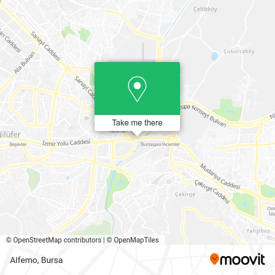
See Alfemo, Osmangazi, on the map
Public Transit to Alfemo in Osmangazi
Wondering how to get to Alfemo in Osmangazi? Moovit helps you find the best way to get to Alfemo with step-by-step directions from the nearest public transit station.
Moovit provides free maps and live directions to help you navigate through your city. View schedules, routes, timetables, and find out how long does it take to get to Alfemo in real time.
Looking for the nearest stop or station to Alfemo? Check out this list of stops closest to your destination: Soğukkuyu Cd. 1; Siteevler 1; Siteevler 2; Odunluk; İhsaniye; Hayran Cd. 2; Hayran Cd. 1; Ali Osman Sönmez Devlet Hastanesi 1; Acemler Aktarma Merkezi.
Bus: 14L2, 31A, 35H, B15, B17, B40, B7, 8L, 14L, 14N, 95, 95B, 97F, B6, B46.Metro: 1, 2, 3.Cable Car: ACEMLER AKTARMA MERKEZI - KELES.
Want to see if there’s another route that gets you there at an earlier time? Moovit helps you find alternative routes or times. Get directions from and directions to Alfemo easily from the Moovit App or Website.
We make riding to Alfemo easy, which is why over 1.5 million users, including users in Osmangazi, trust Moovit as the best app for public transit. You don’t need to download an individual bus app or train app, Moovit is your all-in-one transit app that helps you find the best bus time or train time available.
For information on prices of bus, metro and light rail, costs and ride fares to Alfemo, please check the Moovit app.
Use the app to navigate to popular places including to the airport, hospital, stadium, grocery store, mall, coffee shop, school, college, and university.
Alfemo Address: D-200, 16160 Soğukkuyu, Bursa street in Osmangazi
- Saray Halı,
- Şekerciler Bellona,
- Artemis Halı,
- Ofis,
- Dünya Göz Hastanesi,
- Yaka Halı,
- Karbüratörcü Hoca,
- Povver Akü,
- pierre cardin,
- Kanatçı Baba,
- Soğukkuyu Spor Klübü Tesisleri,
- Atermit Yalıtım,
- HÜRRİYET ERKEK KUAFÖRÜ MEVLÜT,
- Kamasan,
- Osman'ın Yeri,
- Kamasan Bayii,
- Soğukkuyu Caddesi,
- Üst geçit, Carrefour,
- Sekizli Makina & Vinç,
- Şht. Onb. Tolga Taştan Sokak
Places Near Alfemo (Osmangazi)
- Millet Mahallesi,
- Podyum Park, Nilüfer,
- Bursa Yüksek İhtisas Eğitim ve Araştırma Hastanesi Nilüfer Ek Binası, Nilüfer,
- Nilüfer Ağız ve Diş Sağlığı Merkezi, Nilüfer,
- Dörtçelik Çocuk Hastanesi, Nilüfer,
- Sur Yapı Marka, Nilüfer,
- Ali Osman Sönmez Onkoloji Hastanesi, Osmangazi,
- ÖzdilekPark Bursa Nilüfer, Nilüfer,
- Şehir Hastanesi, Nilüfer,
- Çekirge Devlet Hastanesi Otobüs Durağı, Osmangazi,
- FSM Bulvarı, Nilüfer,
- bursa mudanya, Mudanya,
- Bursa, Osmangazi,
- Sur Yapı Marka Avm, Osmangazi,
- Bursa Cumalıkızık Köyü, Osmangazi,
- Mustafakemalpaşa Karacabey Dolmuş Durağı, Mustafakemalpaşa,
- Bursa Teleferik, Yıldırım,
- Şevket Yılmaz Eğitim ve Araştırma Hastanesi, Yıldırım,
- Bursa Hayvanat Bahçesi, Osmangazi,
- Bursa Terminal, Nilüfer
How to get to popular places in Bursa with public transit
Get around Osmangazi by public transit!
Traveling around Osmangazi has never been so easy. See step by step directions as you travel to any attraction, street or major public transit station. View bus and train schedules, arrival times, service alerts and detailed routes on a map, so you know exactly how to get to anywhere in Osmangazi.
When traveling to any destination around Osmangazi use Moovit's Live Directions with Get Off Notifications to know exactly where and how far to walk, how long to wait for your line, and how many stops are left. Moovit will alert you when it's time to get off — no need to constantly re-check whether yours is the next stop.
Wondering how to use public transit in Osmangazi or how to pay for public transit in Osmangazi? Moovit public transit app can help you navigate your way with public transit easily, and at minimum cost. It includes public transit fees, ticket prices, and costs. Looking for a map of Osmangazi public transit lines? Moovit public transit app shows all public transit maps in Osmangazi with all Bus, Metro, Light Rail, Cable Car and Gondola routes and stops on an interactive map.
Bursa has 5 transit type(s), including: Bus, Metro, Light Rail, Cable Car and Gondola, operated by several transit agencies, including BursaRay, BurTram, BBBUS, Burulaş, Minibüs, İlçe Otobüsleri and Bursa Teleferik