How to get to Alfred Hackl by bus?
Click on the bus route to see step by step directions with maps, line arrival times and updated time schedules.
How to get to Alfred Hackl by train?
Click on the train route to see step by step directions with maps, line arrival times and updated time schedules.
Bus stops near Alfred Hackl in Austria
- Linz/Donau Hartheimerstraße, 3 min walk,VIEW
Light Rail stations near Alfred Hackl in Austria
- Linz/Donau Hartheimerstraße, 3 min walk,VIEW
Bus lines to Alfred Hackl in Austria
- 410, Steyr City Point,VIEW
- 411, Niederneukirchen Ortsmitte,VIEW
- 412, St.Florian B.Linz Hbla,VIEW
- 104, Linz/Donau Waldesruh,VIEW
- 106, Rohrbach B.Linz Wambacherberg,VIEW
- 407, St. Florian - Asten - Raffelstetten St. Florian - Asten - Raffelstetten,VIEW
- 413, St. Florian - Hohenbrunn - Kurzenkirchen - St. Marien St. Florian - Hohenbrunn - Kurzenkirchen - St. Marien,VIEW
What are the closest stations to Alfred Hackl?
The closest stations to Alfred Hackl are:
- Linz/Donau Hartheimerstraße is 177 meters away, 3 min walk.
Which train line stops near Alfred Hackl?
S1 (Garsten Bahnhof)
Which light rail line stops near Alfred Hackl?
2 (Linz/Donau Solarcity)
Which bus lines stop near Alfred Hackl?
These bus lines stop near Alfred Hackl: 104, 11, 19, 400, 410, 411.
What’s the nearest light rail station to Alfred Hackl in Austria?
The nearest light rail station to Alfred Hackl in Austria is Linz/Donau Hartheimerstraße. It’s a 3 min walk away.
What’s the nearest bus station to Alfred Hackl in Austria?
The nearest bus station to Alfred Hackl in Austria is Linz/Donau Hartheimerstraße. It’s a 3 min walk away.
What time is the first light rail to Alfred Hackl in Austria?
The 2 is the first light rail that goes to Alfred Hackl in Austria. It stops nearby at 4:20 AM.
What time is the last light rail to Alfred Hackl in Austria?
The 2 is the last light rail that goes to Alfred Hackl in Austria. It stops nearby at 12:31 AM.
What time is the first bus to Alfred Hackl in Austria?
The 411 is the first bus that goes to Alfred Hackl in Austria. It stops nearby at 5:37 AM.
What time is the last bus to Alfred Hackl in Austria?
The 412 is the last bus that goes to Alfred Hackl in Austria. It stops nearby at 11:23 PM.
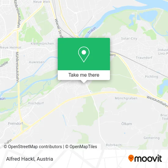
See Alfred Hackl, Austria, on the map
Public Transit to Alfred Hackl in Austria
Wondering how to get to Alfred Hackl in Austria? Moovit helps you find the best way to get to Alfred Hackl with step-by-step directions from the nearest public transit station.
Moovit provides free maps and live directions to help you navigate through your city. View schedules, routes, timetables, and find out how long does it take to get to Alfred Hackl in real time.
Looking for the nearest stop or station to Alfred Hackl? Check out this list of stops closest to your destination: Linz/Donau Hartheimerstraße.
Train: S1.Light Rail: 2.Bus: 104, 11, 19, 400, 410, 411, 412, 106, 407, 413.
Want to see if there’s another route that gets you there at an earlier time? Moovit helps you find alternative routes or times. Get directions from and directions to Alfred Hackl easily from the Moovit App or Website.
We make riding to Alfred Hackl easy, which is why over 1.7 million users, including users in Austria, trust Moovit as the best app for public transit. You don’t need to download an individual bus app or train app, Moovit is your all-in-one transit app that helps you find the best bus time or train time available.
For information on prices of bus, light rail and train, costs and ride fares to Alfred Hackl, please check the Moovit app.
Use the app to navigate to popular places including to the airport, hospital, stadium, grocery store, mall, coffee shop, school, college, and university.
Alfred Hackl Address: Dobretsbergerweg 9 4030 Linz street in Austria
- Hermann Plank,
- Neuroth,
- Bodendesign Mittermayr,
- Projekt-Team Bauträger,
- Traungold Energy,
- Sanli,
- Data-at-Net Korzeniowski,
- Rudolf Schwaiger,
- Dr. Dallamaßl,
- Genduron,
- Sparkasse,
- Haarstudio Gerlinde,
- Dm,
- Gabriele Haindl-Olear,
- Cafe H,
- Tabak Trafik Königsede,
- Stage Department Veranstaltungsmanagement GmbH,
- Tattoostudio Arthouse by Lizz,
- Trafik Königseder,
- Cae Leibetseder KG
Places Near Alfred Hackl (Austria)
- Leopoldauer Alm, Floridsdorf,
- Schiffsanleger Wien-Nussdorf, Döbling,
- Schweizerhaus (Karl Kolariks Schweizerhaus), Leopoldstadt,
- Ghegastraße 3, Landstraße,
- Ronacher, 1., Innere Stadt,
- Strandbad Gänsehäufel, Donaustadt,
- Kabarett Simpl, 1., Innere Stadt,
- Thomas-Klestil-Platz, Landstraße,
- Zentralfriedhof Halle 3, Simmering,
- Türkenschanzpark, Währing,
- Auhof-Center, Penzing,
- Feuerhalle Simmering, Simmering,
- Mariahilfer Strasse, Mariahilf,
- Wien Rennbahn Freudenau, Leopoldstadt,
- Setagayapark, Döbling,
- Donauzentrum, Donaustadt,
- 10er Marie, Ottakring,
- Raimund-Theater, Mariahilf,
- Lugner City, Rudolfsheim-Fünfhaus,
- Klinik Floridsdorf (Krankenhaus Nord), Floridsdorf
How to get to popular places in Austria with public transit
Get around Austria by public transit!
Traveling around Austria has never been so easy. See step by step directions as you travel to any attraction, street or major public transit station. View bus and train schedules, arrival times, service alerts and detailed routes on a map, so you know exactly how to get to anywhere in Austria.
When traveling to any destination around Austria use Moovit's Live Directions with Get Off Notifications to know exactly where and how far to walk, how long to wait for your line, and how many stops are left. Moovit will alert you when it's time to get off — no need to constantly re-check whether yours is the next stop.
Wondering how to use public transit in Austria or how to pay for public transit in Austria? Moovit public transit app can help you navigate your way with public transit easily, and at minimum cost. It includes public transit fees, ticket prices, and costs. Looking for a map of Austria public transit lines? Moovit public transit app shows all public transit maps in Austria with all Bus, Train, Subway, Light Rail, Ferry and Funicular routes and stops on an interactive map.
Austria has 6 transit type(s), including: Bus, Train, Subway, Light Rail, Ferry and Funicular, operated by several transit agencies, including Wiener Linien GmbH & Co KG, Vienna Airport Lines, OEBB Personenverkehr AG Kundenservice, Wiener Lokalbahnen GmbH, City Air Terminal Betriebsgesellschaft m.b.H., CAT, Österreichische Postbus AG, VOR GmbH, Graz Linien, Graz-Köflacher Bahn und Busbetrieb GmbH, Steiermarkbahn und Bus GmbH, Linz Linien GmbH, Salzburg AG (Salzburger Lokalbahn), Salzburg AG (OBus) and KMG Klagenfurt Mobil GmbH
Public transit lines with stations closest to Alfred Hackl in Austria
Bus lines with stations closest to Alfred Hackl in Austria
Linz/Donau Hartheimerstraße
 410Linz - St. Florian - Niederneukirchen - Hofkirchen - Wolfern - Steyr Linz - St. Florian - Niederneuk. - Hofk. - Wolfern - Steyr
- 411Linz - St. Florian - Niederneukirchen - Weichstetten - Sierning Linz - St. Florian - Niederneuk. - Weichstetten - Sierning
- 412Linz - St. Florian HBLA - Niederneukirchen - Hofkirchen - Hargelsberg Linz - St. Florian - Niederneuk. - Hofkirchen - Hargelsberg