Directions to All Hours Mobile Repair Service (Wichita) with public transportation
The following transit lines have routes that pass near All Hours Mobile Repair Service
How to get to All Hours Mobile Repair Service by bus?
Click on the bus route to see step by step directions with maps, line arrival times and updated time schedules.
From Netclix, Wichita
43 minFrom Cpi Technologies, Wichita
58 minFrom God's Place Wichita, Wichita
62 minFrom Popeyes LOUISIANA KITCHEN, Wichita
56 minFrom Wichita Car Transport, Wichita
71 minFrom S West St, Wichita
55 minFrom Carnitas Morelia, Wichita
63 minFrom Auto-Chlor System, Wichita
70 minFrom USPS, Wichita
46 minFrom Starbucks, Wichita
68 min
Bus stops near All Hours Mobile Repair Service in Wichita
Bus lines to All Hours Mobile Repair Service in Wichita
What are the closest stations to All Hours Mobile Repair Service?
The closest stations to All Hours Mobile Repair Service are:
- 11th St. N. And Glendale is 32 yards away, 1 min walk.
- Oliver And 12th Northbound is 327 yards away, 5 min walk.
- 13th St And Oliver Ib is 605 yards away, 8 min walk.
Which bus line stops near All Hours Mobile Repair Service?
ROUTE27: N BDWY- (Route 27 Outboun)
What’s the nearest bus station to All Hours Mobile Repair Service in Wichita?
The nearest bus station to All Hours Mobile Repair Service in Wichita is 11th St. N. And Glendale. It’s a 1 min walk away.
What time is the first bus to All Hours Mobile Repair Service in Wichita?
The ROUTE27: N BDWY- is the first bus that goes to All Hours Mobile Repair Service in Wichita. It stops nearby at 5:35 AM.
What time is the last bus to All Hours Mobile Repair Service in Wichita?
The 202: OLIVE is the last bus that goes to All Hours Mobile Repair Service in Wichita. It stops nearby at 10:06 PM.
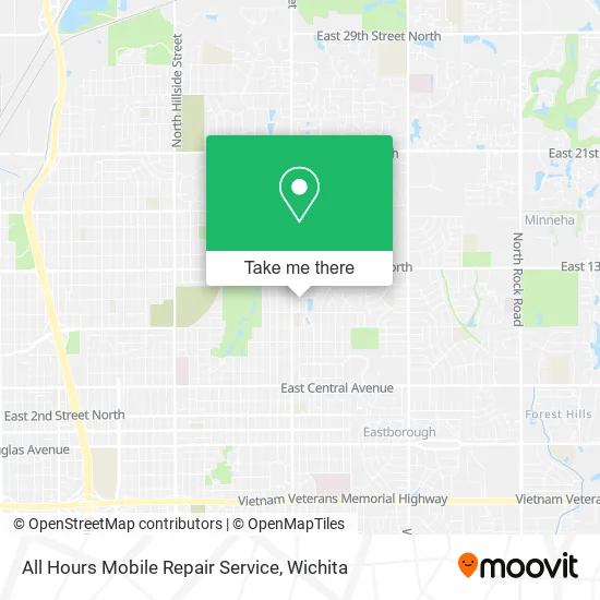
See All Hours Mobile Repair Service, Wichita, on the map
Public Transit to All Hours Mobile Repair Service in Wichita
Wondering how to get to All Hours Mobile Repair Service in Wichita? Moovit helps you find the best way to get to All Hours Mobile Repair Service with step-by-step directions from the nearest public transit station.
Moovit provides free maps and live directions to help you navigate through your city. View schedules, routes, timetables, and find out how long does it take to get to All Hours Mobile Repair Service in real time.
Looking for the nearest stop or station to All Hours Mobile Repair Service? Check out this list of stops closest to your destination: 11th St. N. And Glendale; Oliver And 12th Northbound; 13th St And Oliver Ib.
Bus: ROUTE27: N BDWY-, EAST HIGH SCHOOL, 202: OLIVE.
Want to see if there’s another route that gets you there at an earlier time? Moovit helps you find alternative routes or times. Get directions from and directions to All Hours Mobile Repair Service easily from the Moovit App or Website.
We make riding to All Hours Mobile Repair Service easy, which is why over 1.5 million users, including users in Wichita, trust Moovit as the best app for public transit. You don’t need to download an individual bus app or train app, Moovit is your all-in-one transit app that helps you find the best bus time or train time available.
For information on prices of bus, costs and ride fares to All Hours Mobile Repair Service, please check the Moovit app.
Use the app to navigate to popular places including to the airport, hospital, stadium, grocery store, mall, coffee shop, school, college, and university.
All Hours Mobile Repair Service Address: Wichita, KS 67208 street in Wichita
- Prince Concrete Construction,
- Happily Handy,
- Planet Fast Alteration,
- Chervon at Salon 316,
- Novas Hair House,
- Victory Temple Cogic,
- Trueword,
- Pure Heart Worship Center,
- West Hills Capital,
- Post Office,
- McCray M T Sanitation,
- Kansas Southwest Jurisdiction,
- St. Mark Cathedral Cogic,
- Impact Worship Center,
- Stubbs Estates,
- Coinhub - Bitcoin ATM,
- Tom's Check Cashing,
- 13th & Oliver,
- Church's Texas Chicken,
- Ict Pro Inspections
Places Near All Hours Mobile Repair Service (Wichita)
- Spirit Aerosystems,
- Lopez Services, Wichita,
- Ascencion Via Christi Hospital St Francis, Wichita,
- Afghan Halal Market, Wichita,
- Spirit Aerosystems Inc, Building 1-198D,
- Total Card Solutions, Wichita,
- Ratcliff Auto and Truck Repair, Wichita,
- Paige Place Apartments, Wichita,
- East 21st Street North and Webb Road, Wichita,
- North High School, Wichita,
- Four Corners Cafe @ Wesley Medical Center, Wichita,
- Towne East Mall, Wichita,
- Hubb's glory hole, Wichita,
- Spirit AeroSystems, Bldg 2-280J (Section 9),
- McConnell Air Force Base, Mcconnell Afb,
- Sena African Hair Braiding LLC, Wichita,
- Wichita Dwight D. Eisenhower National Airport (ICT) (Wichita Eisenhower National Airport), Wichita,
- 21st & Maize, Wichita,
- Westside Athletic Field (Friends University Baseball Field), Wichita,
- Bmer Tech Automotive, Wichita
How to get to popular places in Wichita with public transit
Get around Wichita by public transit!
Traveling around Wichita has never been so easy. See step by step directions as you travel to any attraction, street or major public transit station. View bus and train schedules, arrival times, service alerts and detailed routes on a map, so you know exactly how to get to anywhere in Wichita.
When traveling to any destination around Wichita use Moovit's Live Directions with Get Off Notifications to know exactly where and how far to walk, how long to wait for your line, and how many stops are left. Moovit will alert you when it's time to get off — no need to constantly re-check whether yours is the next stop.
Wondering how to use public transit in Wichita or how to pay for public transit in Wichita? Moovit public transit app can help you navigate your way with public transit easily, and at minimum cost. It includes public transit fees, ticket prices, and costs. Looking for a map of Wichita public transit lines? Moovit public transit app shows all public transit maps in Wichita with all bus routes and stops on an interactive map.
Wichita has 1 transit type(s), including: bus, operated by several transit agencies, including Wichita Transit, Greyhound-us and FlixBus-us