Directions to All Pest Control (Roanoke) with public transportation
The following transit lines have routes that pass near All Pest Control
 Bus: 21, GREYHOUND US0600, 15, 85, 26.
- Train: NORTHEAST REGIONAL.
How to get to All Pest Control by bus?
Click on the bus route to see step by step directions with maps, line arrival times and updated time schedules.
How to get to All Pest Control by train?
Click on the train route to see step by step directions with maps, line arrival times and updated time schedules.
Bus stops near All Pest Control in Roanoke
Train station near All Pest Control in Roanoke
- Roanoke, 53 min walk,VIEW
Bus lines to All Pest Control in Roanoke
- 15, 15 - Third Street Station To Valley View Mall,VIEW
- 85, 85 - Third Street Station To Peters Creek Road,VIEW
- 26, 3rd St Station Slip A,VIEW
- 25, 25 - Third Street Station To Airport,VIEW
- 22, 3rd St Station Slip H,VIEW
- SWB, Perry Street Slip 1,VIEW
- 21, 21 - Third Street Station To Valley Court,VIEW
- 16, 16 - Valley View Mall To Third Street Station,VIEW
- 86, 86 - Peters Creek Road To Third Street Station,VIEW
What are the closest stations to All Pest Control?
The closest stations to All Pest Control are:
- Gainsboro Nb at Madison is 219 yards away, 4 min walk.
- Kimball Sb at Rutherford is 482 yards away, 6 min walk.
- Kimball Nb at Rutherford (Roanoke Gas) is 486 yards away, 6 min walk.
- Williamson Sb at Carver (Sheetz) is 572 yards away, 7 min walk.
- Wells at Jefferson is 576 yards away, 8 min walk.
- Gainsboro Sb at Madison is 803 yards away, 10 min walk.
- Roanoke is 4460 yards away, 53 min walk.
Which bus lines stop near All Pest Control?
These bus lines stop near All Pest Control: 21, GREYHOUND US0600.
Which train line stops near All Pest Control?
NORTHEAST REGIONAL (Roanoke)
What’s the nearest bus station to All Pest Control in Roanoke?
The nearest bus station to All Pest Control in Roanoke is Gainsboro Nb at Madison. It’s a 4 min walk away.
What time is the first train to All Pest Control in Roanoke?
The NORTHEAST REGIONAL is the first train that goes to All Pest Control in Roanoke. It stops nearby at 9:35 AM.
What time is the last train to All Pest Control in Roanoke?
The NORTHEAST REGIONAL is the last train that goes to All Pest Control in Roanoke. It stops nearby at 10:13 PM.
What time is the first bus to All Pest Control in Roanoke?
The SWB is the first bus that goes to All Pest Control in Roanoke. It stops nearby at 5:17 AM.
What time is the last bus to All Pest Control in Roanoke?
The 21 is the last bus that goes to All Pest Control in Roanoke. It stops nearby at 8:18 PM.
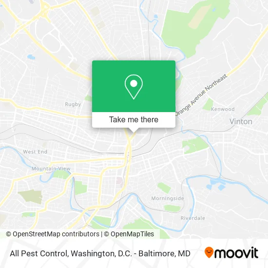
See All Pest Control, Roanoke, on the map
Public Transit to All Pest Control in Roanoke
Wondering how to get to All Pest Control in Roanoke? Moovit helps you find the best way to get to All Pest Control with step-by-step directions from the nearest public transit station.
Moovit provides free maps and live directions to help you navigate through your city. View schedules, routes, timetables, and find out how long does it take to get to All Pest Control in real time.
Looking for the nearest stop or station to All Pest Control? Check out this list of stops closest to your destination: Gainsboro Nb at Madison; Kimball Sb at Rutherford; Kimball Nb at Rutherford (Roanoke Gas); Williamson Sb at Carver (Sheetz); Wells at Jefferson; Gainsboro Sb at Madison; Roanoke.
Bus: 21, GREYHOUND US0600, 15, 85, 26, 25, 22, SWB.Train: NORTHEAST REGIONAL.
Want to see if there’s another route that gets you there at an earlier time? Moovit helps you find alternative routes or times. Get directions from and directions to All Pest Control easily from the Moovit App or Website.
We make riding to All Pest Control easy, which is why over 1.5 million users, including users in Roanoke, trust Moovit as the best app for public transit. You don’t need to download an individual bus app or train app, Moovit is your all-in-one transit app that helps you find the best bus time or train time available.
For information on prices of bus and train, costs and ride fares to All Pest Control, please check the Moovit app.
Use the app to navigate to popular places including to the airport, hospital, stadium, grocery store, mall, coffee shop, school, college, and university.
All Pest Control Address: 710 Williamson Rd NE Roanoke, VA 24016 street in Roanoke
- Broadway in Roanoke,
- Elevation Church Roanoke - Downtown,
- BMO Harris Bank,
- German American Bank Itm,
- Aaac Wildlife Removal of Roanoke,
- McDonald's,
- Berglund Performing Arts Theater,
- ATM,
- Monster Jam,
- Roanoke Auto Spring Works,
- Mount Zion Baptist Church,
- Roanoke Performing Arts Theatre,
- Lfa Kids Consignment,
- Amtrak,
- Wset-TV ABC 13,
- Roanoke Civic Center,
- Elevation Church - Roanoke,
- Berglund Center,
- Roanoke Post Office,
- The Berglund Center
Places Near All Pest Control (Roanoke)
- Warner Theatre, Washington,
- Georgetown, Washington,
- National Museum of African American History and Culture, Washington,
- Camden Yards, Baltimore,
- Amazon Hq2, Arlington County,
- M&T Bank Stadium, Baltimore,
- The Anthem, Washington,
- Sibley Memorial Hospital, Washington,
- Pennsylvania Ave NW (3rd st and pennsylvania), Washington,
- Westfield Montgomery Mall, Montgomery County,
- Washington National Cathedral, Washington,
- Capital One Arena, Washington,
- Museum Of The Bible, Washington,
- National Zoo, Washington,
- Basilica of the National Shrine, Washington,
- Washington DC VA Medical Center, Washington,
- Marriott Marquis Washington, DC, Washington,
- PG Mall, Prince George's County,
- Rock Creek Tennis Center, Washington,
- National Mall, Washington
How to get to popular places in Washington, D.C. - Baltimore, MD with public transit
Get around Roanoke by public transit!
Traveling around Roanoke has never been so easy. See step by step directions as you travel to any attraction, street or major public transit station. View bus and train schedules, arrival times, service alerts and detailed routes on a map, so you know exactly how to get to anywhere in Roanoke.
When traveling to any destination around Roanoke use Moovit's Live Directions with Get Off Notifications to know exactly where and how far to walk, how long to wait for your line, and how many stops are left. Moovit will alert you when it's time to get off — no need to constantly re-check whether yours is the next stop.
Wondering how to use public transit in Roanoke or how to pay for public transit in Roanoke? Moovit public transit app can help you navigate your way with public transit easily, and at minimum cost. It includes public transit fees, ticket prices, and costs. Looking for a map of Roanoke public transit lines? Moovit public transit app shows all public transit maps in Roanoke with all Bus, Train, Metro, Light Rail and Ferry routes and stops on an interactive map.
Washington, D.C. - Baltimore, MD has 5 transit type(s), including: Bus, Train, Metro, Light Rail and Ferry, operated by several transit agencies, including WMATA, Montgomery County Ride On, Fairfax Connector, TheBus, PRTC, DASH - Alexandria, Arlington Transit (ART), RTA of Central Maryland, MDOT MTA, MDOT MTA Light RailLink, MDOT MTA Commuter Bus, MDOT MTA Local Bus, FXBGO!, Virginia Railway Express (VRE) and MARC