How to get to All Progressives Congress by bus?
Click on the bus route to see step by step directions with maps, line arrival times and updated time schedules.
From Walmart, Baltimore County
59 minFrom Loyola University Maryland, Baltimore
52 minFrom I-83 Exit 16 (Timonium Road), Baltimore County
93 minFrom Coppin State University, Baltimore
46 minFrom Johns Hopkins Medicine at Green Spring Station, Baltimore County
75 minFrom Hampden, Baltimore
61 minFrom I-695 @ Exit 17 (Security Blvd/MD 122), Baltimore County
41 minFrom Druid Hill Park, Baltimore
48 minFrom Mva, Baltimore
20 minFrom Sinai Hospital, Baltimore
40 min
How to get to All Progressives Congress by metro?
Click on the metro route to see step by step directions with maps, line arrival times and updated time schedules.
Bus stops near All Progressives Congress in Baltimore County
Metro station near All Progressives Congress in Baltimore County
- Old Court Metro, 6 min walk,VIEW
Bus lines to All Progressives Congress in Baltimore County
What are the closest stations to All Progressives Congress?
The closest stations to All Progressives Congress are:
- Old Court Rd & Greenwood Rd Eb is 23 yards away, 1 min walk.
- Old Court Metro Station Sb is 432 yards away, 6 min walk.
- Old Court Metro is 471 yards away, 6 min walk.
- Reisterstown Rd & Naylors Ln FS Sb is 1061 yards away, 13 min walk.
Which bus line stops near All Progressives Congress?
83 (Old Court Metro)
Which metro line stops near All Progressives Congress?
METRO (Towards Owing Mills)
What’s the nearest metro station to All Progressives Congress in Baltimore County?
The nearest metro station to All Progressives Congress in Baltimore County is Old Court Metro. It’s a 6 min walk away.
What’s the nearest bus station to All Progressives Congress in Baltimore County?
The nearest bus station to All Progressives Congress in Baltimore County is Old Court Rd & Greenwood Rd Eb. It’s a 1 min walk away.
What time is the first metro to All Progressives Congress in Baltimore County?
The METRO is the first metro that goes to All Progressives Congress in Baltimore County. It stops nearby at 3:45 AM.
What time is the last metro to All Progressives Congress in Baltimore County?
The METRO is the last metro that goes to All Progressives Congress in Baltimore County. It stops nearby at 12:26 AM.
What time is the first bus to All Progressives Congress in Baltimore County?
The 83 is the first bus that goes to All Progressives Congress in Baltimore County. It stops nearby at 4:07 AM.
What time is the last bus to All Progressives Congress in Baltimore County?
The 83 is the last bus that goes to All Progressives Congress in Baltimore County. It stops nearby at 2:17 AM.
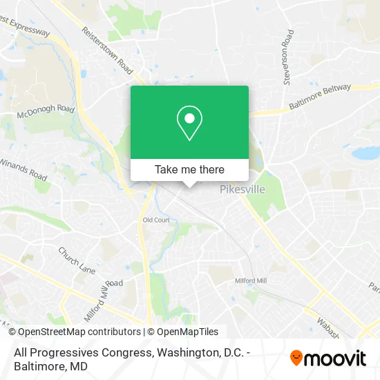
See All Progressives Congress, Baltimore County, on the map
Public Transit to All Progressives Congress in Baltimore County
Wondering how to get to All Progressives Congress in Baltimore County? Moovit helps you find the best way to get to All Progressives Congress with step-by-step directions from the nearest public transit station.
Moovit provides free maps and live directions to help you navigate through your city. View schedules, routes, timetables, and find out how long does it take to get to All Progressives Congress in real time.
Looking for the nearest stop or station to All Progressives Congress? Check out this list of stops closest to your destination: Old Court Rd & Greenwood Rd Eb; Old Court Metro Station Sb; Old Court Metro; Reisterstown Rd & Naylors Ln FS Sb.
Bus: 83, 92, 37, 89.Metro: METRO.
Want to see if there’s another route that gets you there at an earlier time? Moovit helps you find alternative routes or times. Get directions from and directions to All Progressives Congress easily from the Moovit App or Website.
We make riding to All Progressives Congress easy, which is why over 1.5 million users, including users in Baltimore County, trust Moovit as the best app for public transit. You don’t need to download an individual bus app or train app, Moovit is your all-in-one transit app that helps you find the best bus time or train time available.
For information on prices of bus, metro and light rail, costs and ride fares to All Progressives Congress, please check the Moovit app.
Use the app to navigate to popular places including to the airport, hospital, stadium, grocery store, mall, coffee shop, school, college, and university.
All Progressives Congress Address: 4011 Old Court Rd Pikesville, MD 21208 street in Baltimore County
- Mezu International Foundation,
- Studiodna Partners Inc,
- Embody Event Planning and Design,
- All Major Brands Appliance Repair,
- Amazon Locker-Wally,
- Law Office of Kerrie A. Campbell, LLC - the Real Legal Navigators,
- Tier Car Care,
- All Pest K9,
- Dental Sleep Maryland,
- 4000 Old Court Road,
- Infinity Management & Construction,
- Monument Sotheby's International Realty,
- Preserve Joint Venture,
- TNNK Kreations,
- Hutzler McHenry Ave,
- Blessed Soles Podiatry,
- Pop's Garage Doors,
- Special Effects,
- Medication Administration,
- Joseph Tringali CPA
Places Near All Progressives Congress (Baltimore County)
- Capital One Arena, Washington,
- Sibley Memorial Hospital, Washington,
- National Museum of African American History and Culture, Washington,
- Warner Theatre, Washington,
- Basilica of the National Shrine, Washington,
- Rock Creek Tennis Center, Washington,
- National Mall, Washington,
- Amazon Hq2, Arlington County,
- Camden Yards, Baltimore,
- Washington National Cathedral, Washington,
- Washington DC VA Medical Center, Washington,
- The Anthem, Washington,
- National Zoo, Washington,
- M&T Bank Stadium, Baltimore,
- Pennsylvania Ave NW (3rd st and pennsylvania), Washington,
- PG Mall, Prince George's County,
- Marriott Marquis Washington, DC, Washington,
- Museum Of The Bible, Washington,
- Westfield Montgomery Mall, Montgomery County,
- Georgetown, Washington
How to get to popular places in Washington, D.C. - Baltimore, MD with public transit
Get around Baltimore County by public transit!
Traveling around Baltimore County has never been so easy. See step by step directions as you travel to any attraction, street or major public transit station. View bus and train schedules, arrival times, service alerts and detailed routes on a map, so you know exactly how to get to anywhere in Baltimore County.
When traveling to any destination around Baltimore County use Moovit's Live Directions with Get Off Notifications to know exactly where and how far to walk, how long to wait for your line, and how many stops are left. Moovit will alert you when it's time to get off — no need to constantly re-check whether yours is the next stop.
Wondering how to use public transit in Baltimore County or how to pay for public transit in Baltimore County? Moovit public transit app can help you navigate your way with public transit easily, and at minimum cost. It includes public transit fees, ticket prices, and costs. Looking for a map of Baltimore County public transit lines? Moovit public transit app shows all public transit maps in Baltimore County with all Bus, Train, Metro, Light Rail and Ferry routes and stops on an interactive map.
Washington, D.C. - Baltimore, MD has 5 transit type(s), including: Bus, Train, Metro, Light Rail and Ferry, operated by several transit agencies, including WMATA, Montgomery County Ride On, Fairfax Connector, TheBus, PRTC, DASH - Alexandria, Arlington Transit (ART), RTA of Central Maryland, MDOT MTA, MDOT MTA Light RailLink, MDOT MTA Commuter Bus, MDOT MTA Local Bus, FXBGO!, Virginia Railway Express (VRE) and MARC