Allen St/Hester St stop - Monday schedule
| Line | Direction | Time |
|---|---|---|
| M15-SBS | Select Bus Service South Ferry Via 2 Av | 6:06 AM |
| M15-SBS | Select Bus Service South Ferry Via 2 Av | 6:12 AM |
| M15-SBS | Select Bus Service South Ferry Via 2 Av | 6:18 AM |
| M15-SBS | Select Bus Service South Ferry Via 2 Av | 6:24 AM |
| M15-SBS | Select Bus Service South Ferry Via 2 Av | 6:33 AM |
| M15-SBS | Select Bus Service South Ferry Via 2 Av | 6:38 AM |
| M15-SBS | Select Bus Service South Ferry Via 2 Av | 6:43 AM |
| M15-SBS | Select Bus Service South Ferry Via 2 Av | 6:47 AM |
| M15-SBS | Select Bus Service South Ferry Via 2 Av | 6:51 AM |
| M15-SBS | Select Bus Service South Ferry Via 2 Av | 6:55 AM |
| M15-SBS | Select Bus Service South Ferry Via 2 Av | 6:59 AM |
| M15-SBS | Select Bus Service South Ferry Via 2 Av | 7:06 AM |
| M15-SBS | Select Bus Service South Ferry Via 2 Av | 7:12 AM |
| M15-SBS | Select Bus Service South Ferry Via 2 Av | 7:20 AM |
| M15-SBS | Select Bus Service South Ferry Via 2 Av | 7:26 AM |
| M15-SBS | Select Bus Service South Ferry Via 2 Av | 7:32 AM |
| M15-SBS | Select Bus Service South Ferry Via 2 Av | 7:42 AM |
| M15-SBS | Select Bus Service South Ferry Via 2 Av | 7:47 AM |
| M15-SBS | Select Bus Service South Ferry Via 2 Av | 7:52 AM |
| M15-SBS | Select Bus Service South Ferry Via 2 Av | 7:58 AM |
| M15-SBS | Select Bus Service South Ferry Via 2 Av | 8:03 AM |
| M15-SBS | Select Bus Service South Ferry Via 2 Av | 8:08 AM |
| M15-SBS | Select Bus Service South Ferry Via 2 Av | 8:17 AM |
| M15-SBS | Select Bus Service South Ferry Via 2 Av | 8:25 AM |
| M15-SBS | Select Bus Service South Ferry Via 2 Av | 8:32 AM |
Directions to Allen St/Hester St stop (Manhattan) with public transit
The following transit lines have routes that pass near Allen St/Hester St
 Bus: B39, M15, M15-SBS, M9.
- Train: BLU.
- Subway: B, D, F, FX, B39.
How to get to Allen St/Hester St stop by bus?
Click on the bus route to see step by step directions with maps, line arrival times and updated time schedules.
How to get to Allen St/Hester St stop by train?
Click on the train route to see step by step directions with maps, line arrival times and updated time schedules.
How to get to Allen St/Hester St stop by subway?
Click on the subway route to see step by step directions with maps, line arrival times and updated time schedules.
Bus stops near Allen St/Hester St stop in Manhattan
- Essex St/East Broadway, 1 min walk,
- Allen St/Grand St, 2 min walk,
- New York Downtown Canal Street, 3 min walk,
- Bowery/Hester St, 4 min walk,
- New York City Chinatown (28 Allen St), 4 min walk,
- Essex St/Grand St, 5 min walk,
Subway stations near Allen St/Hester St station in Manhattan
- East Broadway, 1 min walk,
- Delancey St-Essex St, 8 min walk,
- Grand St, 10 min walk,
- Canal St, 13 min walk,
Bus lines to Allen St/Hester St stop in Manhattan
- M9, Kips Bay 1 Av - 26 St Via Avenue C,
- M15, Pike St -Via 2 Av,
- M15-SBS, Select Bus Service 125 St Via 1 Av,
- FLIXBUS 2611, Boston (South Station),
- M103, City Hall Via Lex Av,
- FLIXBUS N2471, NYC Chinatown - Atlanta,
- FLIXBUS N2472, NYC Chinatown - Orlando,
- FLIXBUS 2601, NYC - Washington DC,
- FLIXBUS 2605, NYC - Richmond,
- FLIXBUS 2608, NYC - Salisbury - Norfolk,
- FLIXBUS N2640, NYC - Pittsburgh - Chicago,
- M14A-SBS, Select Bus Les Grand-Fdr Via 14 St,
What are the closest stations to Allen St/Hester St?
The closest stations to Allen St/Hester St are:
- Essex St/East Broadway stop is 74 yards away, 1 min walk.
- East Broadway station is 77 yards away, 1 min walk.
- Allen St/Grand St stop is 100 yards away, 2 min walk.
- New York Downtown Canal Street stop is 224 yards away, 3 min walk.
- Bowery/Hester St stop is 293 yards away, 4 min walk.
- New York City Chinatown (28 Allen St) stop is 336 yards away, 4 min walk.
- Essex St/Grand St stop is 395 yards away, 5 min walk.
- Delancey St-Essex St station is 611 yards away, 8 min walk.
- Grand St station is 804 yards away, 10 min walk.
- Canal St station is 1087 yards away, 13 min walk.
Which bus lines stop near Allen St/Hester St?
These bus lines stop near Allen St/Hester St: B39, M15, M15-SBS.
Which train line stops near Allen St/Hester St?
BLU (Hoboken - 33rd Street)
Which subway lines stop near Allen St/Hester St?
These subway lines stop near Allen St/Hester St: B, D, F.
What’s the nearest subway station to Allen St/Hester St in Manhattan?
The nearest subway station to Allen St/Hester St in Manhattan is East Broadway. It’s a 1 min walk away.
What’s the nearest bus station to Allen St/Hester St in Manhattan?
The nearest bus station to Allen St/Hester St in Manhattan is Essex St/East Broadway. It’s a 1 min walk away.
What time is the first subway to Allen St/Hester St in Manhattan?
The J is the first subway that goes to Allen St/Hester St in Manhattan. It stops nearby at 3:00 AM.
What time is the last subway to Allen St/Hester St in Manhattan?
The 6 is the last subway that goes to Allen St/Hester St in Manhattan. It stops nearby at 4:01 AM.
What time is the first bus to Allen St/Hester St in Manhattan?
The M15 is the first bus that goes to Allen St/Hester St in Manhattan. It stops nearby at 3:05 AM.
What time is the last bus to Allen St/Hester St in Manhattan?
The FLIXBUS N2640 is the last bus that goes to Allen St/Hester St in Manhattan. It stops nearby at 5:00 PM.
Allen St/Hester St station
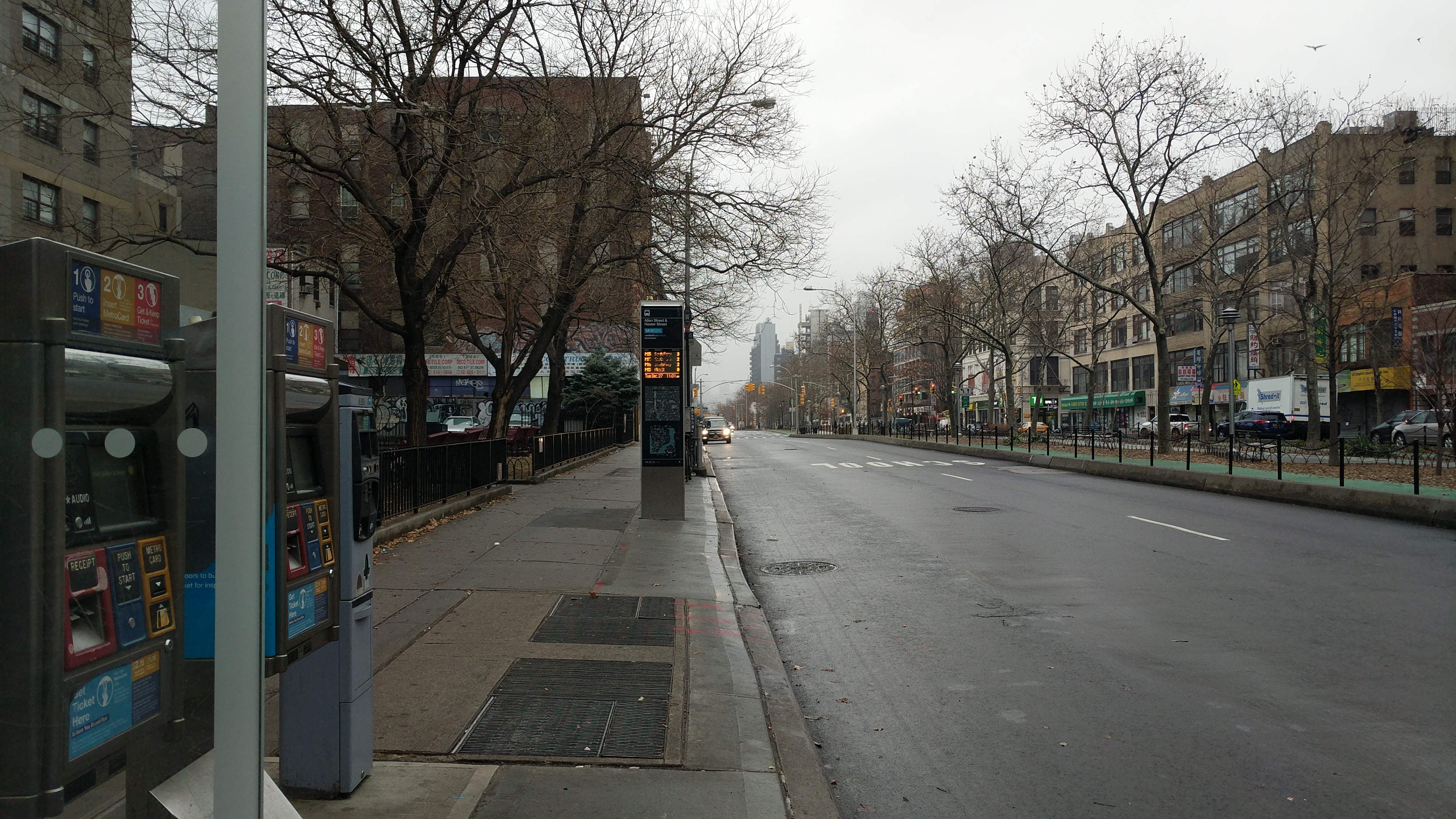 Taken by Anonymous
See Allen St/Hester St stop, Manhattan, on the map
Public transit to Allen St/Hester St stop in Manhattan
Looking for directions to Allen St/Hester St in Manhattan, United States?
Download the Moovit App to find the current schedule and step-by-step directions for Subway, Bus or Train routes that pass through Allen St/Hester St.
Looking for the nearest stops closest to Allen St/Hester St ? Check out this list of closest stops to your destination: Essex St/East Broadway; East Broadway; Allen St/Grand St; New York Downtown Canal Street; Bowery/Hester St; New York City Chinatown (28 Allen St); Essex St/Grand St; Delancey St-Essex St; Grand St; Canal St.
Bus: B39, M15, M15-SBS, M9.Train: BLU.Subway: B, D, F, FX, B39, J, M, Z, N, Q, R, W, 4.
We make riding on public transit to Allen St/Hester St easy, which is why over 1.7 billion users, including users in Manhattan trust Moovit as the best app for public transit.
Use the app to navigate to popular places including to the airport, hospital, stadium, grocery store, mall, coffee shop, school, college, and university.
The first line to this stop is M15-SBS, at 6:06 AM, and the last line is M15-SBS at 5:59 AM.
84 Hester Street, Manhattan, New York, NY, USA
This stop serves MTA Bus’s lines
- Essex St/East Broadway,
- Allen St/Grand St,
- New York Downtown Canal Street,
- Bowery/Hester St,
- New York City Chinatown (28 Allen St),
- Essex St/Grand St
Bus stops near Allen St/Hester St stop
- East Broadway,
- Delancey St-Essex St,
- Grand St,
- Canal St
Subway stations near Allen St/Hester St station
- Lafayette St/Astor Pl,
- Hastings - On- Hudson,
- Amagansett,
- Monsey - Park & Ride,
- Babylon,
- Sutphin Blvd,
- W 181 St/Saint Nicholas Av,
- 85th St & Lexington Ave,
- 6 Av/W 36 St,
- Morristown,
- Locust Valley,
- Junction Blvd,
- 174 St,
- Avenue N,
- Hartsdale,
- Chappaqua,
- Westbury,
- Houston St,
- Newark Penn Station,
- Broadway/Quincy St
Popular public transit stations in Manhattan
Get around Manhattan by public transit!
Traveling around Manhattan has never been so easy. See step by step directions as you travel to any attraction, street or major public transit station. View bus and train schedules, arrival times, service alerts and detailed routes on a map, so you know exactly how to get to anywhere in Manhattan.
When traveling to any destination around Manhattan use Moovit's Live Directions with Get Off Notifications to know exactly where and how far to walk, how long to wait for your line, and how many stops are left. Moovit will alert you when it's time to get off — no need to constantly re-check whether yours is the next stop.
Wondering how to use public transit in Manhattan or how to pay for public transit in Manhattan? Moovit public transit app can help you navigate your way with public transit easily, and at minimum cost. It includes public transit fees, ticket prices, and costs. Looking for a map of Manhattan public transit lines? Moovit public transit app shows all public transit maps in Manhattan with all Bus, Train, Subway, Light Rail, Ferry and Cable Car routes and stops on an interactive map.
New York - New Jersey has 6 transit type(s), including: Bus, Train, Subway, Light Rail, Ferry and Cable Car, operated by several transit agencies, including MTA Subway, Metro-North Railroad, LIRR, PATH, MTA New York City Transit - Express routes, MTA Bus, NJ Transit, NYC Ferry, NICE bus, Bee-Line Bus, NJ Transit Rail, Norwalk Transit District, CTTransit - Waterbury-Meriden, Hartford Line and River Valley Transit