Directions to Allstate Insurance (Kendale Lakes-Tamiami) with public transportation
The following transit lines have routes that pass near Allstate Insurance
 Bus: 137.
How to get to Allstate Insurance by bus?
Click on the bus route to see step by step directions with maps, line arrival times and updated time schedules.
From Miami Cancer Institute, Kendall-Palmetto Bay
89 minFrom Sam's Club, North Westside
83 minFrom Happy Endings Massage Parlor, North Westside
79 minFrom Baptist Hospital of Miami, Kendall-Palmetto Bay
88 minFrom Doral Inn & Suites Miami Airport West, North Westside
86 minFrom John A. Ferguson Senior High School, Kendale Lakes-Tamiami
76 minFrom Explorer 96 Mav, North Westside
85 minFrom Baptist Hospital, Kendall-Palmetto Bay
88 minFrom DoubleTree by Hilton Hotel Miami Airport & Convention Center, North Westside
70 minFrom W 72 Ave & Flagler St, Miami
55 min
Bus stop near Allstate Insurance in Kendale Lakes-Tamiami
- Sw 8 St @ Sw 129 Pl, 11 min walk,VIEW
Bus lines to Allstate Insurance in Kendale Lakes-Tamiami
- 137, 137 - Dolphin Mall Terminal,VIEW
What are the closest stations to Allstate Insurance?
The closest stations to Allstate Insurance are:
- Sw 8 St @ Sw 129 Pl is 893 yards away, 11 min walk.
Which bus line stops near Allstate Insurance?
137 (137 - Dolphin Mall Terminal)
What’s the nearest bus station to Allstate Insurance in Kendale Lakes-Tamiami?
The nearest bus station to Allstate Insurance in Kendale Lakes-Tamiami is Sw 8 St @ Sw 129 Pl. It’s a 11 min walk away.
What time is the first bus to Allstate Insurance in Kendale Lakes-Tamiami?
The 137 is the first bus that goes to Allstate Insurance in Kendale Lakes-Tamiami. It stops nearby at 5:46 AM.
What time is the last bus to Allstate Insurance in Kendale Lakes-Tamiami?
The 137 is the last bus that goes to Allstate Insurance in Kendale Lakes-Tamiami. It stops nearby at 12:07 AM.
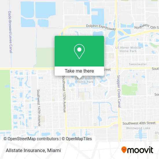
See Allstate Insurance, Kendale Lakes-Tamiami, on the map
Public Transit to Allstate Insurance in Kendale Lakes-Tamiami
Wondering how to get to Allstate Insurance in Kendale Lakes-Tamiami? Moovit helps you find the best way to get to Allstate Insurance with step-by-step directions from the nearest public transit station.
Moovit provides free maps and live directions to help you navigate through your city. View schedules, routes, timetables, and find out how long does it take to get to Allstate Insurance in real time.
Looking for the nearest stop or station to Allstate Insurance? Check out this list of stops closest to your destination: Sw 8 St @ Sw 129 Pl.
Bus: 137.
Want to see if there’s another route that gets you there at an earlier time? Moovit helps you find alternative routes or times. Get directions from and directions to Allstate Insurance easily from the Moovit App or Website.
We make riding to Allstate Insurance easy, which is why over 1.5 million users, including users in Kendale Lakes-Tamiami, trust Moovit as the best app for public transit. You don’t need to download an individual bus app or train app, Moovit is your all-in-one transit app that helps you find the best bus time or train time available.
For information on prices of bus, costs and ride fares to Allstate Insurance, please check the Moovit app.
Use the app to navigate to popular places including to the airport, hospital, stadium, grocery store, mall, coffee shop, school, college, and university.
Allstate Insurance Address: 13155 SW 14th St Miami, FL 33184 street in Kendale Lakes-Tamiami
- SW 131 Av@Sw 11 St,
- El Guajiro de Cautillo,
- Titan Property Inspections,
- Herman's do It All Upholstery,
- Angel's Escorts,
- Carmen B Fleitas,
- Mother of Christ Catholic Church,
- Doggyland,
- Gaupri Moving Services,
- Deco Moderna,
- La Nostra Pizza,
- J & D Ornamental Iron,
- Michelle Madonna Artistry,
- 2 the Rootss,
- Rafael Rodriguez,
- Alicia E Gomez - LPT Realty,
- Shark Appliances,
- Roman Stone Surfaces,
- Car Wash & Detailing,
- Paralegal Wings
Places Near Allstate Insurance (Kendale Lakes-Tamiami)
- Keiser University Flagship Campus, West Palm Beach,
- Miami-Dade County Courthouse, Miami,
- Miami Design District, Miami,
- Aventura Mall, Miami,
- Aventura Mall, Miami Beach,
- Brickell City Centre, Miami,
- Port of Miami Cruise Terminal, Miami,
- Dolphin Mall Bus, Miami,
- Dolphin Mall, Miami,
- Hard Rock Stadium, Miami Gardens,
- Sawgrass Mall, Miami,
- Miami Freedom Park, Miami,
- Marlins Park, Miami,
- Richard E. Gerstein Justice Building, Miami,
- Sawgrass mall ( FL ), Miami Beach,
- Bayside Marketplace, Miami,
- Miami VA Hospital, Miami,
- Wynwood, Miami,
- Zoo Miami, Miami,
- Little Havana, Miami
How to get to popular places in Miami with public transit
Get around Kendale Lakes-Tamiami by public transit!
Traveling around Kendale Lakes-Tamiami has never been so easy. See step by step directions as you travel to any attraction, street or major public transit station. View bus and train schedules, arrival times, service alerts and detailed routes on a map, so you know exactly how to get to anywhere in Kendale Lakes-Tamiami.
When traveling to any destination around Kendale Lakes-Tamiami use Moovit's Live Directions with Get Off Notifications to know exactly where and how far to walk, how long to wait for your line, and how many stops are left. Moovit will alert you when it's time to get off — no need to constantly re-check whether yours is the next stop.
Wondering how to use public transit in Kendale Lakes-Tamiami or how to pay for public transit in Kendale Lakes-Tamiami? Moovit public transit app can help you navigate your way with public transit easily, and at minimum cost. It includes public transit fees, ticket prices, and costs. Looking for a map of Kendale Lakes-Tamiami public transit lines? Moovit public transit app shows all public transit maps in Kendale Lakes-Tamiami with all Bus, Train, Light Rail and Ferry routes and stops on an interactive map.
Miami has 4 transit type(s), including: Bus, Train, Light Rail and Ferry, operated by several transit agencies, including Broward County Transit, Miami-Dade Transit, Metrorail, Palm Tran, Tri-Rail, Brightline, MARTY, City of Homestead Trolley, Key West Transit, Treasure Coast Connector, GoLine IRT, Amtrak, Greyhound-us, FlixBus-us and Aventura Express Shuttle Bus