Directions to Allstate Insurance (Fort Lauderdale) with public transportation
The following transit lines have routes that pass near Allstate Insurance
 Bus: 01, 06, 30, 40.
- Ferry: WATER TROLLEY.
How to get to Allstate Insurance by bus?
Click on the bus route to see step by step directions with maps, line arrival times and updated time schedules.
From Nova High School, Davie
59 minFrom E Oakland Park Blvd / US-1, Fort Lauderdale
35 minFrom The Casino at Dania Beach (Dania Jai-alai), Hollywood
39 minFrom Lauderhill Mall, Plantation
47 minFrom Seminole Hard Rock Hotel & Casino, Hollywood
52 minFrom Hollywood Beach-Broadwalk, Hollywood
63 minFrom Fort Lauderdale airport terminal 3 Jet Blue, Hollywood
52 minFrom Griffin Road & Davie Road, Davie
49 minFrom Bepxxx, Fort Lauderdale
74 minFrom City of Oakland Park, Fort Lauderdale
36 min
Bus stops near Allstate Insurance in Fort Lauderdale
Ferry station near Allstate Insurance in Fort Lauderdale
- South Andrews Buisness District West, 20 min walk,VIEW
Bus lines to Allstate Insurance in Fort Lauderdale
What are the closest stations to Allstate Insurance?
The closest stations to Allstate Insurance are:
- Southeast 3rd Avenue/Davie Boulevard is 211 yards away, 3 min walk.
- Andrews Avenue/Davie Boulevard is 330 yards away, 5 min walk.
- Davie Boulevard & Andrews Avenue is 367 yards away, 5 min walk.
- South Andrews Buisness District West is 1690 yards away, 20 min walk.
Which bus lines stop near Allstate Insurance?
These bus lines stop near Allstate Insurance: 01, 06, 30, 40.
What’s the nearest bus station to Allstate Insurance in Fort Lauderdale?
The nearest bus station to Allstate Insurance in Fort Lauderdale is Southeast 3rd Avenue/Davie Boulevard. It’s a 3 min walk away.
What’s the nearest ferry station to Allstate Insurance in Fort Lauderdale?
The nearest ferry station to Allstate Insurance in Fort Lauderdale is South Andrews Buisness District West. It’s a 20 min walk away.
What time is the first bus to Allstate Insurance in Fort Lauderdale?
The 01 is the first bus that goes to Allstate Insurance in Fort Lauderdale. It stops nearby at 5:10 AM.
What time is the last bus to Allstate Insurance in Fort Lauderdale?
The 01 is the last bus that goes to Allstate Insurance in Fort Lauderdale. It stops nearby at 12:24 AM.
What time is the first ferry to Allstate Insurance in Fort Lauderdale?
The WATER TROLLEY is the first ferry that goes to Allstate Insurance in Fort Lauderdale. It stops nearby at 10:05 AM.
What time is the last ferry to Allstate Insurance in Fort Lauderdale?
The WATER TROLLEY is the last ferry that goes to Allstate Insurance in Fort Lauderdale. It stops nearby at 10:15 PM.
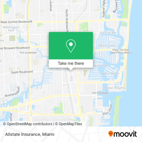
See Allstate Insurance, Fort Lauderdale, on the map
Public Transit to Allstate Insurance in Fort Lauderdale
Wondering how to get to Allstate Insurance in Fort Lauderdale? Moovit helps you find the best way to get to Allstate Insurance with step-by-step directions from the nearest public transit station.
Moovit provides free maps and live directions to help you navigate through your city. View schedules, routes, timetables, and find out how long does it take to get to Allstate Insurance in real time.
Looking for the nearest stop or station to Allstate Insurance? Check out this list of stops closest to your destination: Southeast 3rd Avenue/Davie Boulevard; Andrews Avenue/Davie Boulevard; Davie Boulevard & Andrews Avenue; South Andrews Buisness District West.
Bus: 01, 06, 30, 40.Ferry: WATER TROLLEY.
Want to see if there’s another route that gets you there at an earlier time? Moovit helps you find alternative routes or times. Get directions from and directions to Allstate Insurance easily from the Moovit App or Website.
We make riding to Allstate Insurance easy, which is why over 1.5 million users, including users in Fort Lauderdale, trust Moovit as the best app for public transit. You don’t need to download an individual bus app or train app, Moovit is your all-in-one transit app that helps you find the best bus time or train time available.
For information on prices of bus, costs and ride fares to Allstate Insurance, please check the Moovit app.
Use the app to navigate to popular places including to the airport, hospital, stadium, grocery store, mall, coffee shop, school, college, and university.
Allstate Insurance Address: 150 SW 12th St Fort Lauderdale, FL 33316 street in Fort Lauderdale
- Randolph W Adams,
- Dolman Law Group Accident Injury Lawyers, PA,
- Homehunt,
- Market Realty,
- The Urban Group,
- Trucking Accidents,
- Bensatech, Inc.,
- Veronica S Gipps MD Faapmr,
- Cap Government,
- Law Office and Attorneys Information,
- Dr Wayne White D C,
- Mysynergyhealth,
- Reflections Health and Medical Spa,
- Professional Financial Accounting,
- Alexander Bone and Spine Institute,
- Robert W Murphy,
- World Financial Network Bank,
- Real Estate Attorney Joseph Hughes,
- Howard B Herskowitz Attorney,
- Showtime Pictures
Places Near Allstate Insurance (Fort Lauderdale)
- Marlins Park, Miami,
- Miami VA Hospital, Miami,
- Bayside Marketplace, Miami,
- Dolphin Mall Bus, Miami,
- Brickell City Centre, Miami,
- Dolphin Mall, Miami,
- Aventura Mall, Miami,
- Richard E. Gerstein Justice Building, Miami,
- Aventura Mall, Miami Beach,
- Miami Design District, Miami,
- Port of Miami Cruise Terminal, Miami,
- Zoo Miami, Miami,
- Sawgrass Mall, Miami,
- Hard Rock Stadium, Miami Gardens,
- Wynwood, Miami,
- Little Havana, Miami,
- Miami-Dade County Courthouse, Miami,
- Sawgrass mall ( FL ), Miami Beach,
- Keiser University Flagship Campus, West Palm Beach,
- Miami Freedom Park, Miami
How to get to popular places in Miami with public transit
Get around Fort Lauderdale by public transit!
Traveling around Fort Lauderdale has never been so easy. See step by step directions as you travel to any attraction, street or major public transit station. View bus and train schedules, arrival times, service alerts and detailed routes on a map, so you know exactly how to get to anywhere in Fort Lauderdale.
When traveling to any destination around Fort Lauderdale use Moovit's Live Directions with Get Off Notifications to know exactly where and how far to walk, how long to wait for your line, and how many stops are left. Moovit will alert you when it's time to get off — no need to constantly re-check whether yours is the next stop.
Wondering how to use public transit in Fort Lauderdale or how to pay for public transit in Fort Lauderdale? Moovit public transit app can help you navigate your way with public transit easily, and at minimum cost. It includes public transit fees, ticket prices, and costs. Looking for a map of Fort Lauderdale public transit lines? Moovit public transit app shows all public transit maps in Fort Lauderdale with all Bus, Train, Light Rail and Ferry routes and stops on an interactive map.
Miami has 4 transit type(s), including: Bus, Train, Light Rail and Ferry, operated by several transit agencies, including Broward County Transit, Miami-Dade Transit, Metrorail, Palm Tran, Tri-Rail, Brightline, MARTY, City of Homestead Trolley, Key West Transit, Treasure Coast Connector, GoLine IRT, Amtrak, Greyhound-us, FlixBus-us and Aventura Express Shuttle Bus