How to get to Allstate Insurance by bus?
Click on the bus route to see step by step directions with maps, line arrival times and updated time schedules.
From Cam Transfer, Coral Springs-Margate
49 minFrom Coral Springs, FL, Coral Springs-Margate
23 minFrom Trapeze Swing Club, Fort Lauderdale
46 minFrom Plantation, Florida, Plantation
38 minFrom Lauderhill Mall, Plantation
51 minFrom Jay's Professional Enterprises, Fort Lauderdale
51 minFrom Sawgrass Recreation Park / Airboat Rides, Plantation
55 minFrom N University Dr, Plantation
42 minFrom Oakland Park Boulevard & State Road 7, Fort Lauderdale
50 minFrom Holiday Inn Hotel & Suites Sawgrass Mills, Plantation
57 min
Bus stops near Allstate Insurance in Coral Springs-Margate
Bus lines to Allstate Insurance in Coral Springs-Margate
What are the closest stations to Allstate Insurance?
The closest stations to Allstate Insurance are:
- Pine Island Road/Woodmont Terrace is 184 yards away, 3 min walk.
- McNab Road & Pine Island Road is 344 yards away, 5 min walk.
Which bus lines stop near Allstate Insurance?
These bus lines stop near Allstate Insurance: 62, 88.
What’s the nearest bus station to Allstate Insurance in Coral Springs-Margate?
The nearest bus station to Allstate Insurance in Coral Springs-Margate is Pine Island Road/Woodmont Terrace. It’s a 3 min walk away.
What time is the first bus to Allstate Insurance in Coral Springs-Margate?
The 62 is the first bus that goes to Allstate Insurance in Coral Springs-Margate. It stops nearby at 5:08 AM.
What time is the last bus to Allstate Insurance in Coral Springs-Margate?
The 62 is the last bus that goes to Allstate Insurance in Coral Springs-Margate. It stops nearby at 11:39 PM.
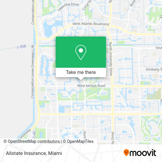
See Allstate Insurance, Coral Springs-Margate, on the map
Public Transit to Allstate Insurance in Coral Springs-Margate
Wondering how to get to Allstate Insurance in Coral Springs-Margate? Moovit helps you find the best way to get to Allstate Insurance with step-by-step directions from the nearest public transit station.
Moovit provides free maps and live directions to help you navigate through your city. View schedules, routes, timetables, and find out how long does it take to get to Allstate Insurance in real time.
Looking for the nearest stop or station to Allstate Insurance? Check out this list of stops closest to your destination: Pine Island Road/Woodmont Terrace; McNab Road & Pine Island Road.
Bus: 62, 88.
Want to see if there’s another route that gets you there at an earlier time? Moovit helps you find alternative routes or times. Get directions from and directions to Allstate Insurance easily from the Moovit App or Website.
We make riding to Allstate Insurance easy, which is why over 1.5 million users, including users in Coral Springs-Margate, trust Moovit as the best app for public transit. You don’t need to download an individual bus app or train app, Moovit is your all-in-one transit app that helps you find the best bus time or train time available.
For information on prices of bus, costs and ride fares to Allstate Insurance, please check the Moovit app.
Use the app to navigate to popular places including to the airport, hospital, stadium, grocery store, mall, coffee shop, school, college, and university.
Allstate Insurance Address: 7249 NW 88th Ave Fort Lauderdale, FL 33321 street in Coral Springs-Margate
- Paisa Envios,
- Florida Open Mri,
- Home Improvement Guys,
- PCJ Crystal Mobile Wash,
- Chads Pressure Washing,
- Closets by Emilio,
- Buzzman Awning Broward,
- La French Maid Cleaning Services,
- Eco-Aura Cleaning,
- Christy's Kitchen,
- Boriken Bakes,
- Komfortkare Services,
- Parker Painting,
- Prolific Entertainment Services,
- Elegant Estate Sales,
- Update Landscaping,
- Fresh Feel Transformations,
- Tamarac Pressure Washing,
- Ride Well TRANSIT,
- Drip Masters IV Hydration and Wellness
Places Near Allstate Insurance (Coral Springs-Margate)
- Bayside Marketplace, Miami,
- Port of Miami Cruise Terminal, Miami,
- Miami-Dade County Courthouse, Miami,
- Hard Rock Stadium, Miami Gardens,
- Marlins Park, Miami,
- Sawgrass Mall, Miami,
- Dolphin Mall Bus, Miami,
- Richard E. Gerstein Justice Building, Miami,
- Keiser University Flagship Campus, West Palm Beach,
- Dolphin Mall, Miami,
- Miami Design District, Miami,
- Little Havana, Miami,
- Miami VA Hospital, Miami,
- Sawgrass mall ( FL ), Miami Beach,
- Zoo Miami, Miami,
- Brickell City Centre, Miami,
- Aventura Mall, Miami,
- Miami Freedom Park, Miami,
- Aventura Mall, Miami Beach,
- Wynwood, Miami
How to get to popular places in Miami with public transit
Get around Coral Springs-Margate by public transit!
Traveling around Coral Springs-Margate has never been so easy. See step by step directions as you travel to any attraction, street or major public transit station. View bus and train schedules, arrival times, service alerts and detailed routes on a map, so you know exactly how to get to anywhere in Coral Springs-Margate.
When traveling to any destination around Coral Springs-Margate use Moovit's Live Directions with Get Off Notifications to know exactly where and how far to walk, how long to wait for your line, and how many stops are left. Moovit will alert you when it's time to get off — no need to constantly re-check whether yours is the next stop.
Wondering how to use public transit in Coral Springs-Margate or how to pay for public transit in Coral Springs-Margate? Moovit public transit app can help you navigate your way with public transit easily, and at minimum cost. It includes public transit fees, ticket prices, and costs. Looking for a map of Coral Springs-Margate public transit lines? Moovit public transit app shows all public transit maps in Coral Springs-Margate with all Bus, Train, Light Rail and Ferry routes and stops on an interactive map.
Miami has 4 transit type(s), including: Bus, Train, Light Rail and Ferry, operated by several transit agencies, including Broward County Transit, Miami-Dade Transit, Metrorail, Palm Tran, Tri-Rail, Brightline, MARTY, City of Homestead Trolley, Key West Transit, Treasure Coast Connector, GoLine IRT, Amtrak, Greyhound-us, FlixBus-us and Aventura Express Shuttle Bus