How to get to Allstate Insurance by bus?
Click on the bus route to see step by step directions with maps, line arrival times and updated time schedules.
From Bethesda Hospital East-ER, Boynton Beach-Delray Beach
57 minFrom DXN Florida, Boynton Beach-Delray Beach
61 minFrom Forest Hill Community High School, West Palm Beach
56 minFrom JFK Medical Center, Lake Worth
26 minFrom Pretty in Palm Beach, Boynton Beach-Delray Beach
83 minFrom Greenacres, FL, Lake Worth
63 minFrom W Woolbright Rd / Jog Rd, Boynton Beach-Delray Beach
69 minFrom 1661B South Congress Avenue, Lake Worth
41 minFrom Somerset Academy Canyons Charter School, Sunshine Parkway
57 minFrom Ollie's Bargain Outlet, Boynton Beach-Delray Beach
64 min
Bus stops near Allstate Insurance in Boynton Beach-Delray Beach
Bus lines to Allstate Insurance in Boynton Beach-Delray Beach
What are the closest stations to Allstate Insurance?
The closest stations to Allstate Insurance are:
- GATEWAY BLVD at HAMPTON INN is 544 yards away, 7 min walk.
- CONGRESS AV at SHOPS OF BOYNTN SE EN is 548 yards away, 7 min walk.
Which bus lines stop near Allstate Insurance?
These bus lines stop near Allstate Insurance: 2, 71.
What’s the nearest bus station to Allstate Insurance in Boynton Beach-Delray Beach?
The nearest bus stations to Allstate Insurance in Boynton Beach-Delray Beach are GATEWAY BLVD at HAMPTON INN and CONGRESS AV at SHOPS OF BOYNTN SE EN. The closest one is a 7 min walk away.
What time is the first bus to Allstate Insurance in Boynton Beach-Delray Beach?
The 2 is the first bus that goes to Allstate Insurance in Boynton Beach-Delray Beach. It stops nearby at 5:33 AM.
What time is the last bus to Allstate Insurance in Boynton Beach-Delray Beach?
The 2 is the last bus that goes to Allstate Insurance in Boynton Beach-Delray Beach. It stops nearby at 10:32 PM.
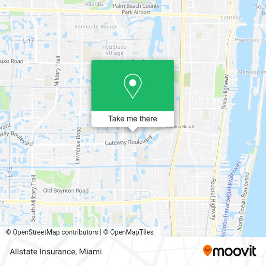
See Allstate Insurance, Boynton Beach-Delray Beach, on the map
Public Transit to Allstate Insurance in Boynton Beach-Delray Beach
Wondering how to get to Allstate Insurance in Boynton Beach-Delray Beach? Moovit helps you find the best way to get to Allstate Insurance with step-by-step directions from the nearest public transit station.
Moovit provides free maps and live directions to help you navigate through your city. View schedules, routes, timetables, and find out how long does it take to get to Allstate Insurance in real time.
Looking for the nearest stop or station to Allstate Insurance? Check out this list of stops closest to your destination: GATEWAY BLVD at HAMPTON INN; CONGRESS AV at SHOPS OF BOYNTN SE EN.
Bus: 2, 71, 4.
Want to see if there’s another route that gets you there at an earlier time? Moovit helps you find alternative routes or times. Get directions from and directions to Allstate Insurance easily from the Moovit App or Website.
We make riding to Allstate Insurance easy, which is why over 1.5 million users, including users in Boynton Beach-Delray Beach, trust Moovit as the best app for public transit. You don’t need to download an individual bus app or train app, Moovit is your all-in-one transit app that helps you find the best bus time or train time available.
For information on prices of bus, costs and ride fares to Allstate Insurance, please check the Moovit app.
Use the app to navigate to popular places including to the airport, hospital, stadium, grocery store, mall, coffee shop, school, college, and university.
Allstate Insurance Address: 2457 Quantum Blvd Boynton Beach, FL 33426 street in Boynton Beach-Delray Beach
- Med Labs,
- Blue Star Realty Pros,
- Rapid Treatment Solutions,
- Vanguard Hammer Property Renovations,
- Frederick Fox,
- The Answer Management Services,
- Towneplace Suites by Marriott,
- Maximum Wellness,
- Boynton Beach Paver Sealing,
- Oasis Events Venue in,
- Zoom Room Boynton Beach,
- Amazon Locker-Xue,
- Deerfield Beach Aventura,
- Medflorida Pharmacy,
- ATM,
- KeKe's Breakfast Cafe,
- My Medical / Sport Massage & Spa LLC,
- Amazon Appeal,
- Pmi Expert PB,
- Supportclub
Places Near Allstate Insurance (Boynton Beach-Delray Beach)
- Brickell City Centre, Miami,
- Bayside Marketplace, Miami,
- Marlins Park, Miami,
- Hard Rock Stadium, Miami Gardens,
- Richard E. Gerstein Justice Building, Miami,
- Dolphin Mall Bus, Miami,
- Miami VA Hospital, Miami,
- Miami Design District, Miami,
- Keiser University Flagship Campus, West Palm Beach,
- Wynwood, Miami,
- Miami Freedom Park, Miami,
- Miami-Dade County Courthouse, Miami,
- Zoo Miami, Miami,
- Little Havana, Miami,
- Sawgrass Mall, Miami,
- Port of Miami Cruise Terminal, Miami,
- Aventura Mall, Miami,
- Aventura Mall, Miami Beach,
- Dolphin Mall, Miami,
- Sawgrass mall ( FL ), Miami Beach
How to get to popular places in Miami with public transit
Get around Boynton Beach-Delray Beach by public transit!
Traveling around Boynton Beach-Delray Beach has never been so easy. See step by step directions as you travel to any attraction, street or major public transit station. View bus and train schedules, arrival times, service alerts and detailed routes on a map, so you know exactly how to get to anywhere in Boynton Beach-Delray Beach.
When traveling to any destination around Boynton Beach-Delray Beach use Moovit's Live Directions with Get Off Notifications to know exactly where and how far to walk, how long to wait for your line, and how many stops are left. Moovit will alert you when it's time to get off — no need to constantly re-check whether yours is the next stop.
Wondering how to use public transit in Boynton Beach-Delray Beach or how to pay for public transit in Boynton Beach-Delray Beach? Moovit public transit app can help you navigate your way with public transit easily, and at minimum cost. It includes public transit fees, ticket prices, and costs. Looking for a map of Boynton Beach-Delray Beach public transit lines? Moovit public transit app shows all public transit maps in Boynton Beach-Delray Beach with all Bus, Train, Light Rail and Ferry routes and stops on an interactive map.
Miami has 4 transit type(s), including: Bus, Train, Light Rail and Ferry, operated by several transit agencies, including Broward County Transit, Miami-Dade Transit, Metrorail, Palm Tran, Tri-Rail, Brightline, MARTY, City of Homestead Trolley, Key West Transit, Treasure Coast Connector, GoLine IRT, Amtrak, Greyhound-us, FlixBus-us and Aventura Express Shuttle Bus