How to get to Allstate Insurance by bus?
Click on the bus route to see step by step directions with maps, line arrival times and updated time schedules.
From Canton, Baltimore
57 minFrom Patapsco High School and Center for the Arts, Baltimore County
53 minFrom Target, Baltimore County
41 minFrom BJ's Wholesale Club, Baltimore
52 minFrom Canton Waterfront Park, Baltimore
55 minFrom I-695 @ Exit 31 (MD 147/Harford Rd), Baltimore County
51 minFrom Looney's Pub, Baltimore
57 minFrom Butchers Hill, Baltimore
46 minFrom Parkside Gardens, Baltimore
53 minFrom Hillendale Shopping Center, Baltimore County
36 min
Which bus lines stop near Allstate Insurance?
These bus lines stop near Allstate Insurance: 36, 56, 62.
What time is the first bus to Allstate Insurance in Baltimore County?
The 56 is the first bus that goes to Allstate Insurance in Baltimore County. It stops nearby at 4:21 AM.
What time is the last bus to Allstate Insurance in Baltimore County?
The 56 is the last bus that goes to Allstate Insurance in Baltimore County. It stops nearby at 2:26 AM.
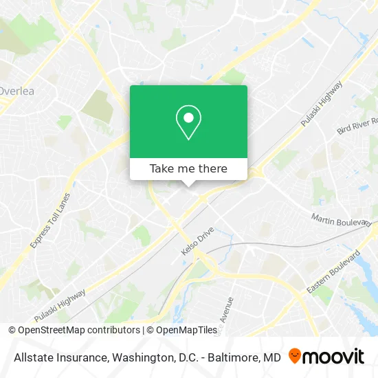
See Allstate Insurance, Baltimore County, on the map
Public Transit to Allstate Insurance in Baltimore County
Wondering how to get to Allstate Insurance in Baltimore County? Moovit helps you find the best way to get to Allstate Insurance with step-by-step directions from the nearest public transit station.
Moovit provides free maps and live directions to help you navigate through your city. View schedules, routes, timetables, and find out how long does it take to get to Allstate Insurance in real time.
Bus: 36, 56, 62.
Want to see if there’s another route that gets you there at an earlier time? Moovit helps you find alternative routes or times. Get directions from and directions to Allstate Insurance easily from the Moovit App or Website.
We make riding to Allstate Insurance easy, which is why over 1.5 million users, including users in Baltimore County, trust Moovit as the best app for public transit. You don’t need to download an individual bus app or train app, Moovit is your all-in-one transit app that helps you find the best bus time or train time available.
For information on prices of bus, costs and ride fares to Allstate Insurance, please check the Moovit app.
Use the app to navigate to popular places including to the airport, hospital, stadium, grocery store, mall, coffee shop, school, college, and university.
Allstate Insurance Address: 1224 Race Rd Rosedale, MD 21237 street in Baltimore County
- Cash2u Loans,
- Optimized Medical Group,
- Chiropractors in My City Accept,
- Asia Massage Reflexology,
- Maryland Institute of Nail Technology,
- Mirza A Baig MD,
- Awan Giftshop,
- T-Mobile,
- Ross Village,
- House of Judah Way of the Cross Church,
- smart Start Ignition Interlock,
- Rossville Blvd (rossville blvd & Yellow Brick Rd),
- Philadelphia Rd and Ridge Rd,
- Bmore Clean Carwash,
- Giant Pharmacy,
- ATM,
- Redeemed Christian CH of God RCCG,
- Unifirst Corporation,
- Philadelphia Road & Fontana Lane,
- Country Inn & Suites by Radisson-Country by Radisson Baltimore North
Places Near Allstate Insurance (Baltimore County)
- Marriott Marquis Washington, DC, Washington,
- Museum Of The Bible, Washington,
- Washington DC VA Medical Center, Washington,
- Camden Yards, Baltimore,
- Warner Theatre, Washington,
- Basilica of the National Shrine, Washington,
- Pennsylvania Ave NW (3rd st and pennsylvania), Washington,
- National Mall, Washington,
- The Anthem, Washington,
- M&T Bank Stadium, Baltimore,
- PG Mall, Prince George's County,
- Westfield Montgomery Mall, Montgomery County,
- National Museum of African American History and Culture, Washington,
- Sibley Memorial Hospital, Washington,
- National Zoo, Washington,
- Amazon Hq2, Arlington County,
- Rock Creek Tennis Center, Washington,
- Capital One Arena, Washington,
- Washington National Cathedral, Washington,
- Georgetown, Washington
How to get to popular places in Washington, D.C. - Baltimore, MD with public transit
Get around Baltimore County by public transit!
Traveling around Baltimore County has never been so easy. See step by step directions as you travel to any attraction, street or major public transit station. View bus and train schedules, arrival times, service alerts and detailed routes on a map, so you know exactly how to get to anywhere in Baltimore County.
When traveling to any destination around Baltimore County use Moovit's Live Directions with Get Off Notifications to know exactly where and how far to walk, how long to wait for your line, and how many stops are left. Moovit will alert you when it's time to get off — no need to constantly re-check whether yours is the next stop.
Wondering how to use public transit in Baltimore County or how to pay for public transit in Baltimore County? Moovit public transit app can help you navigate your way with public transit easily, and at minimum cost. It includes public transit fees, ticket prices, and costs. Looking for a map of Baltimore County public transit lines? Moovit public transit app shows all public transit maps in Baltimore County with all Bus, Train, Metro, Light Rail and Ferry routes and stops on an interactive map.
Washington, D.C. - Baltimore, MD has 5 transit type(s), including: Bus, Train, Metro, Light Rail and Ferry, operated by several transit agencies, including WMATA, Montgomery County Ride On, Fairfax Connector, TheBus, PRTC, DASH - Alexandria, Arlington Transit (ART), RTA of Central Maryland, MDOT MTA, MDOT MTA Light RailLink, MDOT MTA Commuter Bus, MDOT MTA Local Bus, FXBGO!, Virginia Railway Express (VRE) and MARC