How to get to Allstate Insurance: Robin Greene by bus?
Click on the bus route to see step by step directions with maps, line arrival times and updated time schedules.
From St Joseph s Basilica, Edmonton
44 minFrom Misericordia Community Hospital, Edmonton
47 minFrom St. Nicholas Seniors Home, Edmonton
49 minFrom Capilano Mall, Edmonton
49 minFrom Sir Winston Churchill Square, Edmonton
31 minFrom A L Technical Services, Edmonton
49 minFrom Capilano Transit Centre, Edmonton
48 minFrom Strathcona Science Park, Strathcona County
79 minFrom Lorne Akins Junior High School, St. Albert
73 minFrom 7 Oceans Convenience, Edmonton
44 min
Bus stops near Allstate Insurance: Robin Greene in Edmonton
Bus lines to Allstate Insurance: Robin Greene in Edmonton
- 118, West Clareview Transit Centre,VIEW
- 009, Southgate - Eaux Claires,VIEW
- 103, Eaux Claires - Castle Downs - Kingsway,VIEW
- 110X, Eaux Claires - Downtown,VIEW
- 112, Castle Downs - Eaux Claires,VIEW
- 117, Eaux Claires - West Clareview,VIEW
- 119, Eaux Claires - West Clareview,VIEW
- 120X, Eaux Claires - Government Centre,VIEW
- 122, Eaux Claires - Lago Lindo - Klarvatten,VIEW
- 124, Westmount - Eaux Claires,VIEW
- 130X, Baturyn - Eaux Claires - Government Centre,VIEW
- 610, Queen E. - Dickinsfield - Lago Lindo,VIEW
- 611, Cardinal Leger - Lago Lindo,VIEW
- 617, Mary Butterworth - Eaux Claires,VIEW
- 684, Archbishop Macdonald - Ross Sheppard - Lago Lindo,VIEW
What are the closest stations to Allstate Insurance: Robin Greene?
The closest stations to Allstate Insurance: Robin Greene are:
- 97 Street & 160 Avenue is 235 meters away, 4 min walk.
- Eaux Claires Transit Centre is 318 meters away, 5 min walk.
Which bus line stops near Allstate Insurance: Robin Greene?
009 (Southgate Transit Centre→Eaux Claires Transit Centre)
What’s the nearest bus station to Allstate Insurance: Robin Greene in Edmonton?
The nearest bus station to Allstate Insurance: Robin Greene in Edmonton is 97 Street & 160 Avenue. It’s a 4 min walk away.
What time is the first bus to Allstate Insurance: Robin Greene in Edmonton?
The 009 is the first bus that goes to Allstate Insurance: Robin Greene in Edmonton. It stops nearby at 3:23 AM.
What time is the last bus to Allstate Insurance: Robin Greene in Edmonton?
The 009 is the last bus that goes to Allstate Insurance: Robin Greene in Edmonton. It stops nearby at 3:23 AM.
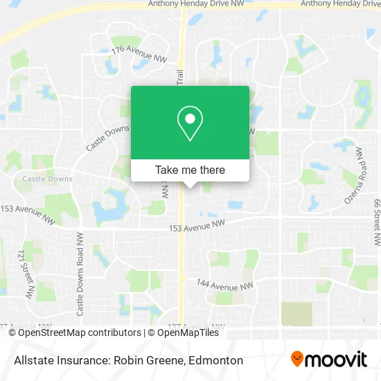
See Allstate Insurance: Robin Greene, Edmonton, on the map
Public Transit to Allstate Insurance: Robin Greene in Edmonton
Wondering how to get to Allstate Insurance: Robin Greene in Edmonton? Moovit helps you find the best way to get to Allstate Insurance: Robin Greene with step-by-step directions from the nearest public transit station.
Moovit provides free maps and live directions to help you navigate through your city. View schedules, routes, timetables, and find out how long does it take to get to Allstate Insurance: Robin Greene in real time.
Looking for the nearest stop or station to Allstate Insurance: Robin Greene? Check out this list of stops closest to your destination: 97 Street & 160 Avenue; Eaux Claires Transit Centre.
Bus: 009, 118, 103, 110X, 112, 117.
Want to see if there’s another route that gets you there at an earlier time? Moovit helps you find alternative routes or times. Get directions from and directions to Allstate Insurance: Robin Greene easily from the Moovit App or Website.
We make riding to Allstate Insurance: Robin Greene easy, which is why over 1.5 million users, including users in Edmonton, trust Moovit as the best app for public transit. You don’t need to download an individual bus app or train app, Moovit is your all-in-one transit app that helps you find the best bus time or train time available.
For information on prices of bus, costs and ride fares to Allstate Insurance: Robin Greene, please check the Moovit app.
Use the app to navigate to popular places including to the airport, hospital, stadium, grocery store, mall, coffee shop, school, college, and university.
Allstate Insurance: Robin Greene Address: 15949 97 St NW Edmonton, AB T5X 0C7 street in Edmonton
- Allstate Insurance: Tiffany Yu,
- Allstate Insurance: Cayla Hiscock,
- Allstate Insurance: Margaret Knight,
- Northern Tadkaa,
- New Streets of India,
- Innovation Physical Therapy,
- Medical Imaging Consultants (MIC),
- The Glam Room,
- Mercy Animal Hospital,
- Benefit,
- Namao Centre,
- Newera Coaching Centre,
- Urban Vision Edmonton,
- U-Haul,
- Oa Light and Sound,
- Nosh Cafe,
- Allstate Insurance: Martena Estabrooks,
- Tommy Gun's Original Barbershop,
- Mah Mandy Dr Optometrist,
- BMO Financial Group
Places Near Allstate Insurance: Robin Greene (Edmonton)
- Londonderry Mall, Edmonton,
- Canada Place Service Canada Centre, Edmonton,
- University of Alberta, Edmonton,
- Edmonton Valley Zoo, Edmonton,
- Edmonton EXPO Centre, Edmonton,
- Fort Edmonton Park, Edmonton,
- Royal Alexandra Hospital, Edmonton,
- Edmonton Commonwealth Stadium, Edmonton,
- Edmonton VIA Rail Station, Edmonton,
- Alberta Legislature Building, Edmonton,
- Kingsway Mall, Edmonton,
- West Edmonton Mall, Edmonton,
- Rogers Place, Edmonton,
- Whyte Avenue, Edmonton,
- Cross Cancer Institute, Edmonton,
- Borden Park, Edmonton,
- Northgate Centre, Edmonton,
- Grey Nuns Community Hospital, Edmonton,
- Kaye Edmonton Clinic, Edmonton,
- MacEwan University, Edmonton
How to get to popular places in Edmonton with public transit
Get around Edmonton by public transit!
Traveling around Edmonton has never been so easy. See step by step directions as you travel to any attraction, street or major public transit station. View bus and train schedules, arrival times, service alerts and detailed routes on a map, so you know exactly how to get to anywhere in Edmonton.
When traveling to any destination around Edmonton use Moovit's Live Directions with Get Off Notifications to know exactly where and how far to walk, how long to wait for your line, and how many stops are left. Moovit will alert you when it's time to get off — no need to constantly re-check whether yours is the next stop.
Wondering how to use public transit in Edmonton or how to pay for public transit in Edmonton? Moovit public transit app can help you navigate your way with public transit easily, and at minimum cost. It includes public transit fees, ticket prices, and costs. Looking for a map of Edmonton public transit lines? Moovit public transit app shows all public transit maps in Edmonton with all Bus and Light Rail routes and stops on an interactive map.
Edmonton has 2 transit type(s), including: Bus and Light Rail, operated by several transit agencies, including ETS LRT, ETS, Strathcona County Transit, St. Albert Transit, Spruce Grove Transit, Fort Saskatchewan Transit, Beaumont Transit and Leduc Transit