Alma School Rd & 8th Av stop - Saturday schedule
| Line | Direction | Time |
|---|---|---|
| 104 | Southern+Alma Schl | 6:19 AM |
| 104 | Southern+Alma Schl | 6:49 AM |
| 104 | Southern+Alma Schl | 7:19 AM |
| 104 | Southern+Alma Schl | 7:49 AM |
| 104 | Southern+Alma Schl | 8:19 AM |
| 104 | Southern+Alma Schl | 8:49 AM |
| 104 | Southern+Alma Schl | 9:19 AM |
| 104 | Southern+Alma Schl | 9:49 AM |
| 104 | Southern+Alma Schl | 10:19 AM |
| 104 | Southern+Alma Schl | 10:49 AM |
| 104 | Southern+Alma Schl | 11:19 AM |
| 104 | Southern+Alma Schl | 11:49 AM |
| 104 | Southern+Alma Schl | 12:19 PM |
| 104 | Southern+Alma Schl | 12:49 PM |
| 104 | Southern+Alma Schl | 1:19 PM |
| 104 | Southern+Alma Schl | 1:49 PM |
| 104 | Southern+Alma Schl | 2:19 PM |
| 104 | Southern+Alma Schl | 2:49 PM |
| 104 | Southern+Alma Schl | 3:19 PM |
| 104 | Southern+Alma Schl | 3:49 PM |
| 104 | Southern+Alma Schl | 4:19 PM |
| 104 | Southern+Alma Schl | 4:49 PM |
| 104 | Southern+Alma Schl | 5:19 PM |
| 104 | Southern+Alma Schl | 5:49 PM |
| 104 | Southern+Alma Schl | 6:19 PM |
Directions to Alma School Rd & 8th Av stop (Mesa) with public transit
The following transit lines have routes that pass near Alma School Rd & 8th Av
 Bus: 104, FBUZ, 61, 61S.
How to get to Alma School Rd & 8th Av stop by bus?
Click on the bus route to see step by step directions with maps, line arrival times and updated time schedules.
Bus stops near Alma School Rd & 8th Av stop in Mesa
- 8th Av & Alma School Rd (Flag Zone), 2 min walk,
- Alma School Rd & 8th Av, 2 min walk,
- Southern Av & Alma School Rd, 11 min walk,
Light Rail stations near Alma School Rd & 8th Av station in Mesa
- Sycamore/Main St, 37 min walk,
Bus lines to Alma School Rd & 8th Av stop in Mesa
- FBUZ, Mesa Riverview,
- 104, Mesa Riverview,
- 61, Price+Southern,
- 61S, Price+Southern,
What are the closest stations to Alma School Rd & 8th Av?
The closest stations to Alma School Rd & 8th Av are:
- 8th Av & Alma School Rd (Flag Zone) is 104 yards away, 2 min walk.
- Alma School Rd & 8th Av is 120 yards away, 2 min walk.
- Southern Av & Alma School Rd is 872 yards away, 11 min walk.
- Sycamore/Main St is 3176 yards away, 37 min walk.
Which bus line stops near Alma School Rd & 8th Av?
104 (Hamilton+Morelos)
What’s the nearest bus station to Alma School Rd & 8th Av in Mesa?
The nearest bus stations to Alma School Rd & 8th Av in Mesa are 8th Av & Alma School Rd (Flag Zone) and Alma School Rd & 8th Av. The closest one is a 2 min walk away.
What time is the first light rail to Alma School Rd & 8th Av in Mesa?
The A is the first light rail that goes to Alma School Rd & 8th Av in Mesa. It stops nearby at 4:02 AM.
What time is the last light rail to Alma School Rd & 8th Av in Mesa?
The A is the last light rail that goes to Alma School Rd & 8th Av in Mesa. It stops nearby at 1:44 AM.
What time is the first bus to Alma School Rd & 8th Av in Mesa?
The 61 is the first bus that goes to Alma School Rd & 8th Av in Mesa. It stops nearby at 5:06 AM.
What time is the last bus to Alma School Rd & 8th Av in Mesa?
The FBUZ is the last bus that goes to Alma School Rd & 8th Av in Mesa. It stops nearby at 11:49 PM.
Alma School Rd & 8th Av station
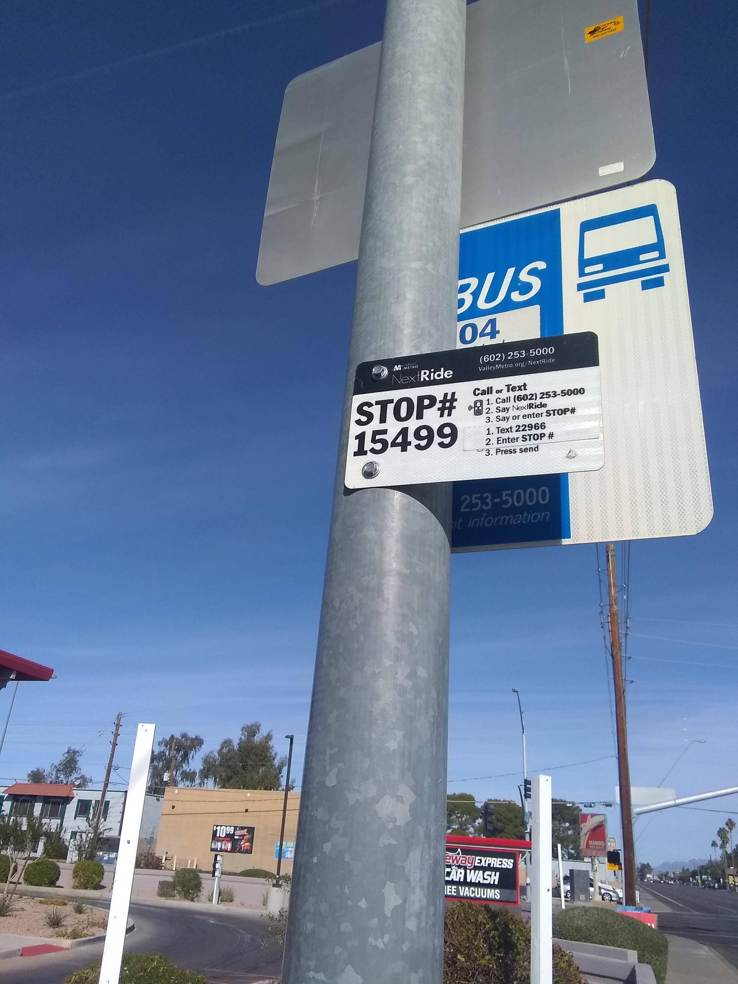 Taken by Stephen G.
See Alma School Rd & 8th Av stop, Mesa, on the map
Public transit to Alma School Rd & 8th Av stop (ID: 15499) in Mesa
Looking for directions to Alma School Rd & 8th Av in Mesa, United States?
Download the Moovit App to find the current schedule and step-by-step directions for Bus or Light Rail routes that pass through Alma School Rd & 8th Av.
Looking for the nearest stops closest to Alma School Rd & 8th Av ? Check out this list of closest stops to your destination: 8th Av & Alma School Rd (Flag Zone); Alma School Rd & 8th Av; Southern Av & Alma School Rd; Sycamore/Main St.
Bus: 104, FBUZ, 61, 61S.
We make riding on public transit to Alma School Rd & 8th Av easy, which is why over 1.5 million users, including users in Mesa trust Moovit as the best app for public transit.
Use the app to navigate to popular places including to the airport, hospital, stadium, grocery store, mall, coffee shop, school, college, and university.
Alma School Rd & 8th Av stop’s code is 15499
The first line to this stop is 104, at 6:19 AM, and the last line is 104 at 9:49 PM.
808 S Alma School Rd, Mesa, AZ, USA
This stop serves Valley Metro-Bus’s lines
- 8th Av & Alma School Rd (Flag Zone),
- Alma School Rd & 8th Av,
- Southern Av & Alma School Rd
Bus stops near Alma School Rd & 8th Av stop
- Sycamore/Main St
Light Rail station near Alma School Rd & 8th Av station
- Indian School Rd & 75th Av,
- Roosevelt St & 28th St,
- Grove Pkwy & 600 West,
- 7th Av & Broadway Rd,
- Mcdowell Rd & 27th St,
- Arrowhead Mall South,
- 19th Av & Monte Vista Rd,
- 32nd St & Fillmore St,
- 51st Av & Maldonado Rd,
- 19th Ave/Camelback,
- Baseline Rd & 46th St,
- Greenway Pkwy & Cave Creek Rd,
- Hayden Rd & Via Linda,
- 32nd St & Osborn Rd,
- Buckeye Rd & 12th St,
- Cactus Rd & 43rd Av,
- Thomas/Central Ave,
- Greenway Rd & 29th Av,
- 7th St & Missouri Av,
- Pinnacle Peak Rd & 29th Av
Popular public transit stations in Mesa
Get around Mesa by public transit!
Traveling around Mesa has never been so easy. See step by step directions as you travel to any attraction, street or major public transit station. View bus and train schedules, arrival times, service alerts and detailed routes on a map, so you know exactly how to get to anywhere in Mesa.
When traveling to any destination around Mesa use Moovit's Live Directions with Get Off Notifications to know exactly where and how far to walk, how long to wait for your line, and how many stops are left. Moovit will alert you when it's time to get off — no need to constantly re-check whether yours is the next stop.
Wondering how to use public transit in Mesa or how to pay for public transit in Mesa? Moovit public transit app can help you navigate your way with public transit easily, and at minimum cost. It includes public transit fees, ticket prices, and costs. Looking for a map of Mesa public transit lines? Moovit public transit app shows all public transit maps in Mesa with all Bus and Light Rail routes and stops on an interactive map.
Phoenix has 2 transit type(s), including: Bus and Light Rail, operated by several transit agencies, including Valley Metro-Tram, Valley Metro-Bus, Phoenix Sky Harbor International Airport, Stagecoach Express, Groome Transportation, Greyhound-us and FlixBus-us