How to get to Alpha & Omega by bus?
Click on the bus route to see step by step directions with maps, line arrival times and updated time schedules.
From Ada M Barreto P A, North Westside
78 minFrom Dolphin Mall Entrance 2, North Westside
80 minFrom Macy's International Mall, Miami
78 minFrom IKEA Miami, North Westside
78 minFrom City Of Doral Trolly, Miami
51 minFrom SW 88th St / SW 137th Ave, Kendale Lakes-Tamiami
59 minFrom Dolphin Mall, North Westside
82 minFrom 8th Street Latinas, Miami
105 minFrom Shops at Merrick Park, Miami
51 minFrom La Colmena del Dr. Fausto Losana, Kendale Lakes-Tamiami
60 min
Bus stop near Alpha & Omega in Miami
- Sw 56 St @ Sw 77 Ct, 2 min walk,VIEW
Train station near Alpha & Omega in Miami
- South Miami, 38 min walk,VIEW
Bus lines to Alpha & Omega in Miami
- 56, 56 - SW 56 St/152 Av,VIEW
What are the closest stations to Alpha & Omega?
The closest stations to Alpha & Omega are:
- Sw 56 St @ Sw 77 Ct is 67 yards away, 2 min walk.
- South Miami is 3223 yards away, 38 min walk.
Which bus line stops near Alpha & Omega?
56 (56 - University Station)
What’s the nearest bus station to Alpha & Omega in Miami?
The nearest bus station to Alpha & Omega in Miami is Sw 56 St @ Sw 77 Ct. It’s a 2 min walk away.
What time is the first train to Alpha & Omega in Miami?
The GREEN is the first train that goes to Alpha & Omega in Miami. It stops nearby at 5:00 AM.
What time is the last train to Alpha & Omega in Miami?
The GREEN is the last train that goes to Alpha & Omega in Miami. It stops nearby at 1:04 AM.
What time is the first bus to Alpha & Omega in Miami?
The 56 is the first bus that goes to Alpha & Omega in Miami. It stops nearby at 6:21 AM.
What time is the last bus to Alpha & Omega in Miami?
The 56 is the last bus that goes to Alpha & Omega in Miami. It stops nearby at 8:26 PM.
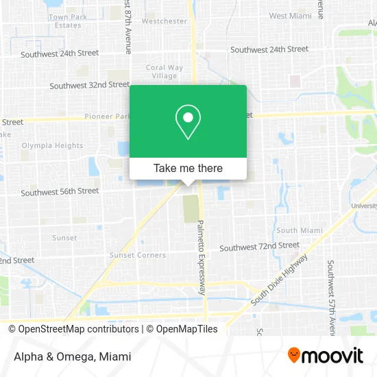
See Alpha & Omega, Miami, on the map
Public Transit to Alpha & Omega in Miami
Wondering how to get to Alpha & Omega in Miami? Moovit helps you find the best way to get to Alpha & Omega with step-by-step directions from the nearest public transit station.
Moovit provides free maps and live directions to help you navigate through your city. View schedules, routes, timetables, and find out how long does it take to get to Alpha & Omega in real time.
Looking for the nearest stop or station to Alpha & Omega? Check out this list of stops closest to your destination: Sw 56 St @ Sw 77 Ct; South Miami.
Bus: 56.Train: GREEN, ORANGE.
Want to see if there’s another route that gets you there at an earlier time? Moovit helps you find alternative routes or times. Get directions from and directions to Alpha & Omega easily from the Moovit App or Website.
We make riding to Alpha & Omega easy, which is why over 1.5 million users, including users in Miami, trust Moovit as the best app for public transit. You don’t need to download an individual bus app or train app, Moovit is your all-in-one transit app that helps you find the best bus time or train time available.
For information on prices of bus and train, costs and ride fares to Alpha & Omega, please check the Moovit app.
Use the app to navigate to popular places including to the airport, hospital, stadium, grocery store, mall, coffee shop, school, college, and university.
Alpha & Omega Address: 7800 SW 56th St Miami, FL 33143 street in Miami
- Dazzle Beauty Studio,
- Sepi Southeast Pastoral Institute,
- Entrance SR-874-TOLL S,
- Gulliver Prep,
- Memorial Plan Cemeteries & Funeral Homes,
- Sr-874-Toll N Hialeah,
- Tropical Park-Top Of The Hill,
- SW 56th St / SW 74th Ave,
- Vintage Florida Properties LLC,
- Gateway Office Tech Assn,
- Southwest 56th Street & Southwest 84th Avenue,
- lake david,
- Southwest 56th Street & Southwest 72nd Avenue,
- Ferris Wheel,
- Santa's Enchanted Forest (Santas Enchanted Forest),
- Red Zone Sports Flag Football,
- Tropical Park,
- St Thomas the Apostile Catholic Church (St Thomas the Apostle Catholic Sch),
- Dade Elevator Inspections,
- SW 64th St
Places Near Alpha & Omega (Miami)
- Sawgrass mall ( FL ), Miami Beach,
- Port of Miami Cruise Terminal, Miami,
- Hard Rock Stadium, Miami Gardens,
- Miami VA Hospital, Miami,
- Keiser University Flagship Campus, West Palm Beach,
- Sawgrass Mall, Miami,
- Little Havana, Miami,
- Aventura Mall, Miami Beach,
- Richard E. Gerstein Justice Building, Miami,
- Dolphin Mall Bus, Miami,
- Aventura Mall, Miami,
- Brickell City Centre, Miami,
- Zoo Miami, Miami,
- Wynwood, Miami,
- Miami Freedom Park, Miami,
- Marlins Park, Miami,
- Miami Design District, Miami,
- Bayside Marketplace, Miami,
- Miami-Dade County Courthouse, Miami,
- Dolphin Mall, Miami
How to get to popular places in Miami with public transit
Get around Miami by public transit!
Traveling around Miami has never been so easy. See step by step directions as you travel to any attraction, street or major public transit station. View bus and train schedules, arrival times, service alerts and detailed routes on a map, so you know exactly how to get to anywhere in Miami.
When traveling to any destination around Miami use Moovit's Live Directions with Get Off Notifications to know exactly where and how far to walk, how long to wait for your line, and how many stops are left. Moovit will alert you when it's time to get off — no need to constantly re-check whether yours is the next stop.
Wondering how to use public transit in Miami or how to pay for public transit in Miami? Moovit public transit app can help you navigate your way with public transit easily, and at minimum cost. It includes public transit fees, ticket prices, and costs. Looking for a map of Miami public transit lines? Moovit public transit app shows all public transit maps in Miami with all Bus, Train, Light Rail and Ferry routes and stops on an interactive map.
Miami has 4 transit type(s), including: Bus, Train, Light Rail and Ferry, operated by several transit agencies, including Broward County Transit, Miami-Dade Transit, Metrorail, Palm Tran, Tri-Rail, Brightline, MARTY, City of Homestead Trolley, Key West Transit, Treasure Coast Connector, GoLine IRT, Amtrak, Greyhound-us, FlixBus-us and Aventura Express Shuttle Bus